MTC Regional Mapping & Wayfinding Project
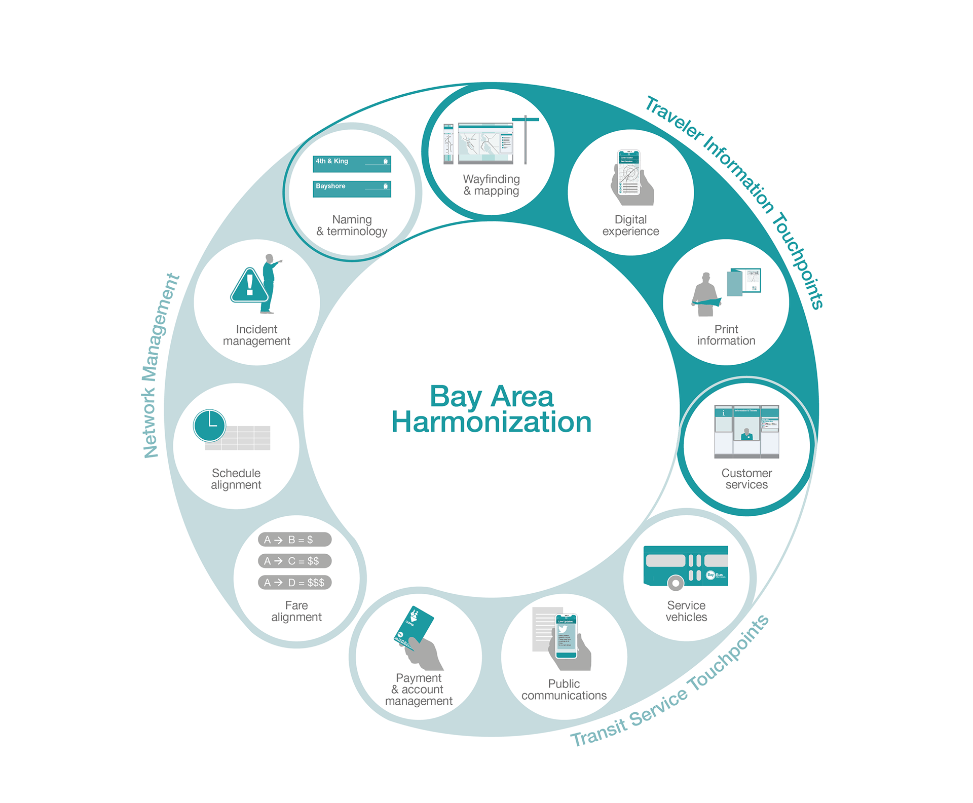
The Regional Mapping and Wayfinding Project will make it easier to ride transit in the Bay Area by making wayfinding materials (maps, signs, screens, etc.) more consistent and easy to identify. Whether you are traveling by bus, rail, ferry, or a combination, the signs and communication systems will be the same across all nine Bay Area counties.
The complex process of designing new regional wayfinding standards is being led by MTC, with the partnership of transit riders, Bay Area cities and counties and all 27 Bay Area transit agencies.
In my role at Applied Information Group I was centrally involved to the work of Phase 3, including: creation of regional standards and regional wayfinding identity, all aspects of implementation of prototypes, user research activities, stakeholder engagement, regular client meetings, coordination with subconsultants and parallel client-run project.
I first started working on this project during my time at City ID, where I was centrally involved in all aspects of Phase 2, including: redefining the scope, developing and documenting the principles of the system, planning for user focus groups, stakeholder engagement, and development of ROMs for the business case.
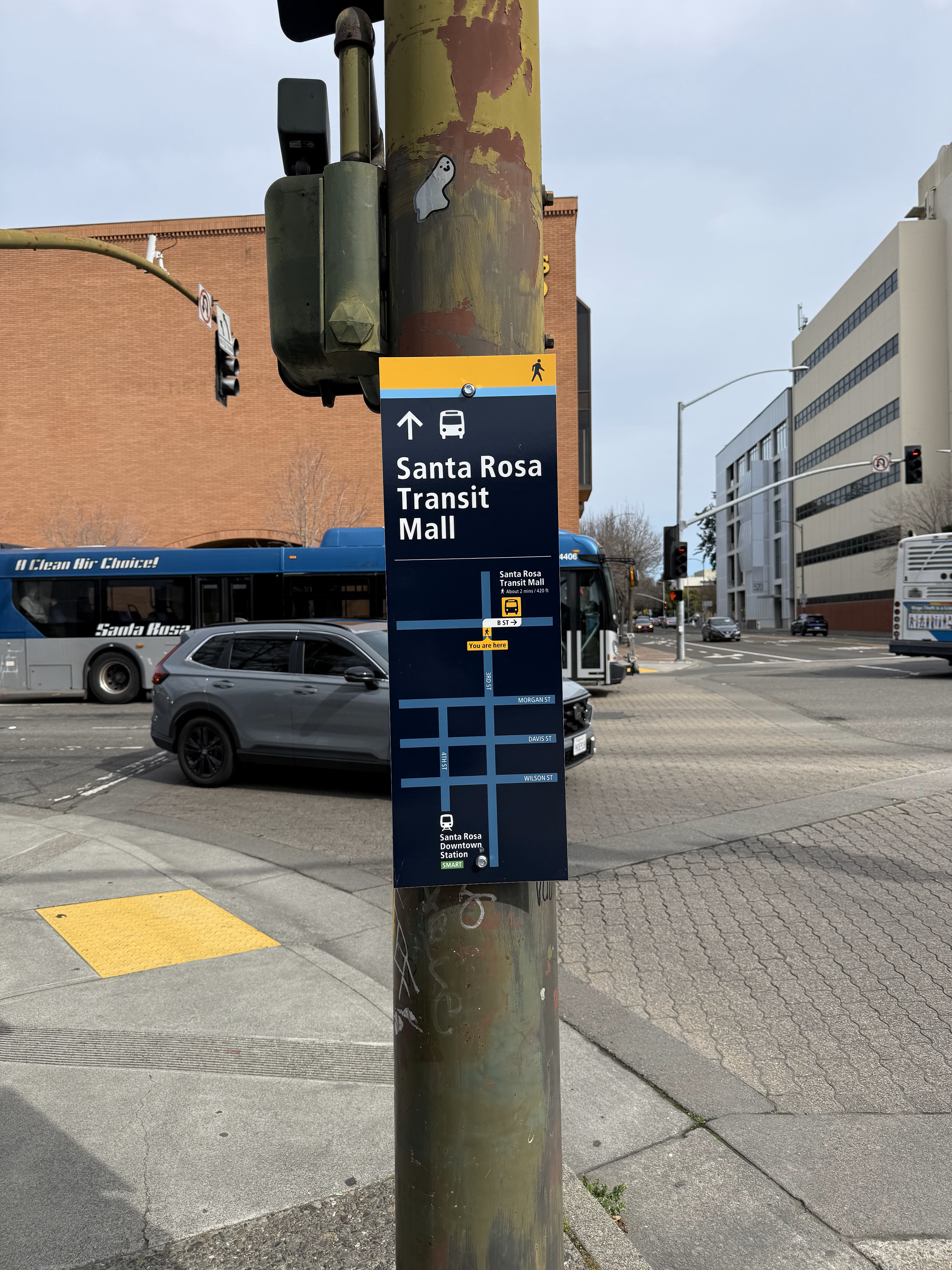
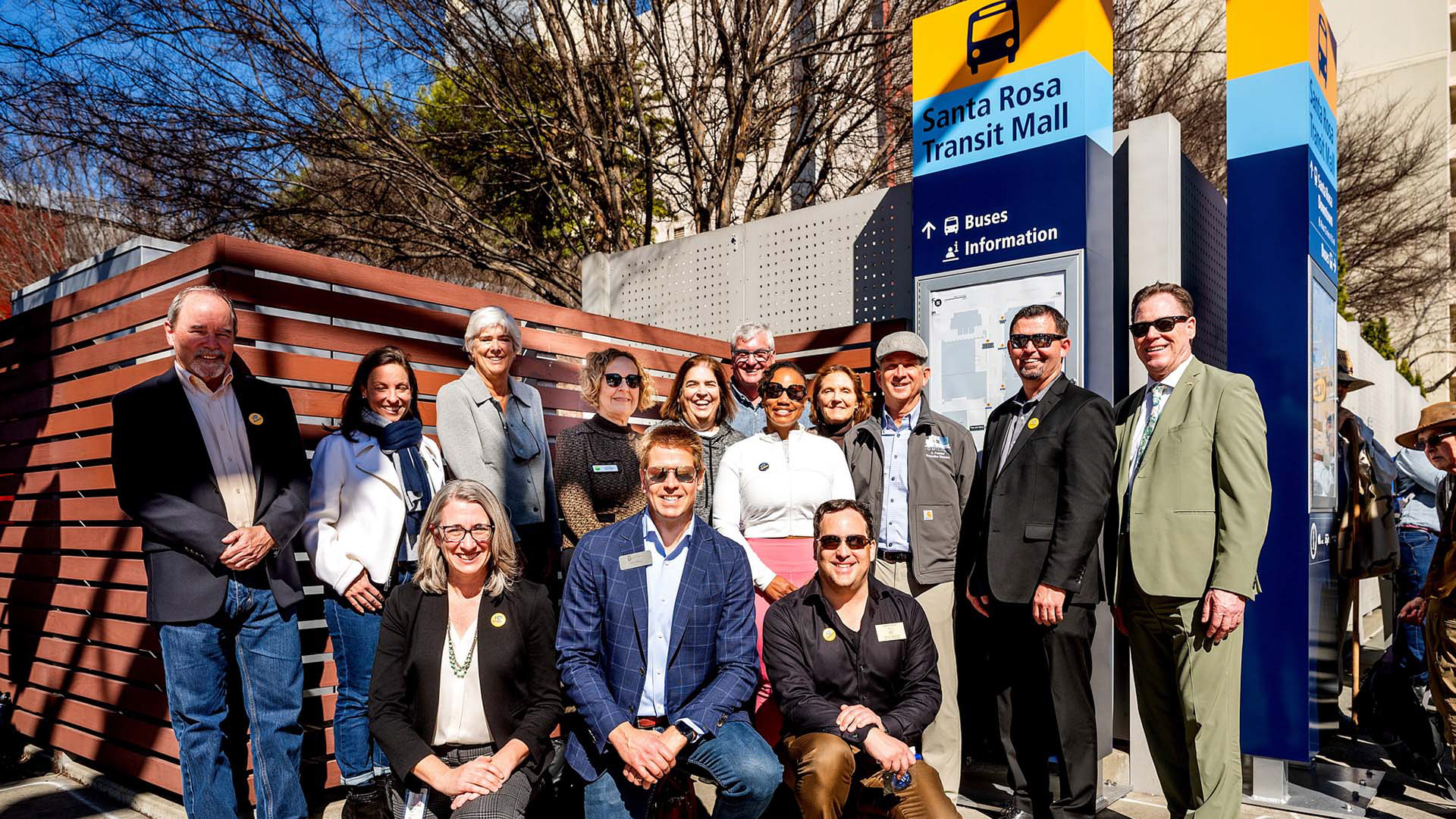
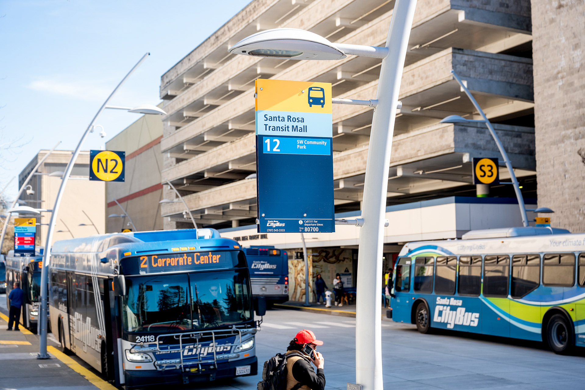
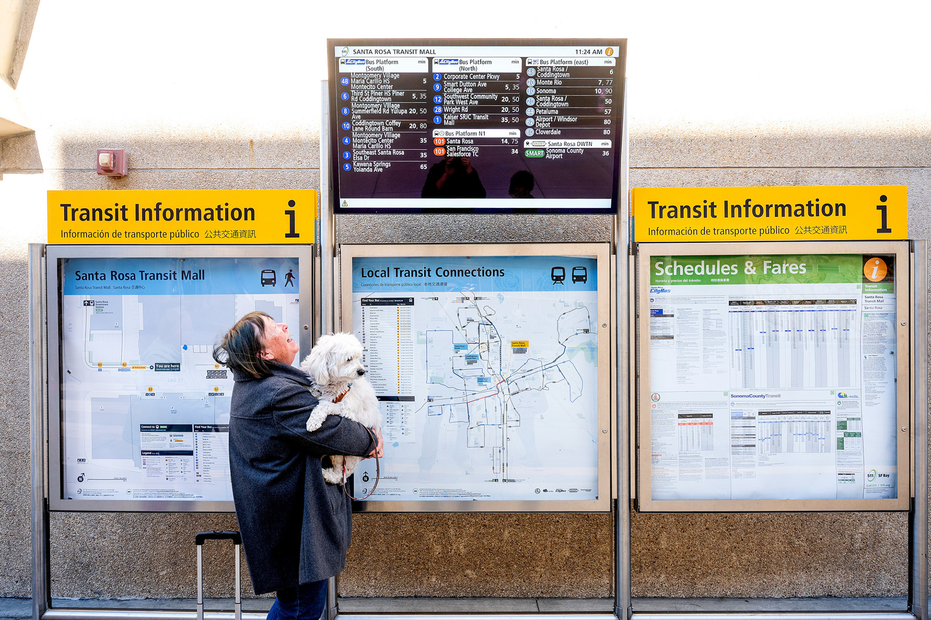
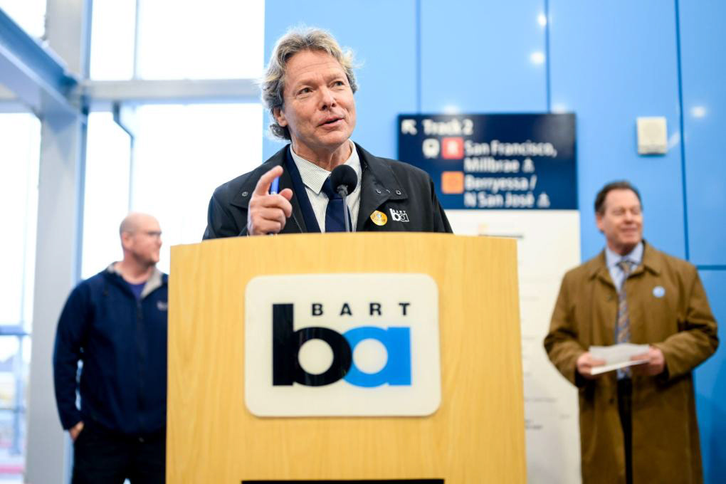
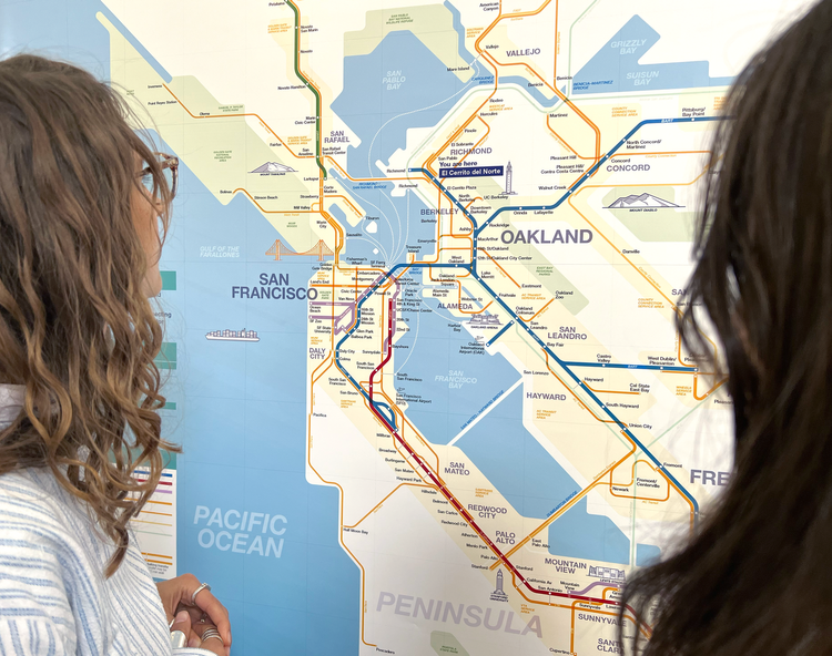
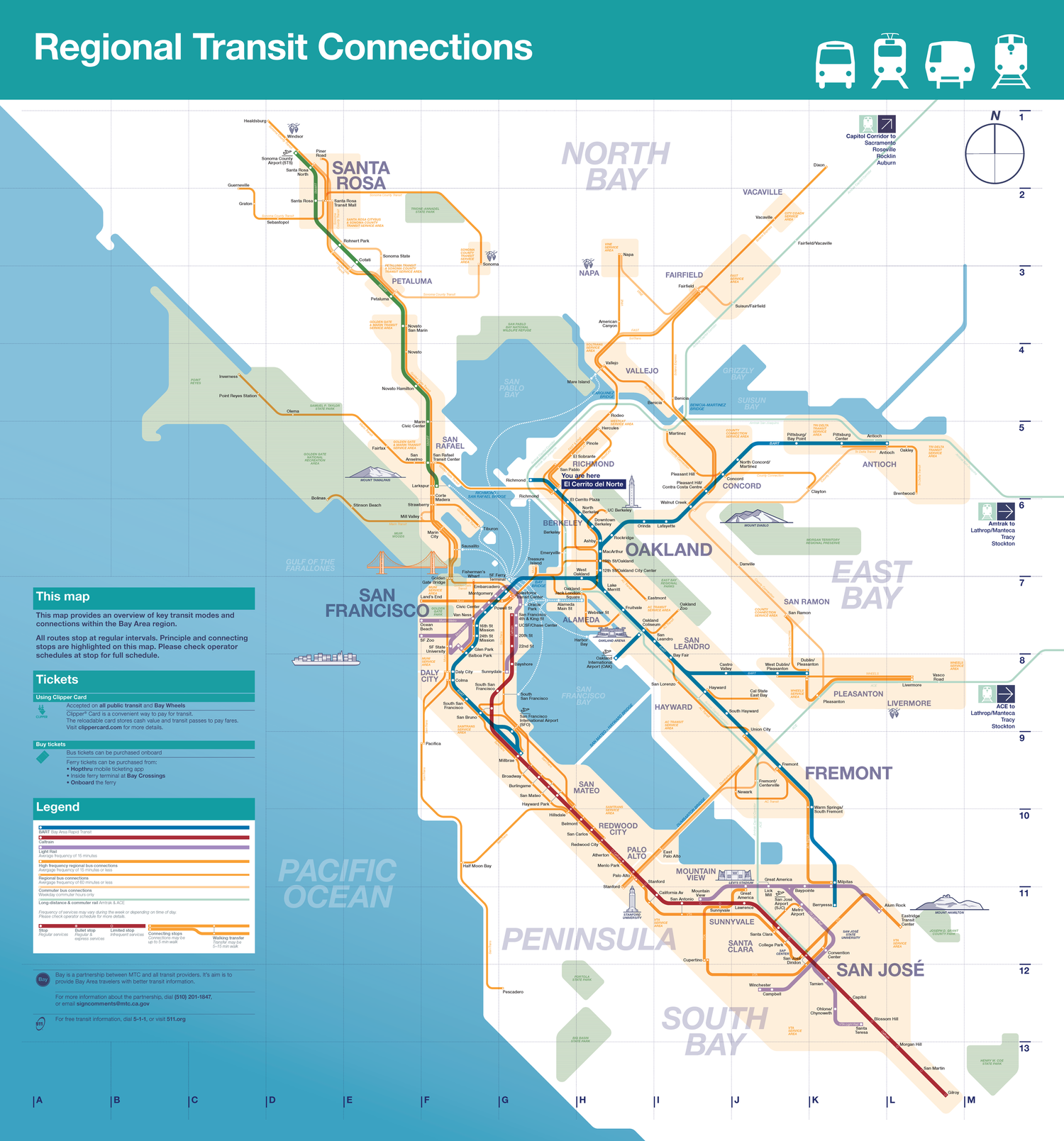
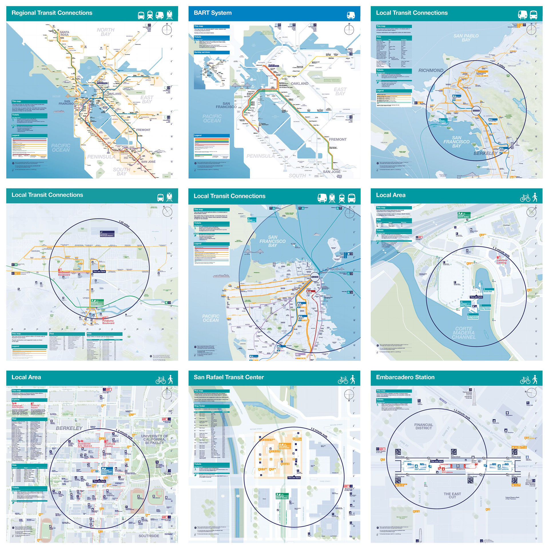
The images below are from public presentations give at various committee meetings and press releases by MTC (1, 2, 3, 4, 5, 6, 7, 8), BART (1, 2, 3), County Connection, Dugan Dotson, Hunt Masonry, Patch Media Article, Bay Area Transit Discord Photos, and City ID's website.
Phase 3
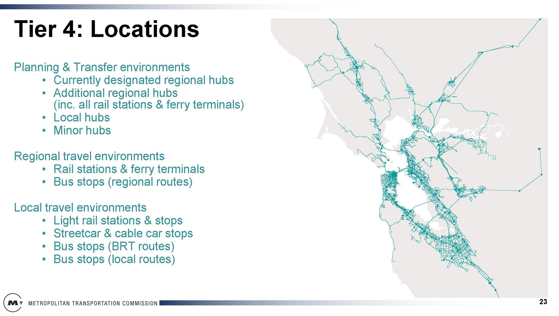
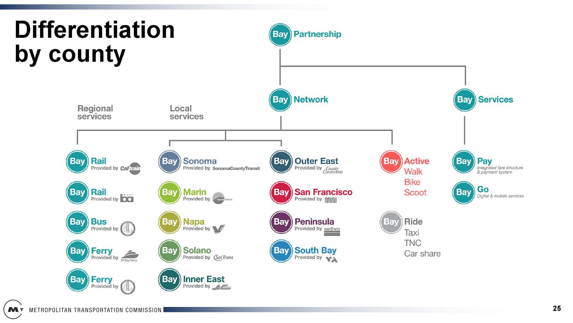
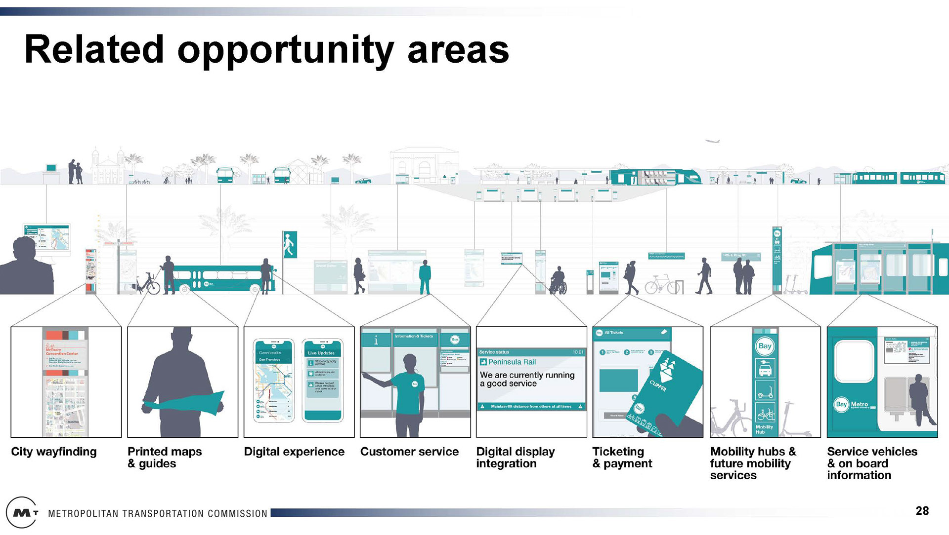
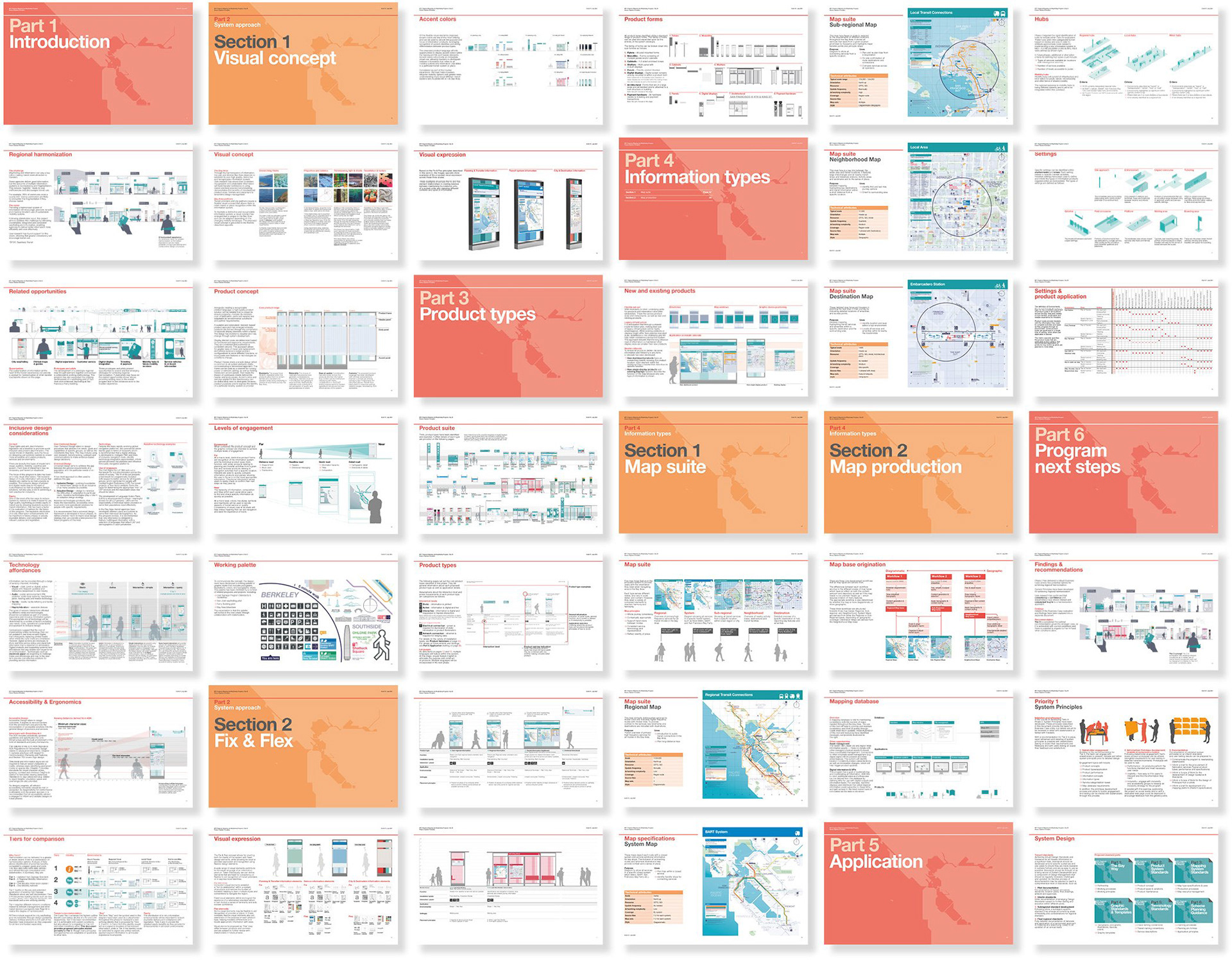
Standards, Regional Identity, and Prototypes
Standards, Regional Identity, and Prototypes
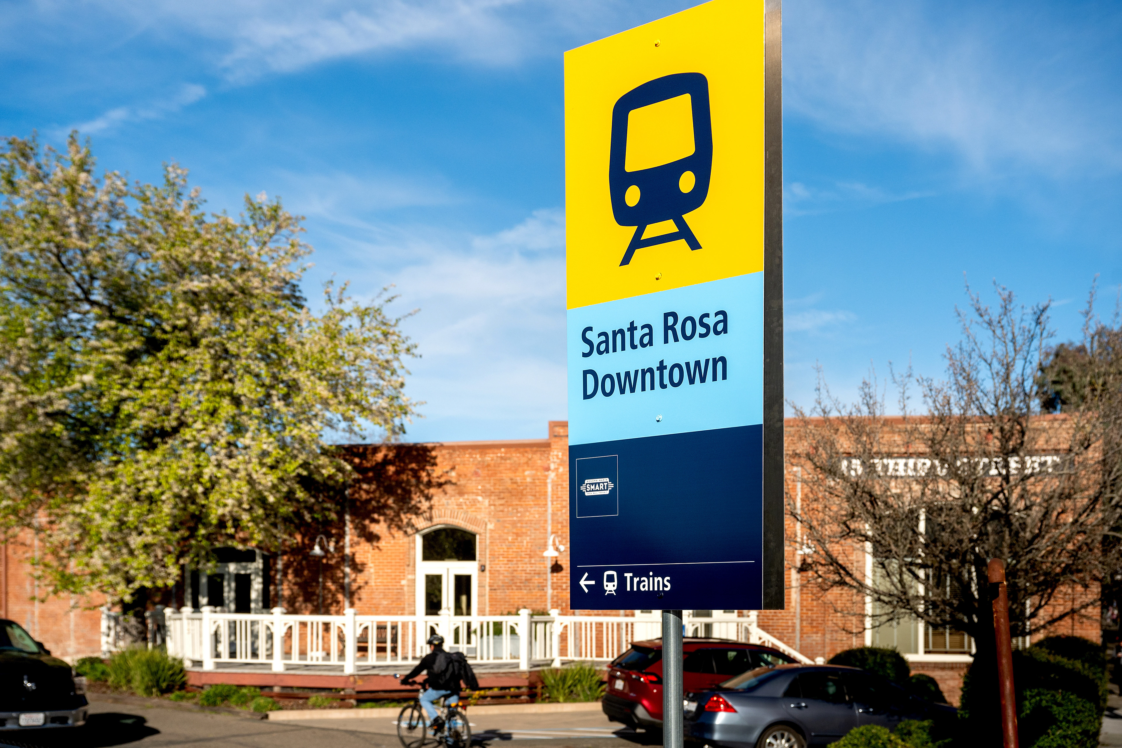
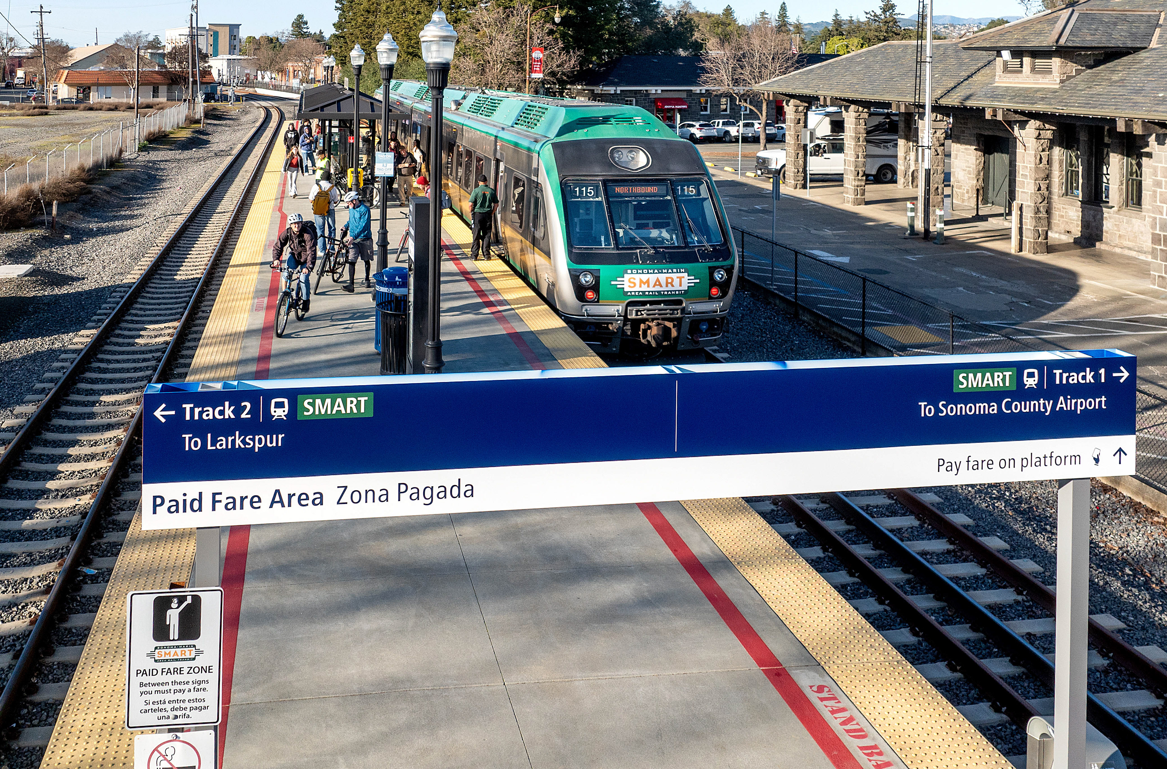
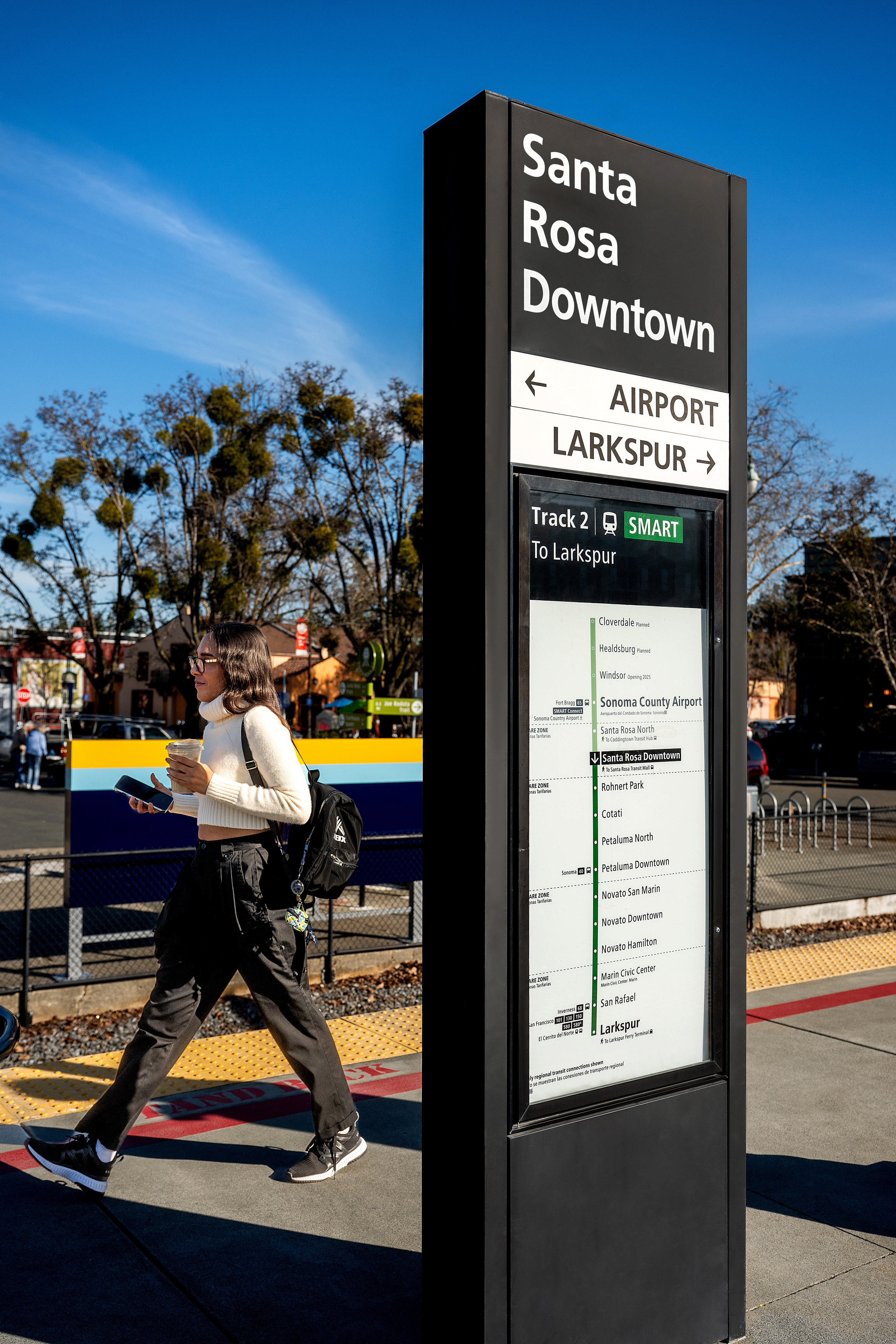
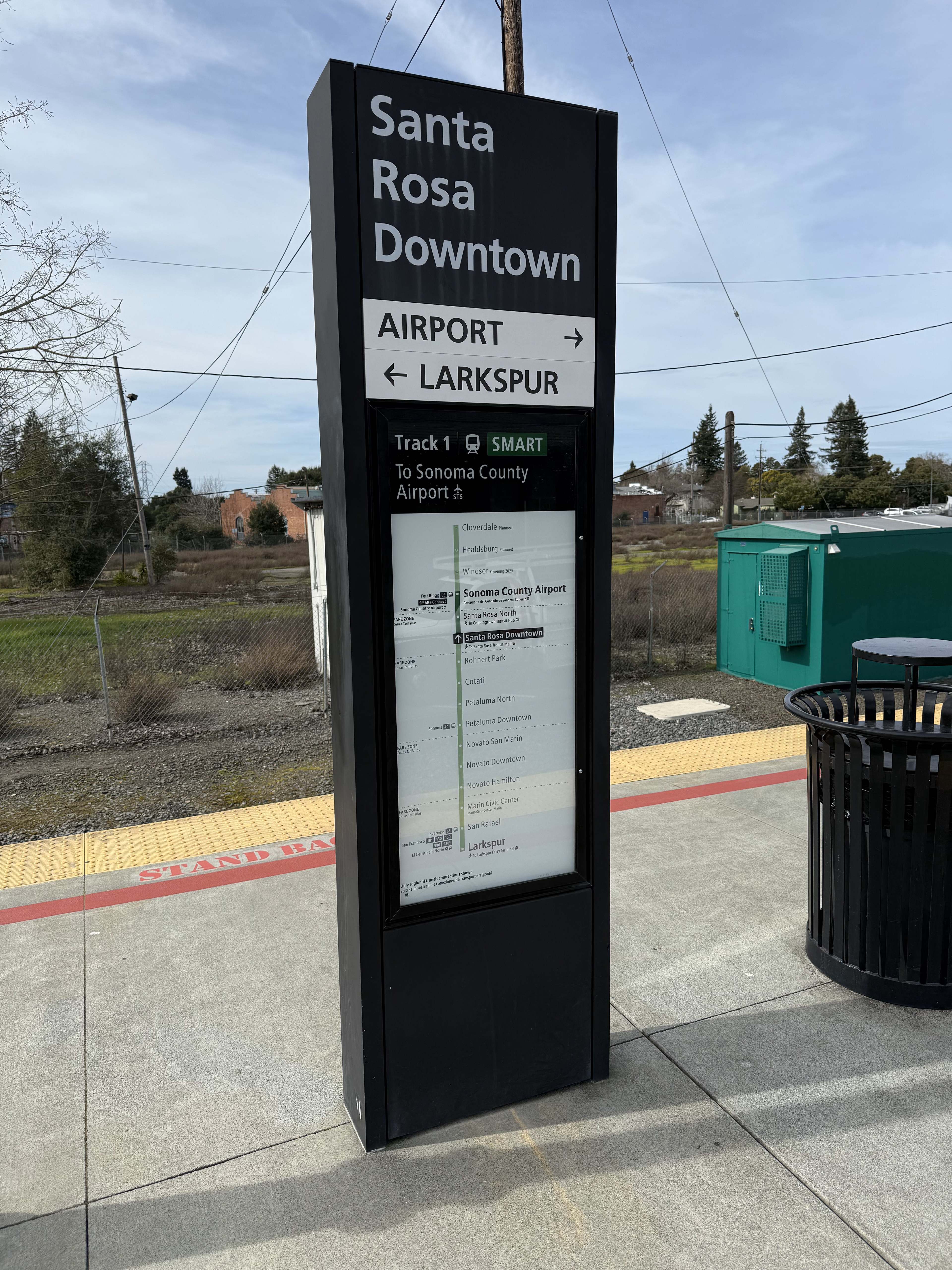
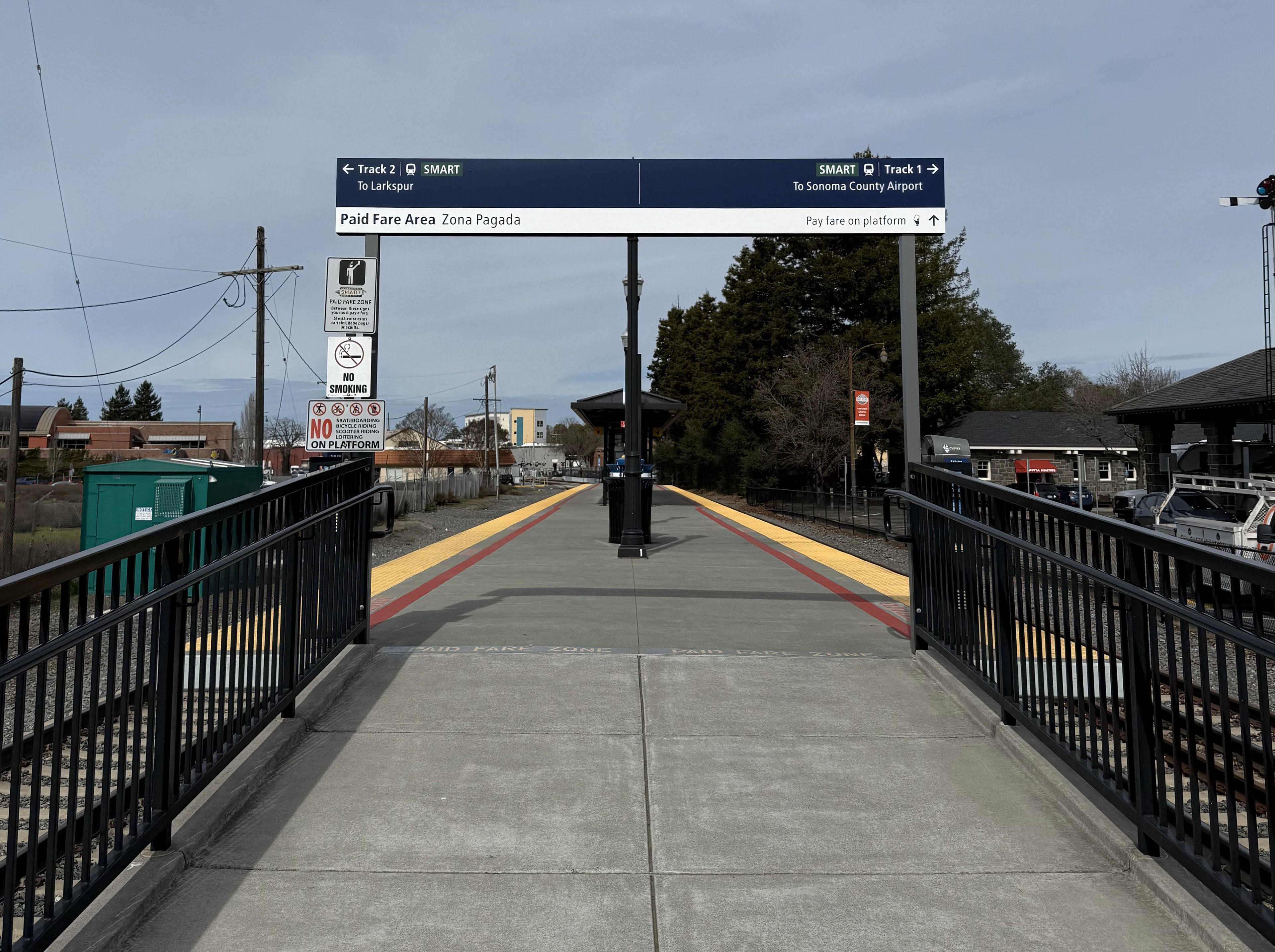
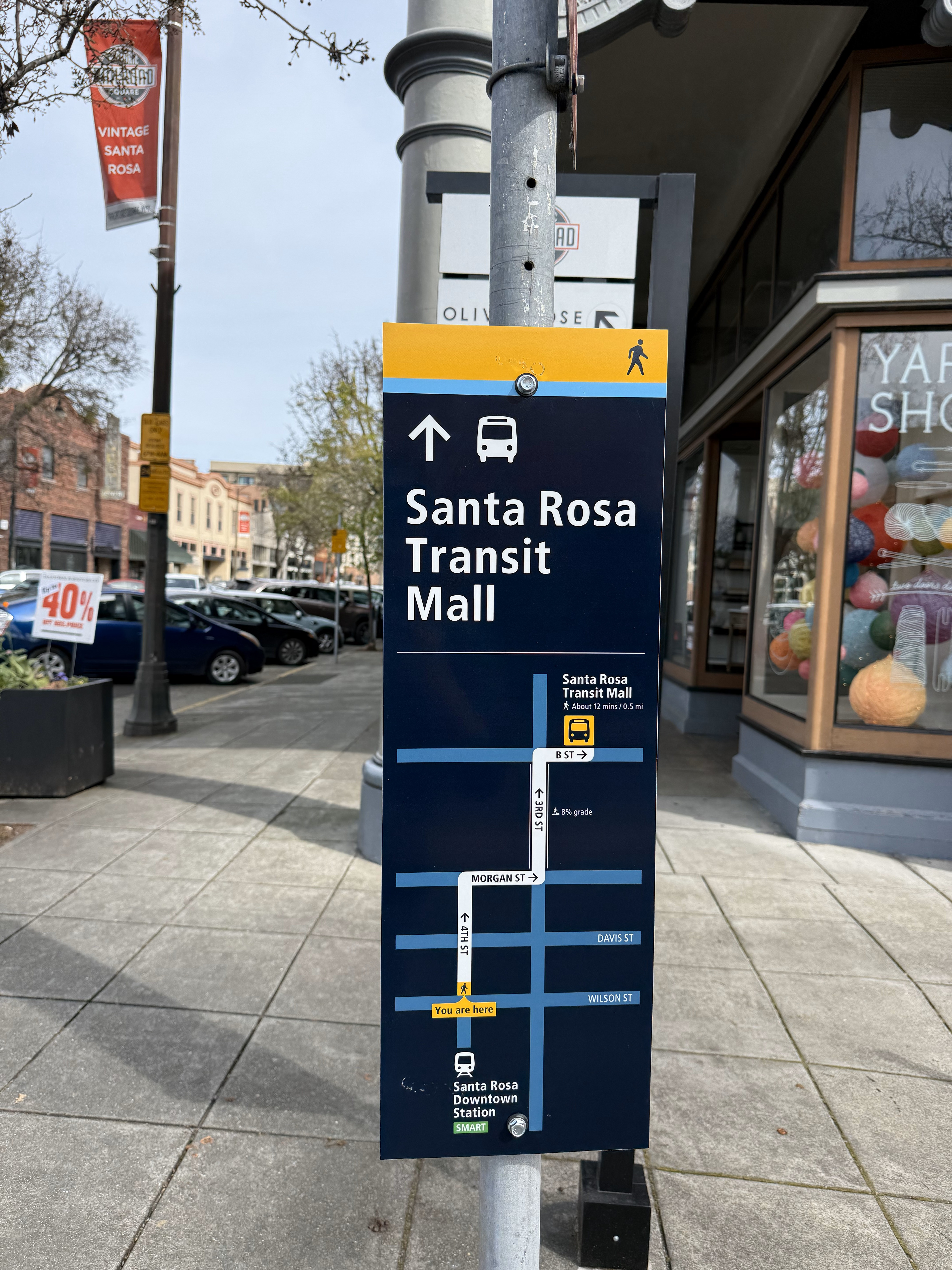
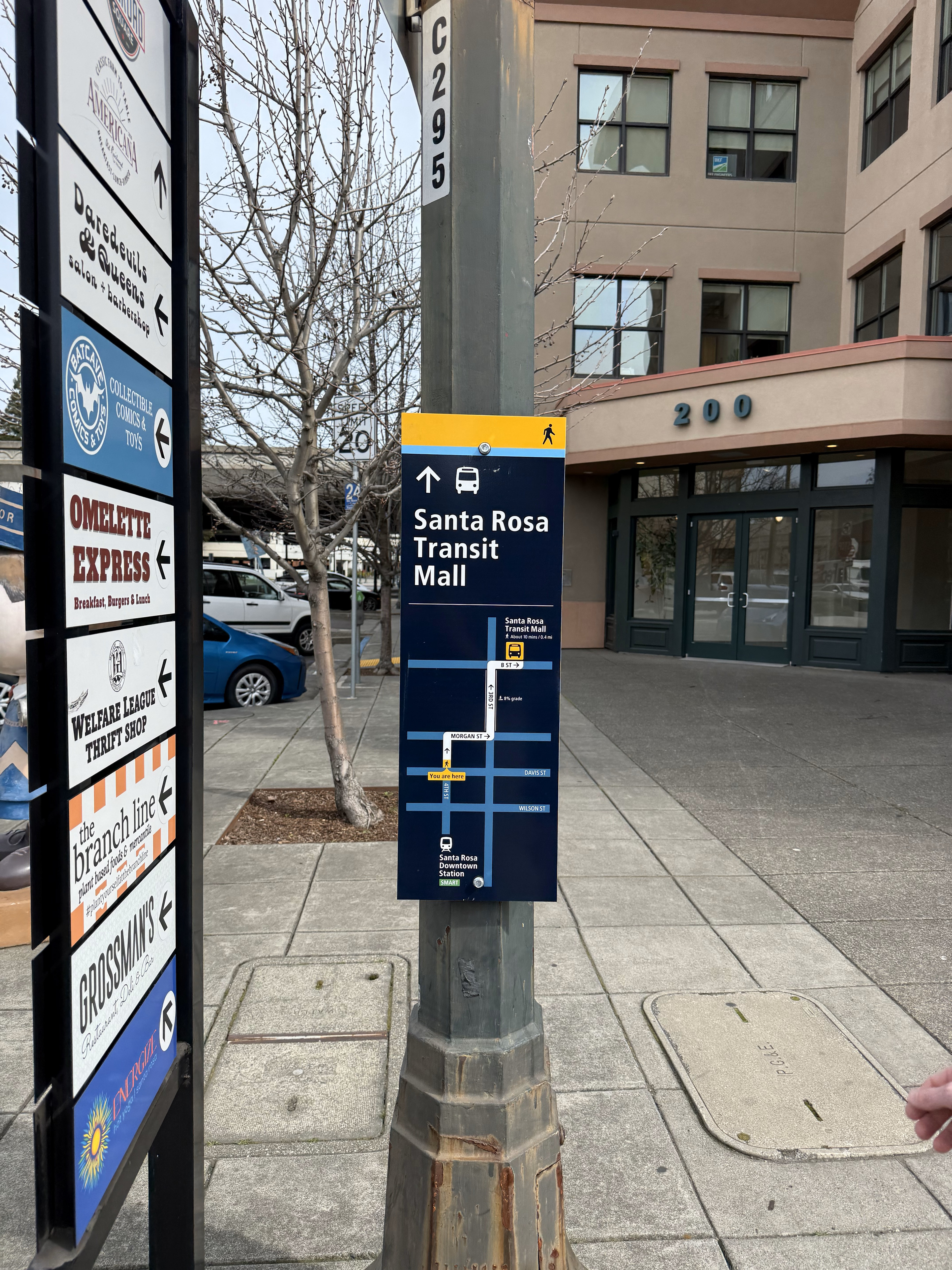
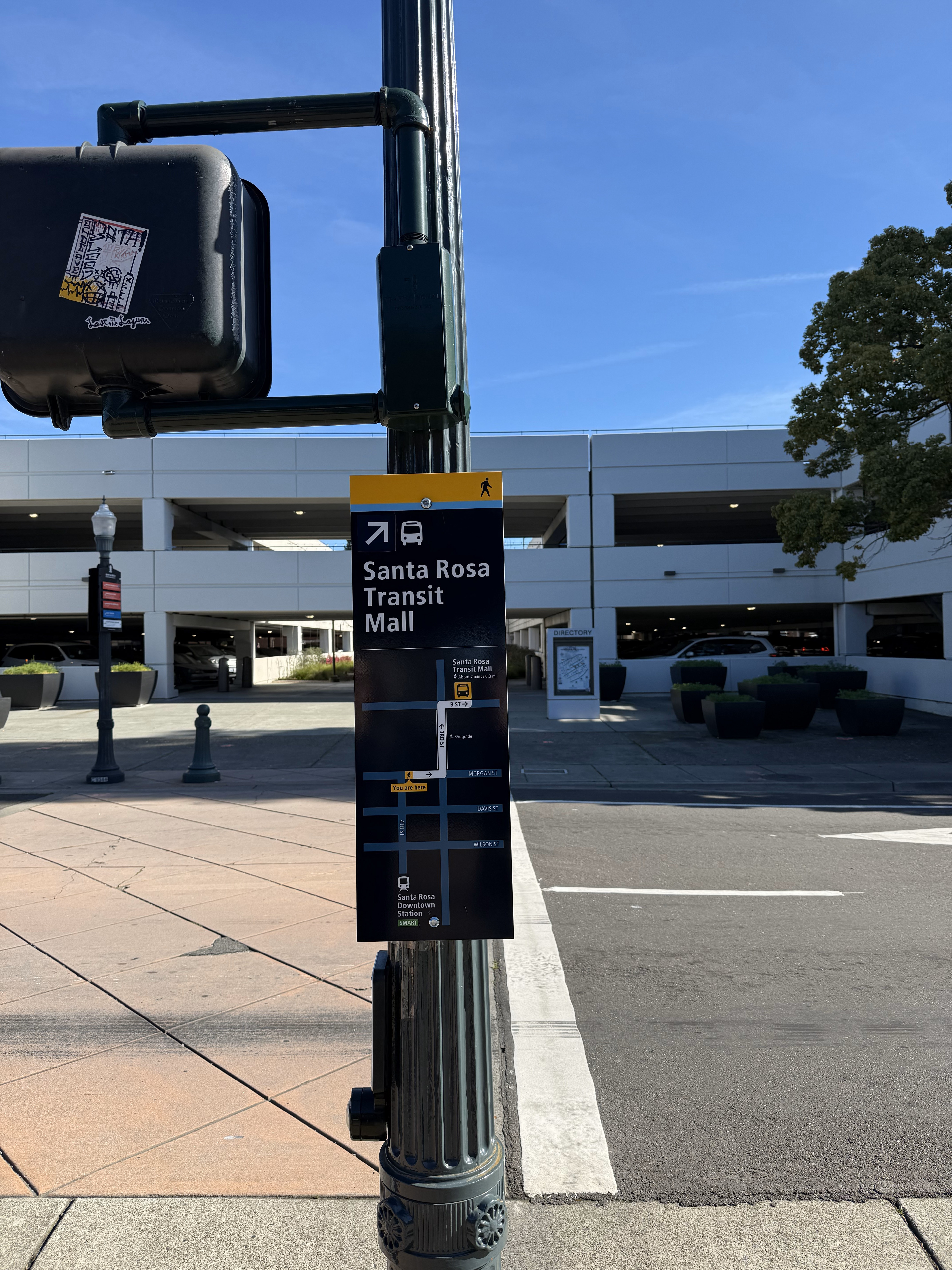
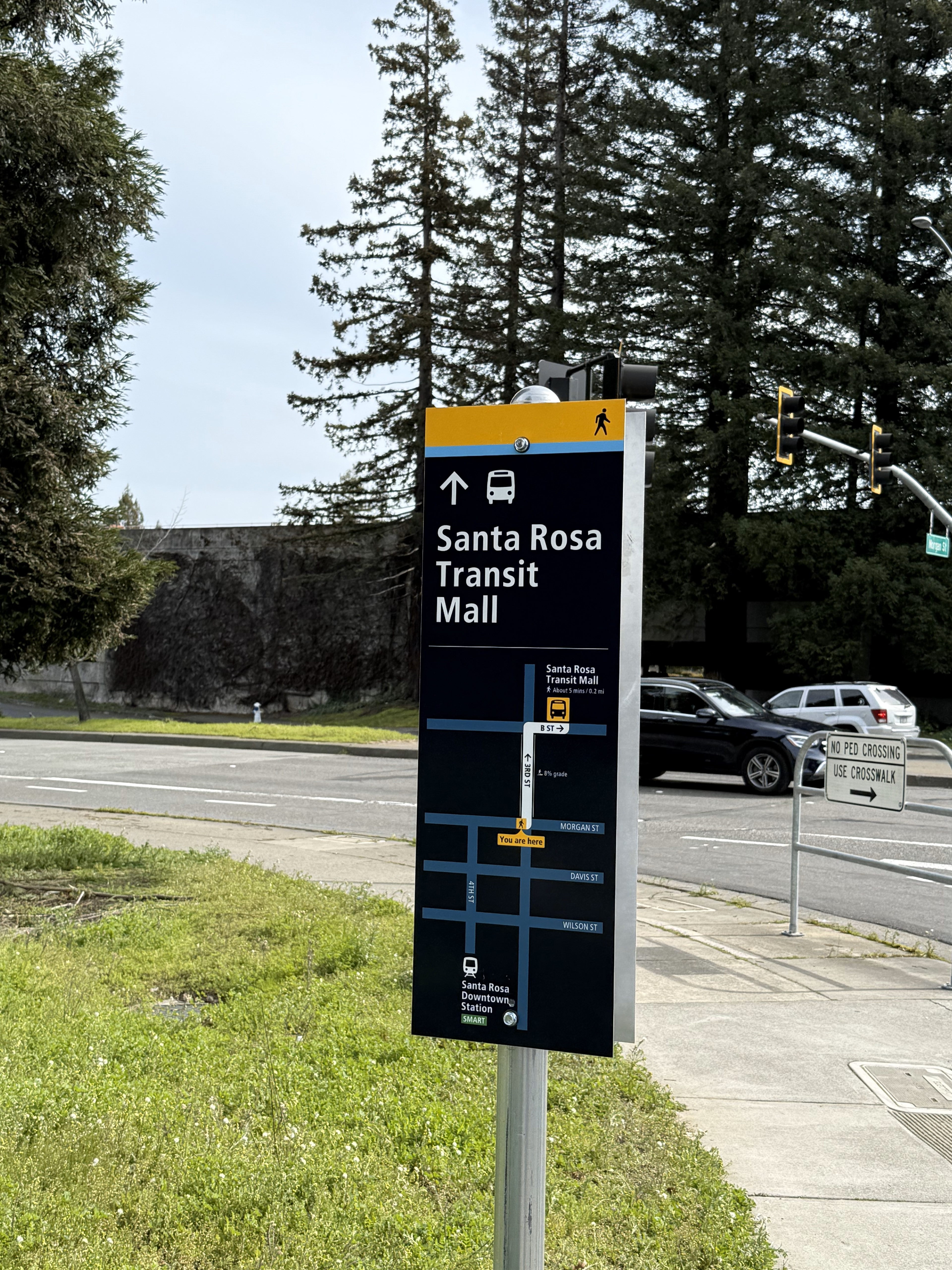
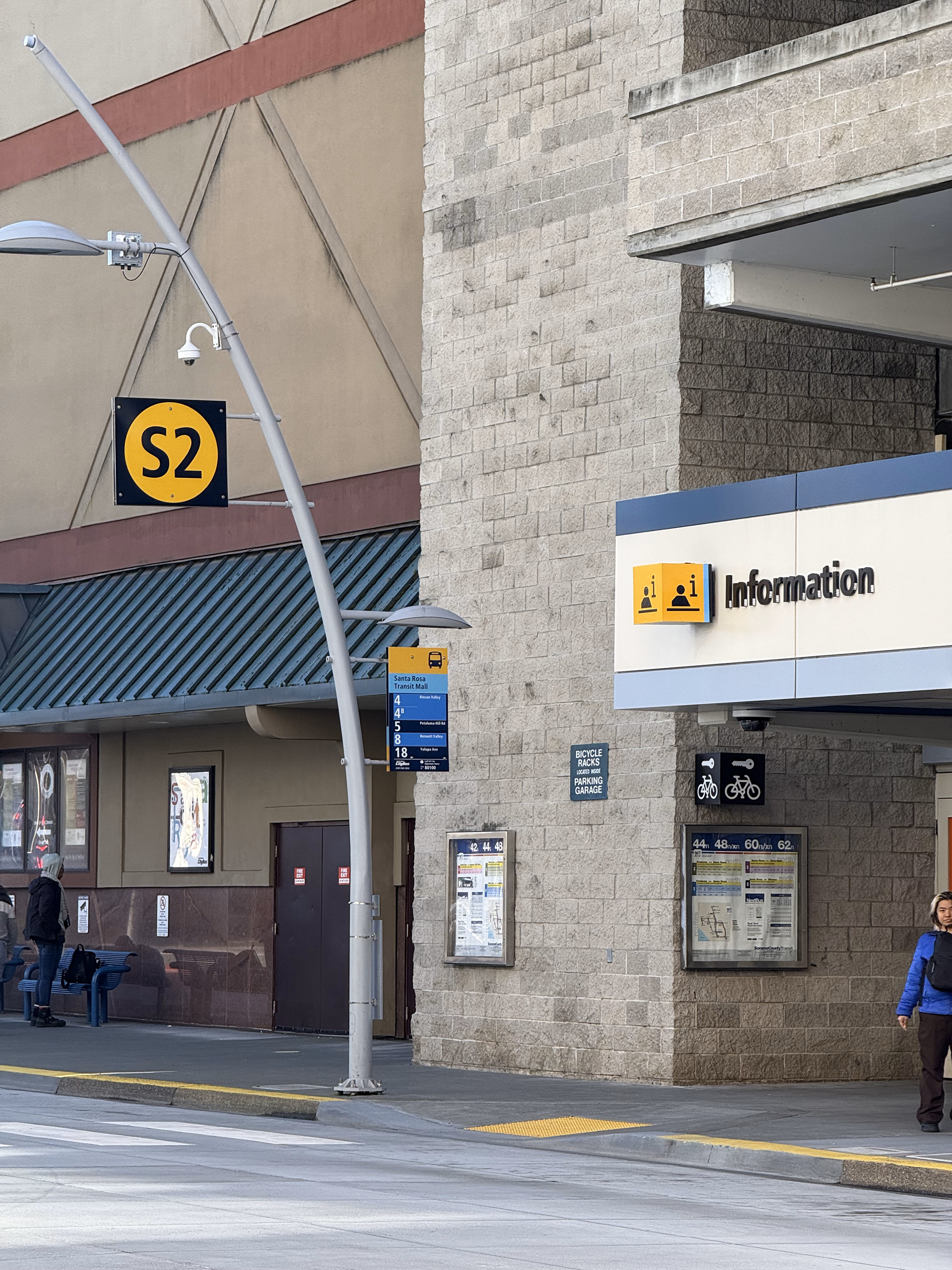
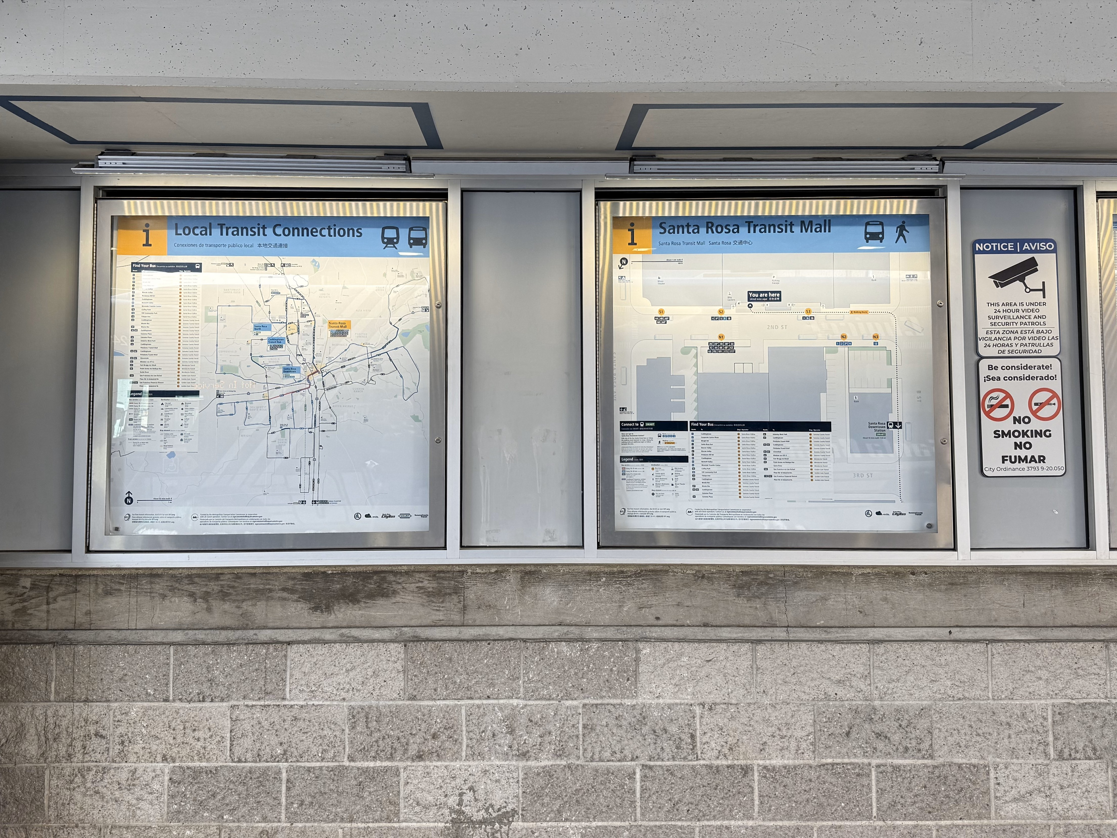
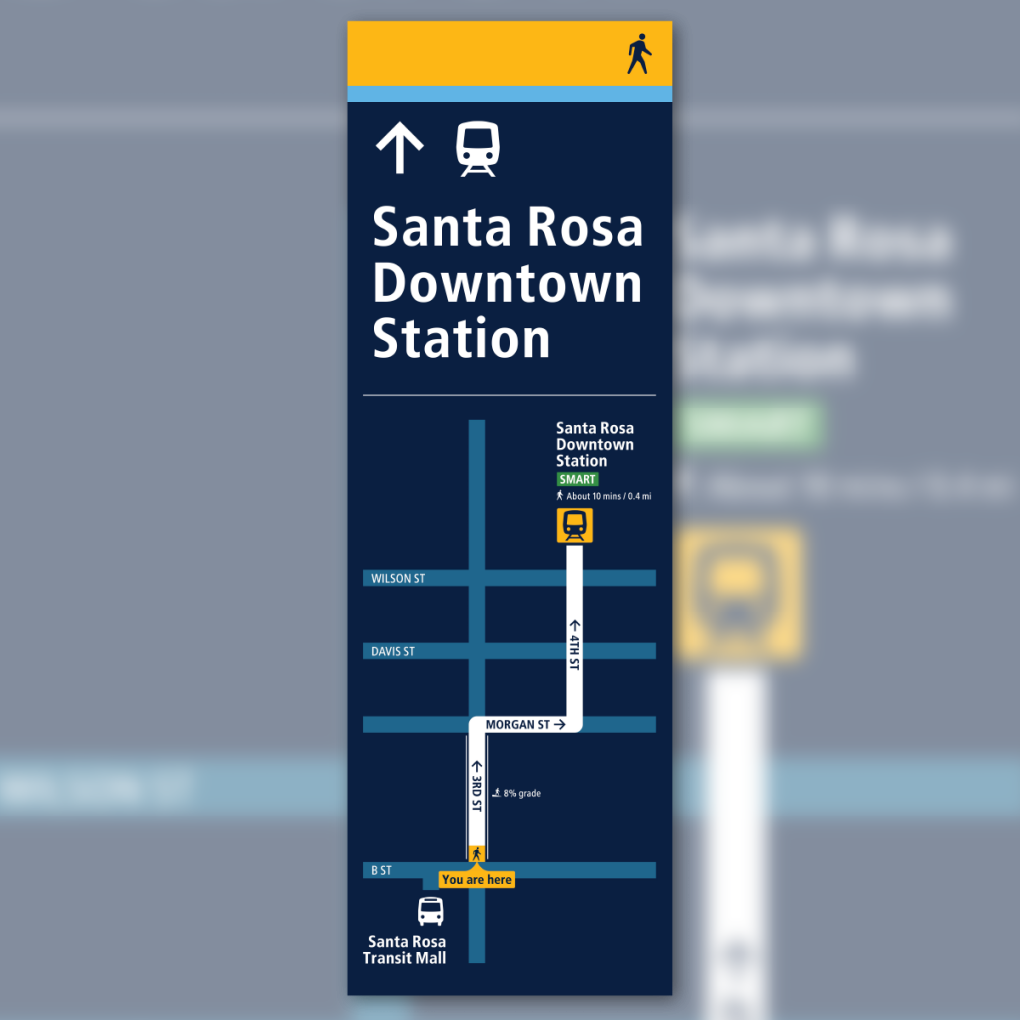
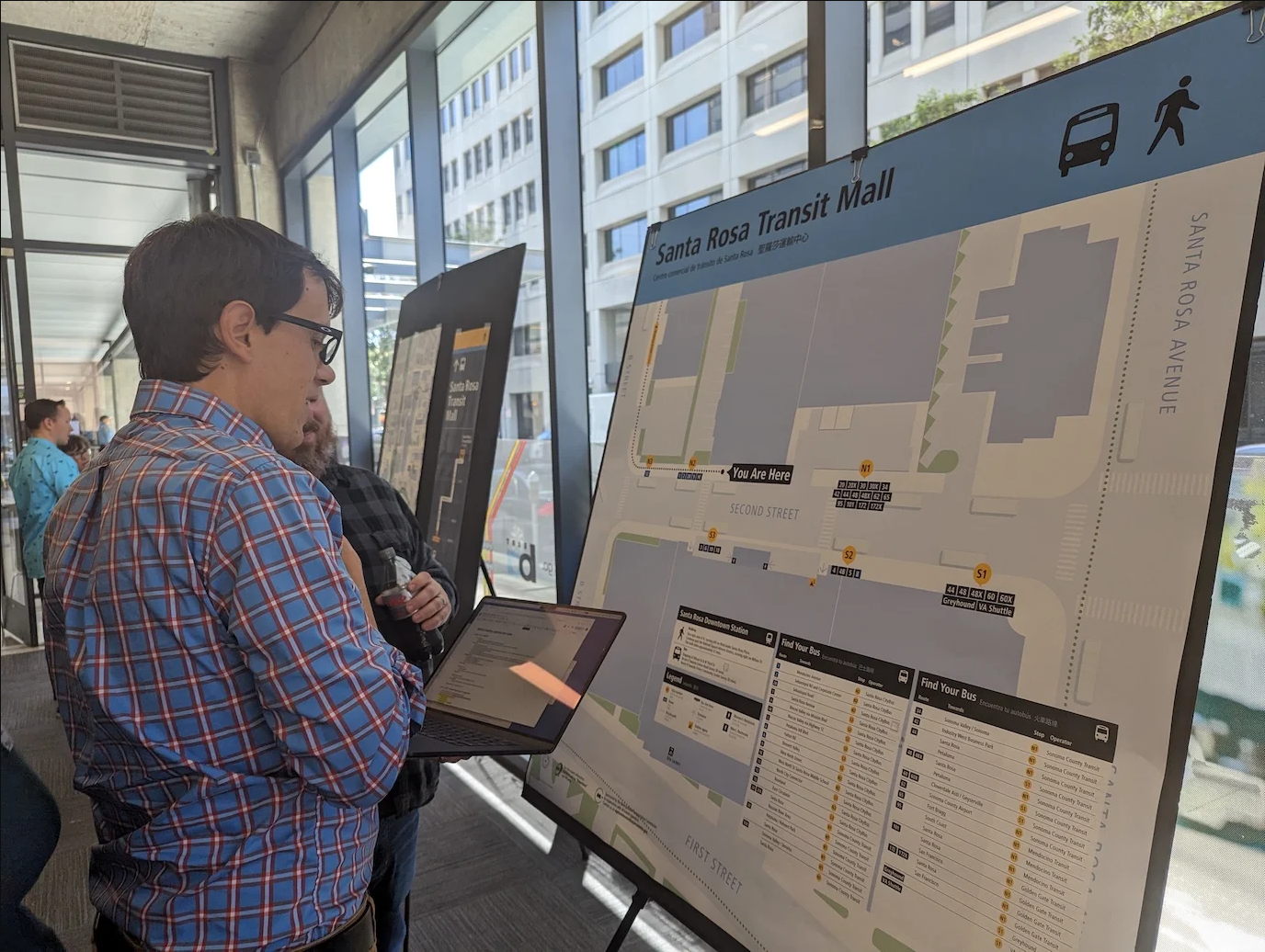
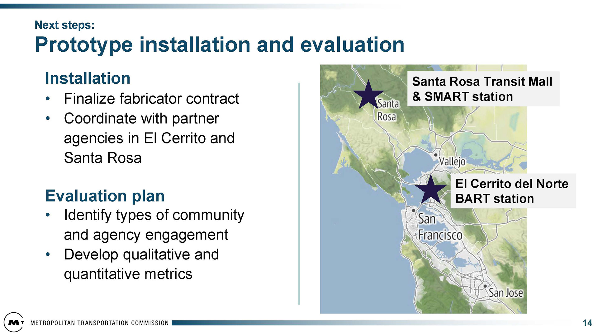
2025: Santa Rosa Downtown Station to Santa Rosa Transit Mall Prototype


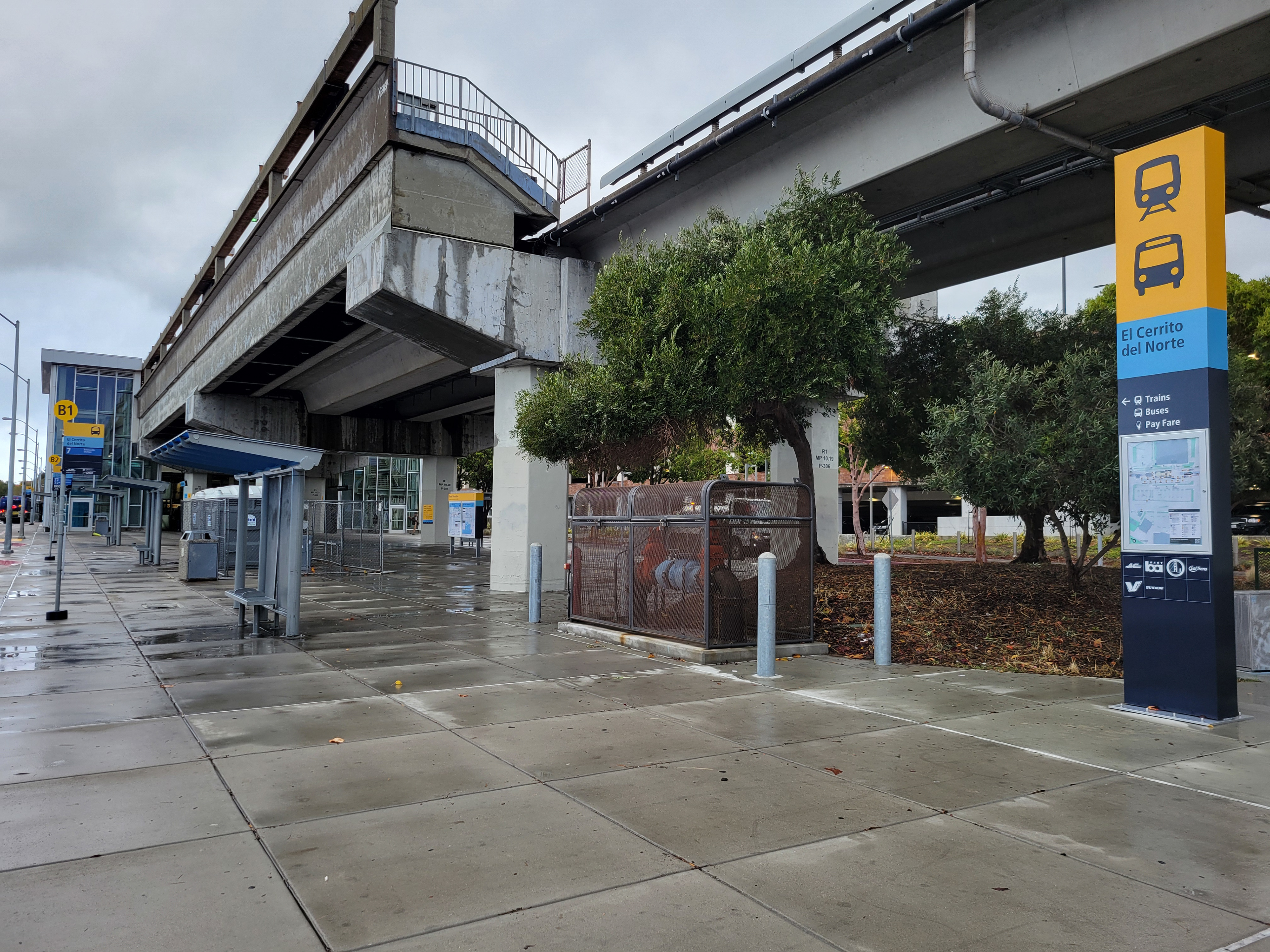
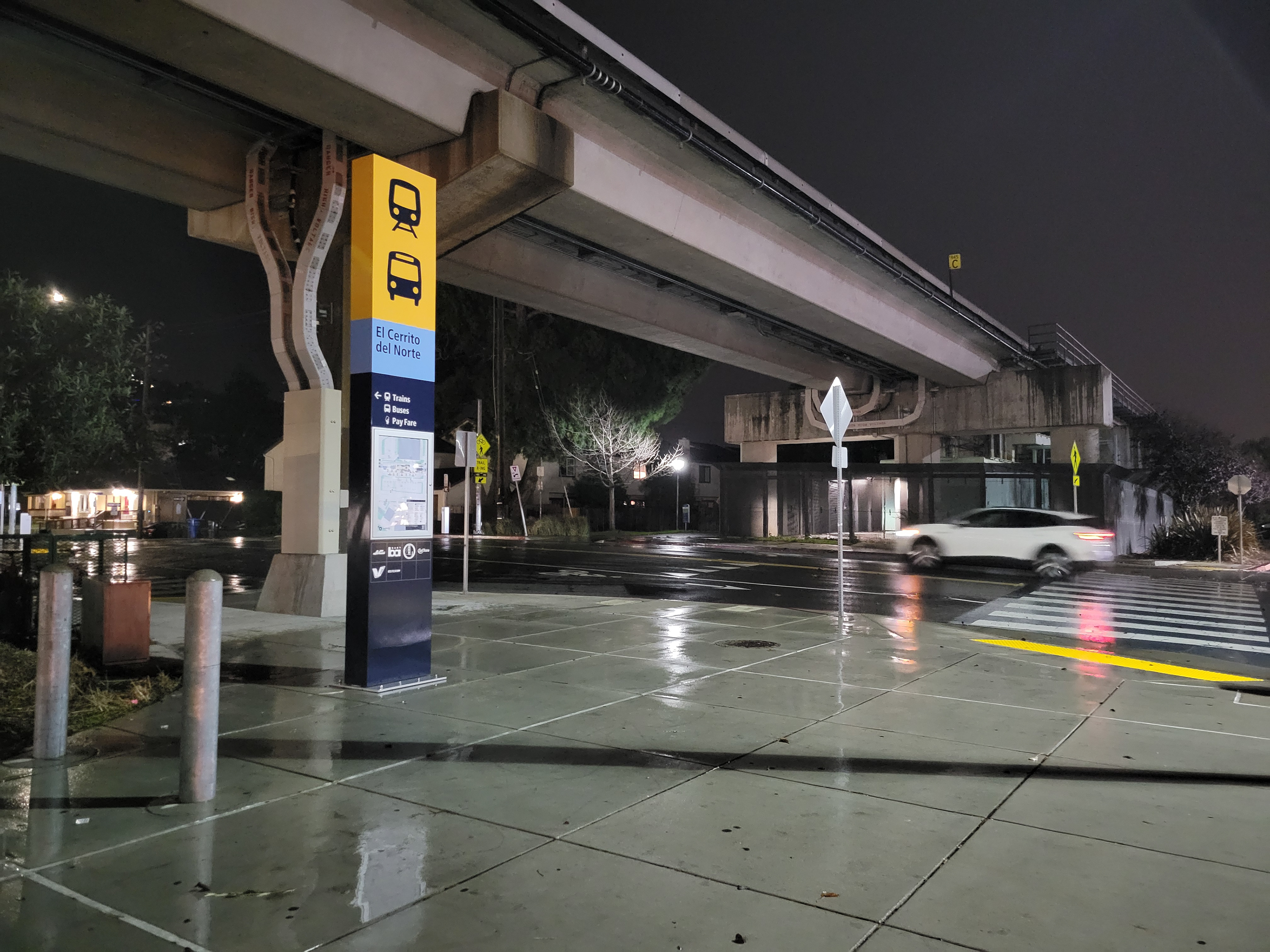
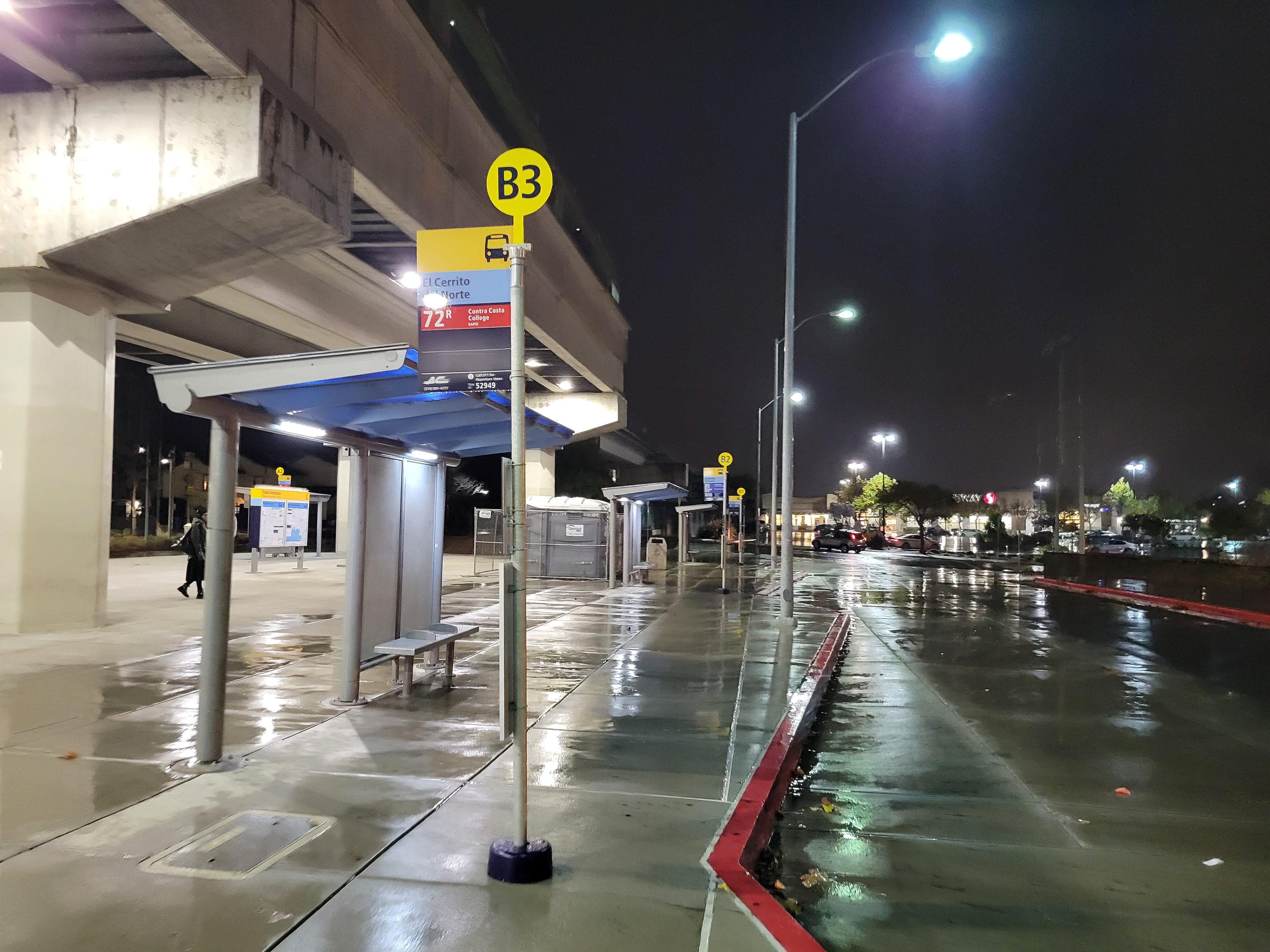
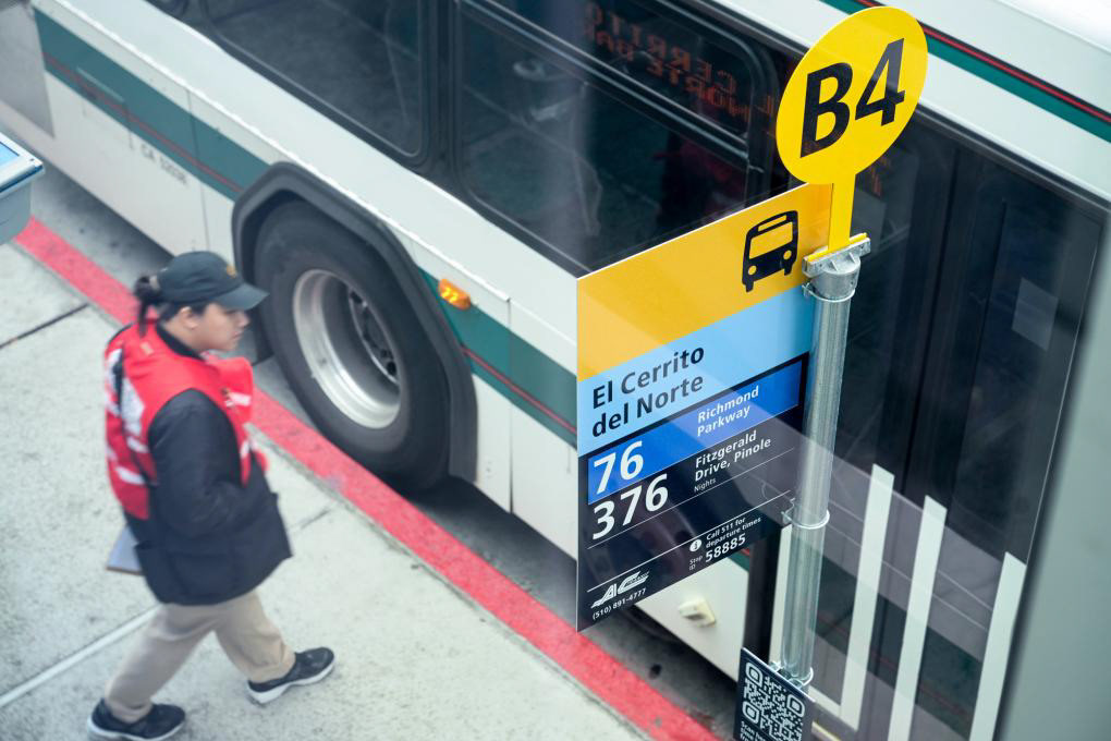
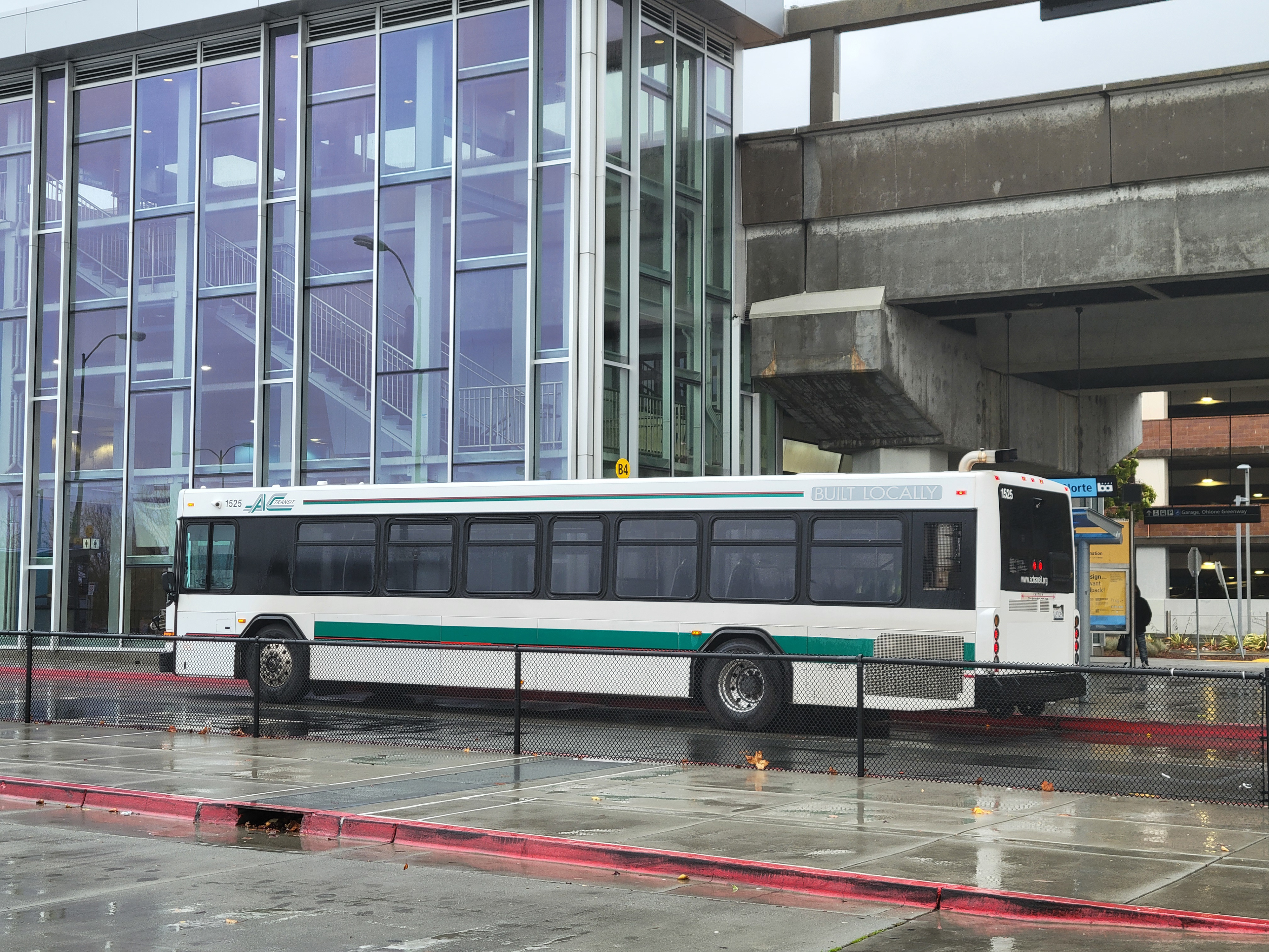
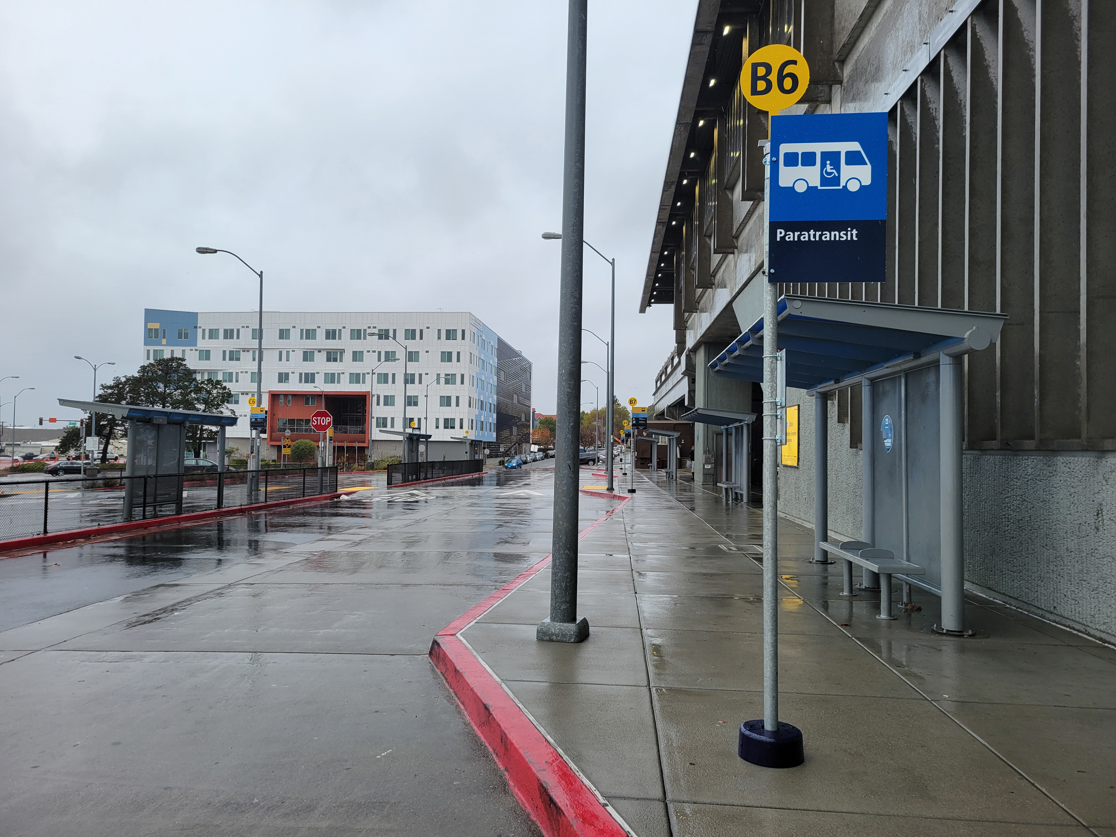
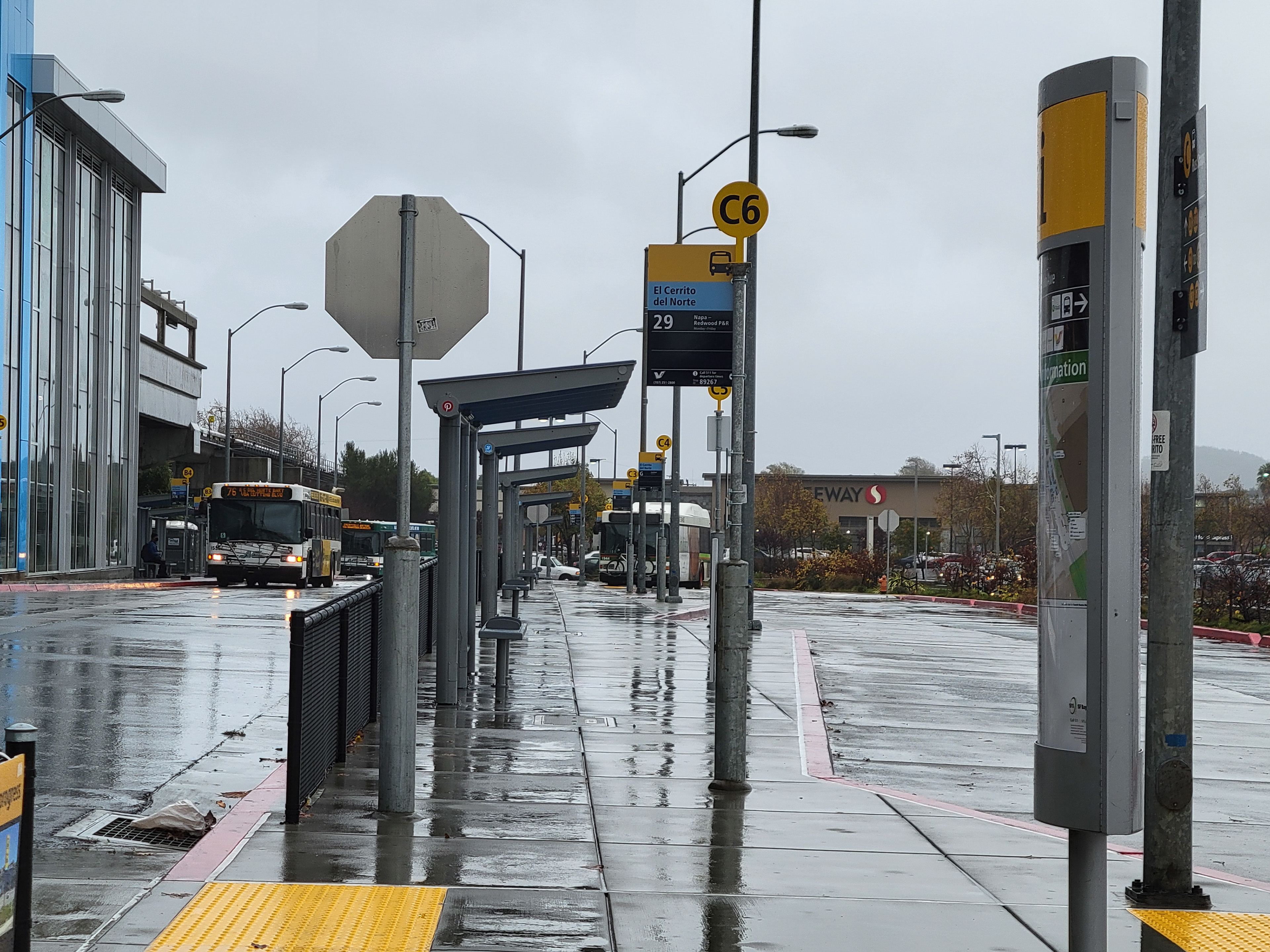
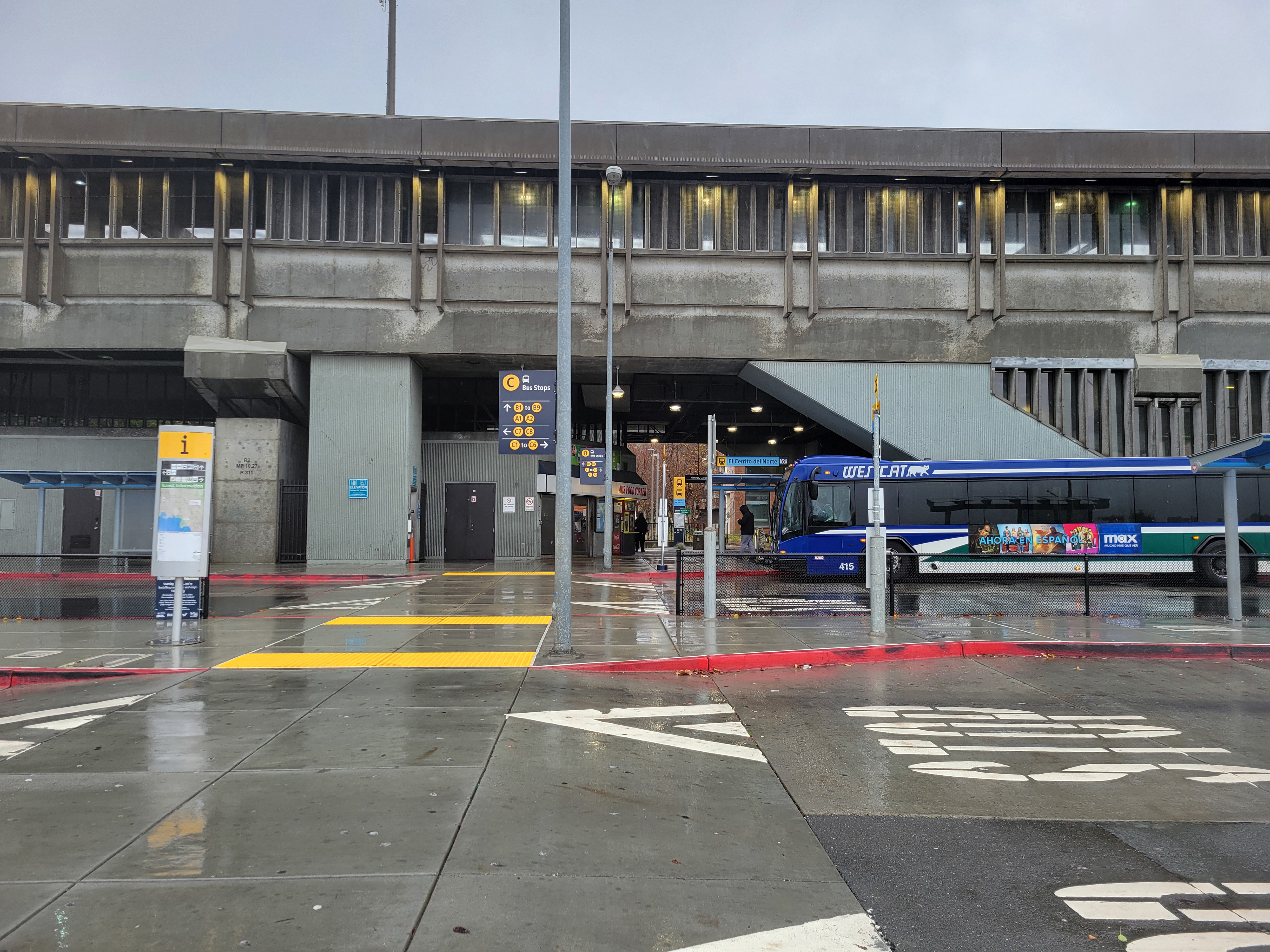
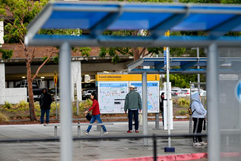
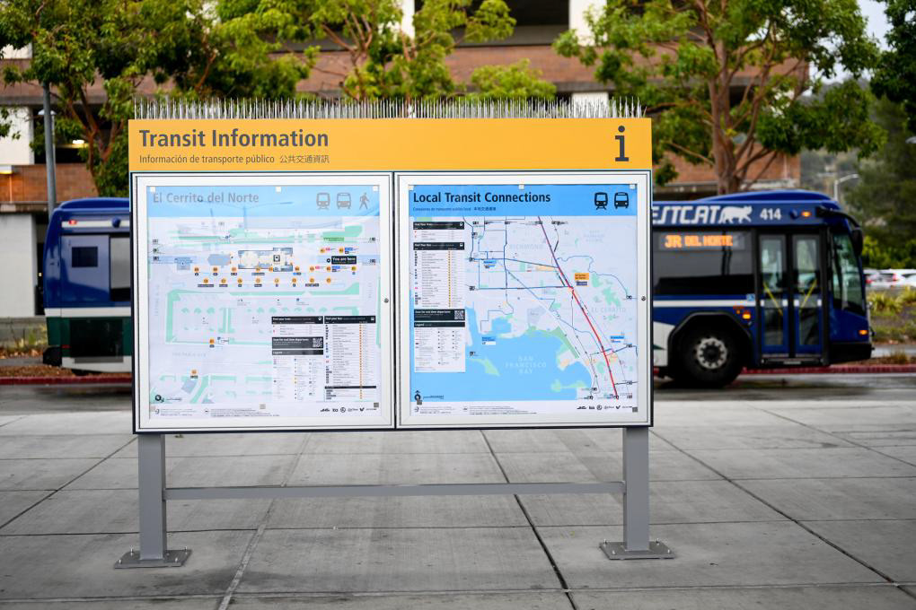
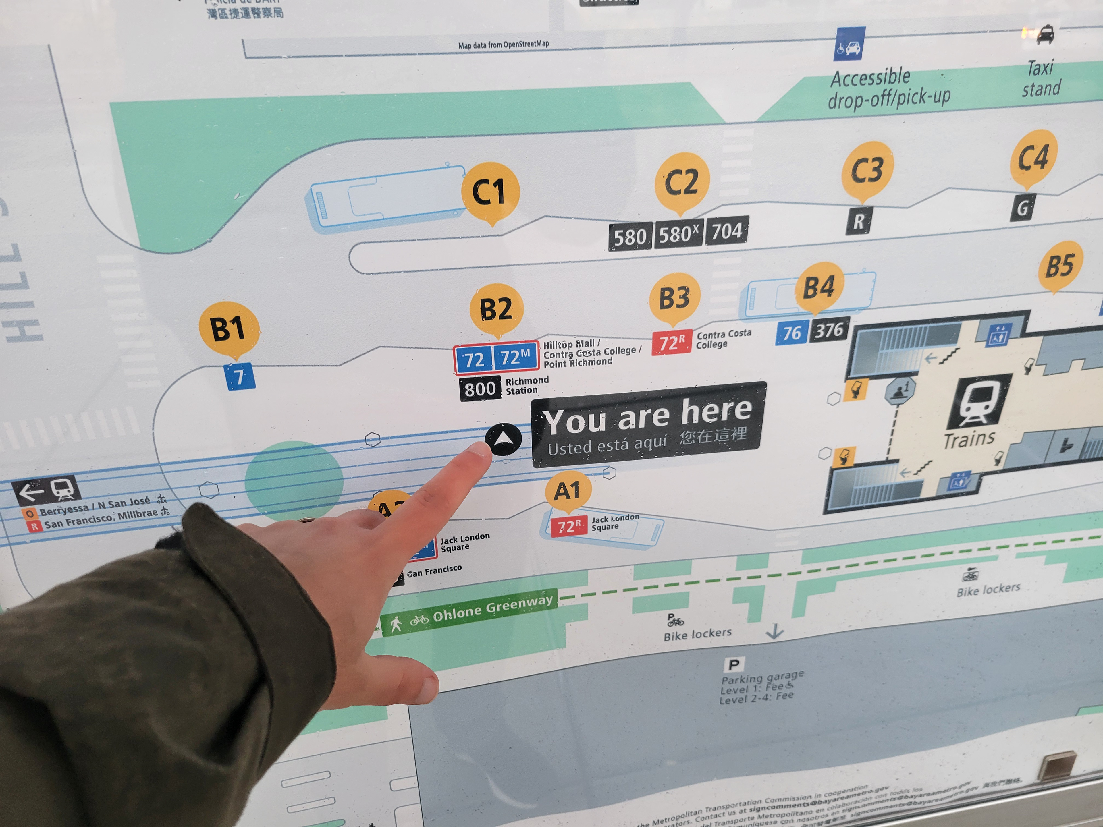
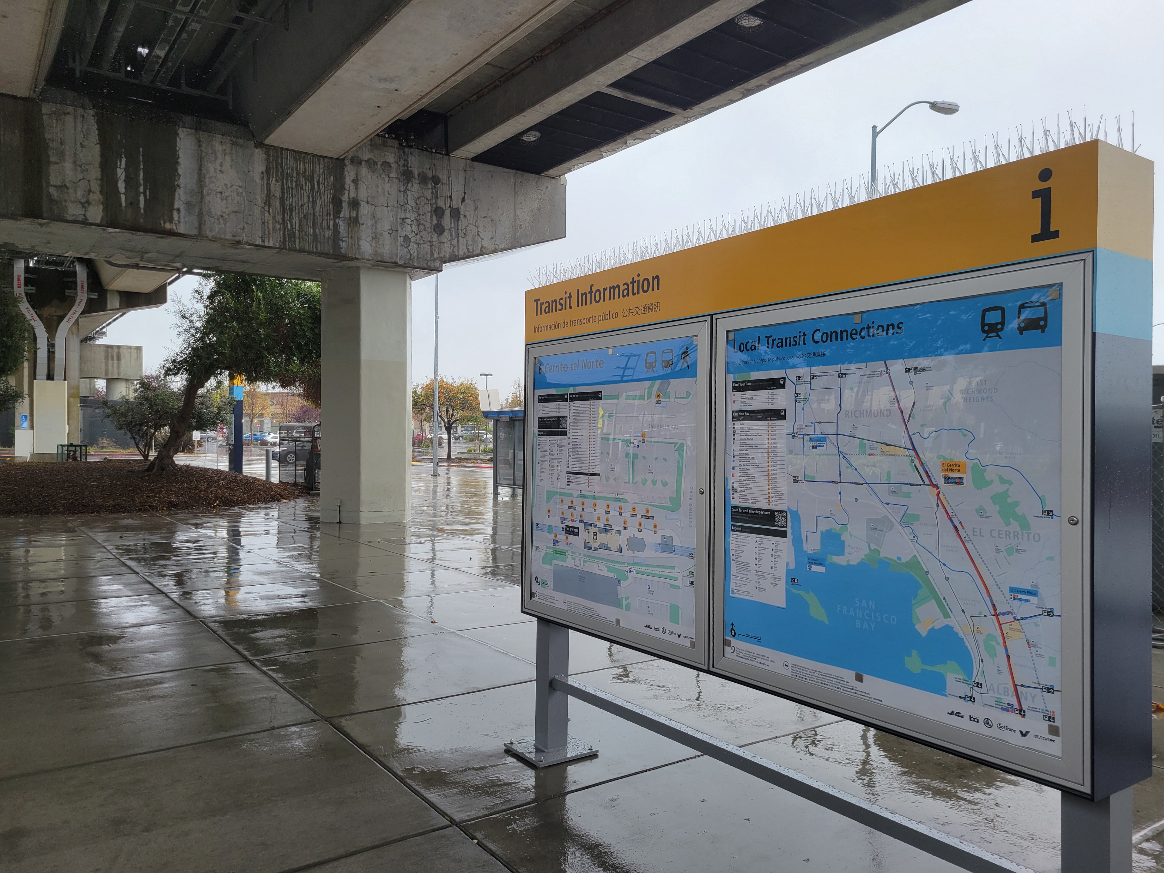
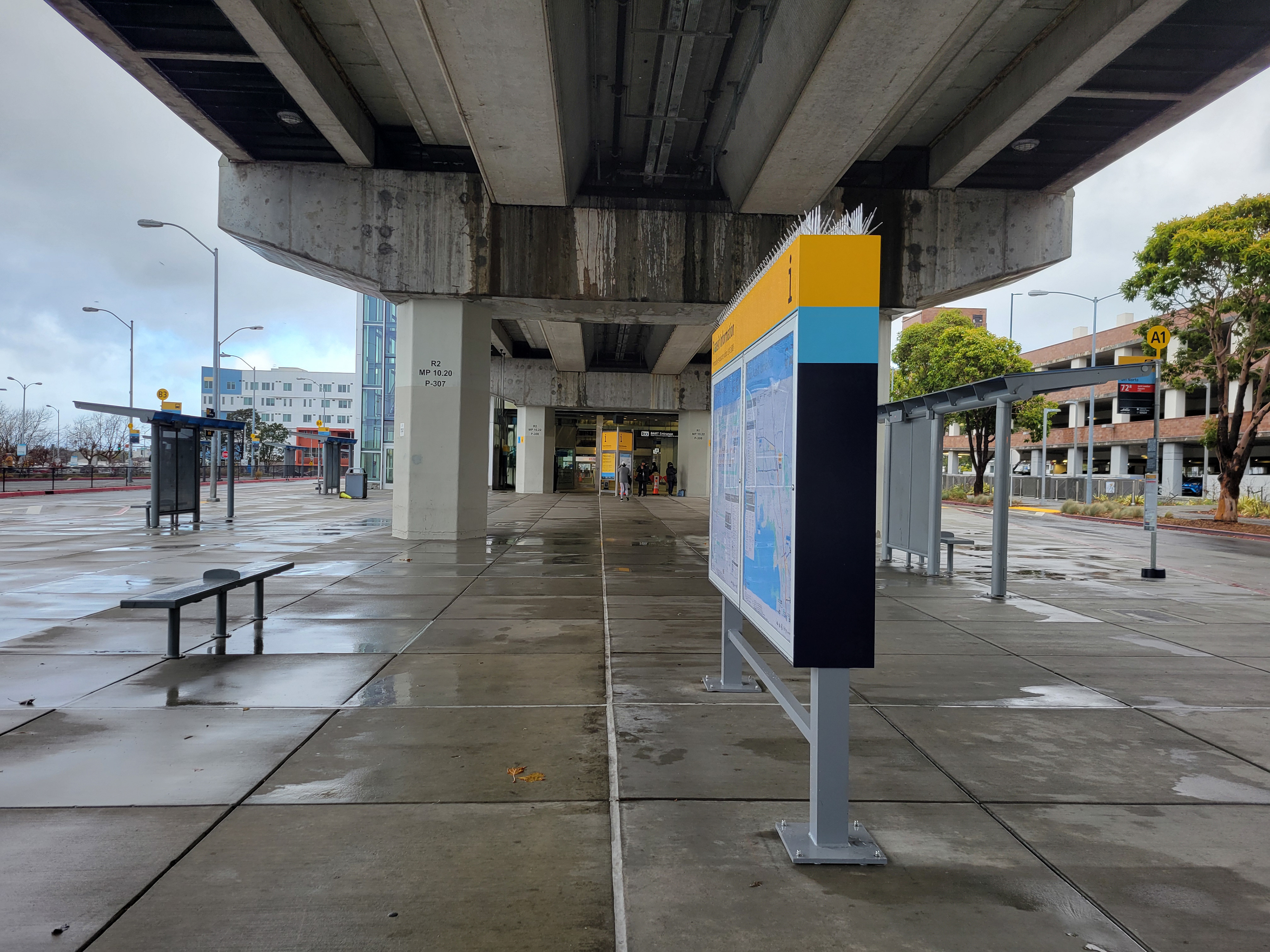
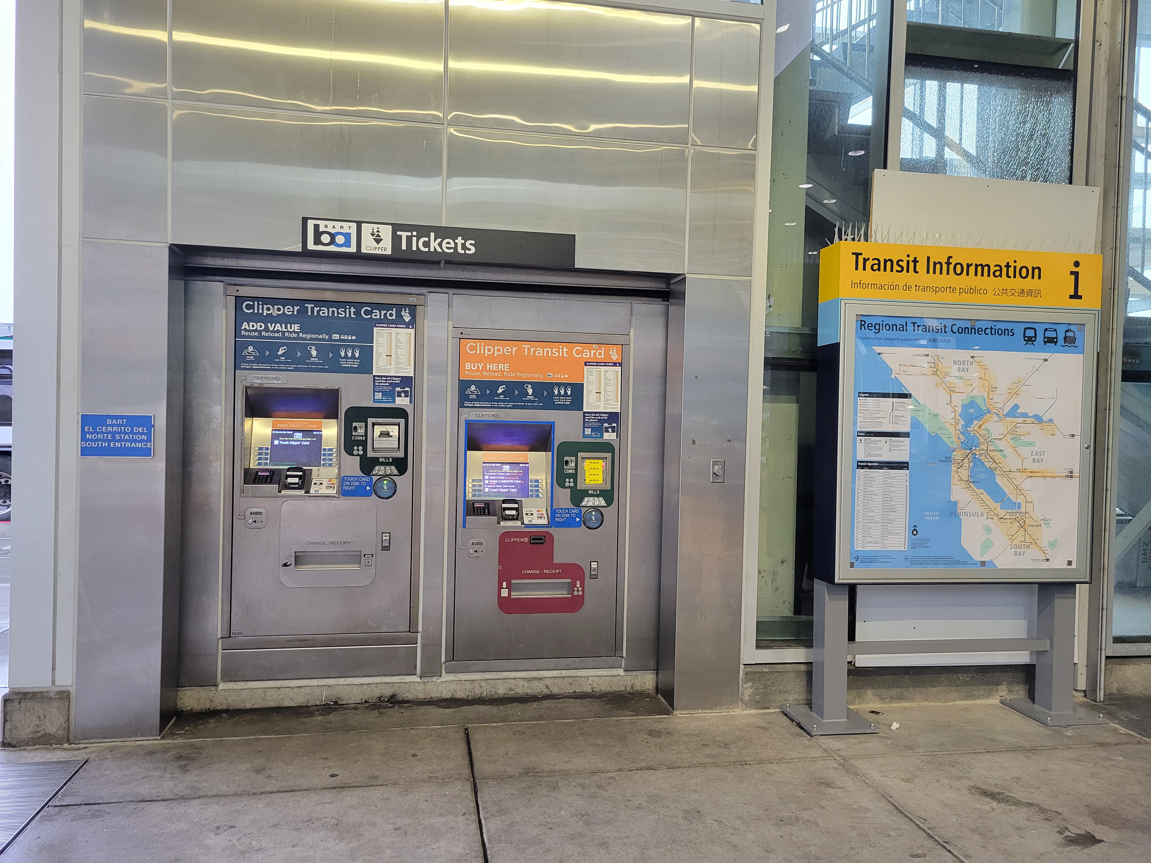
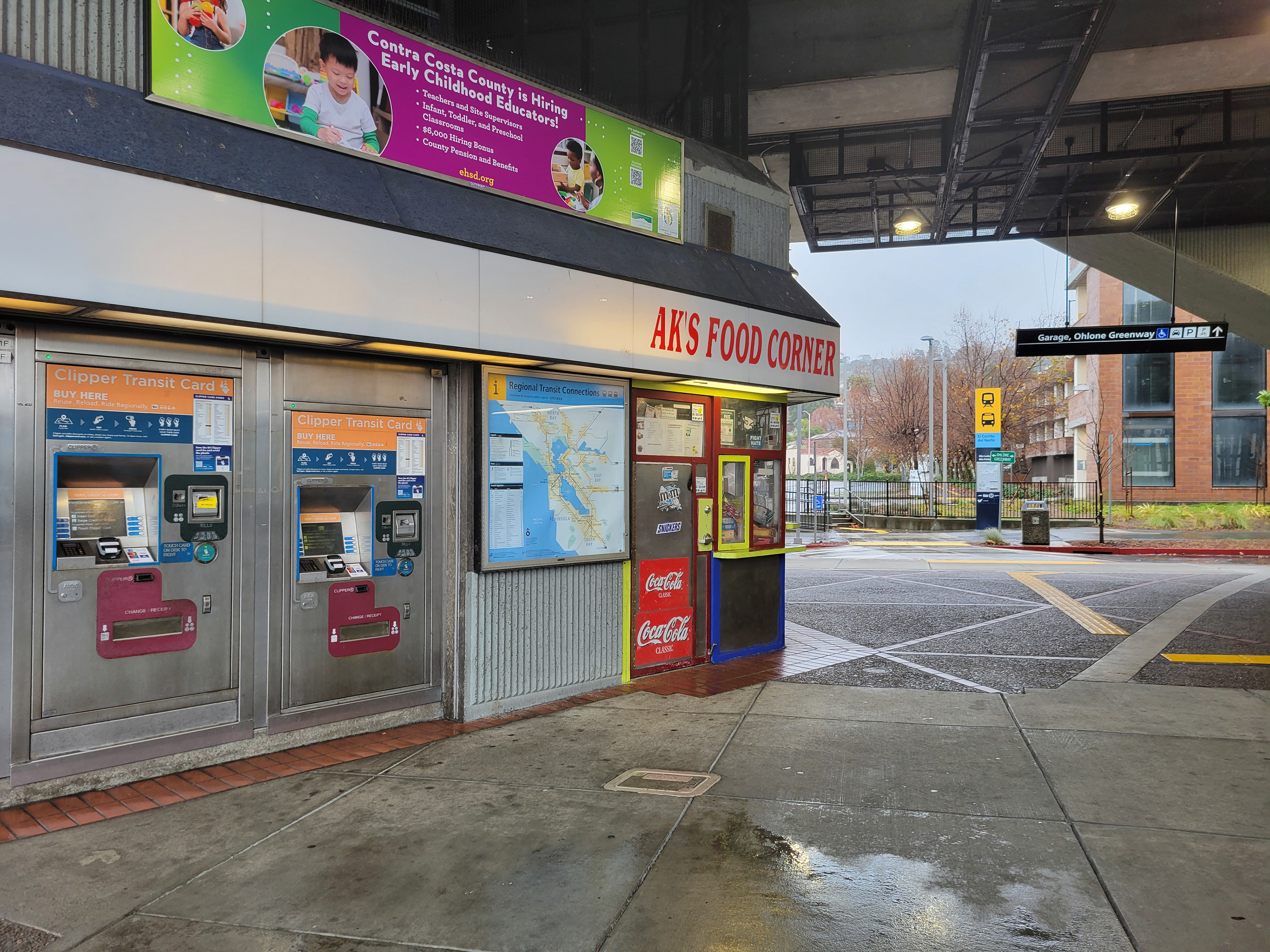
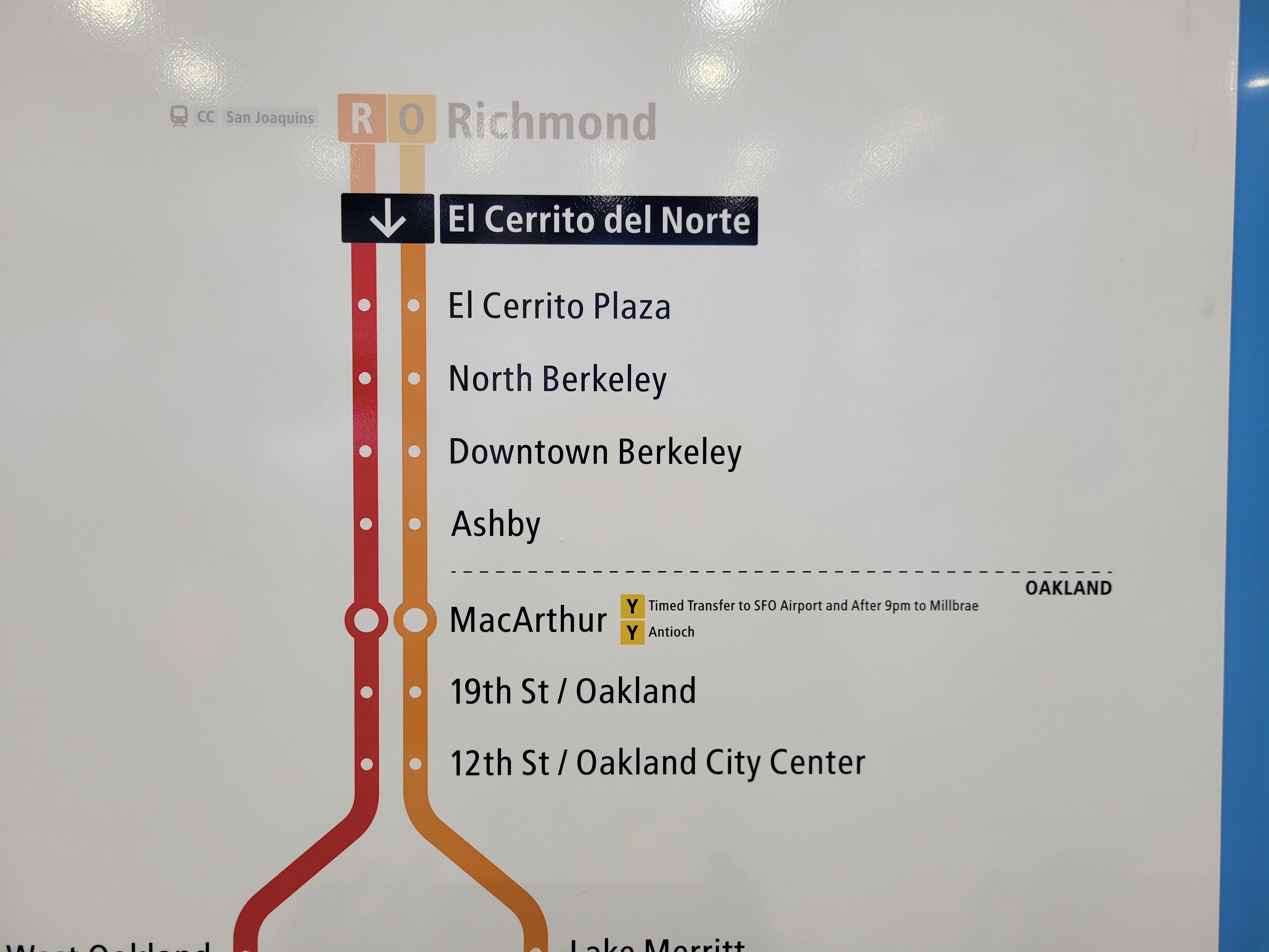
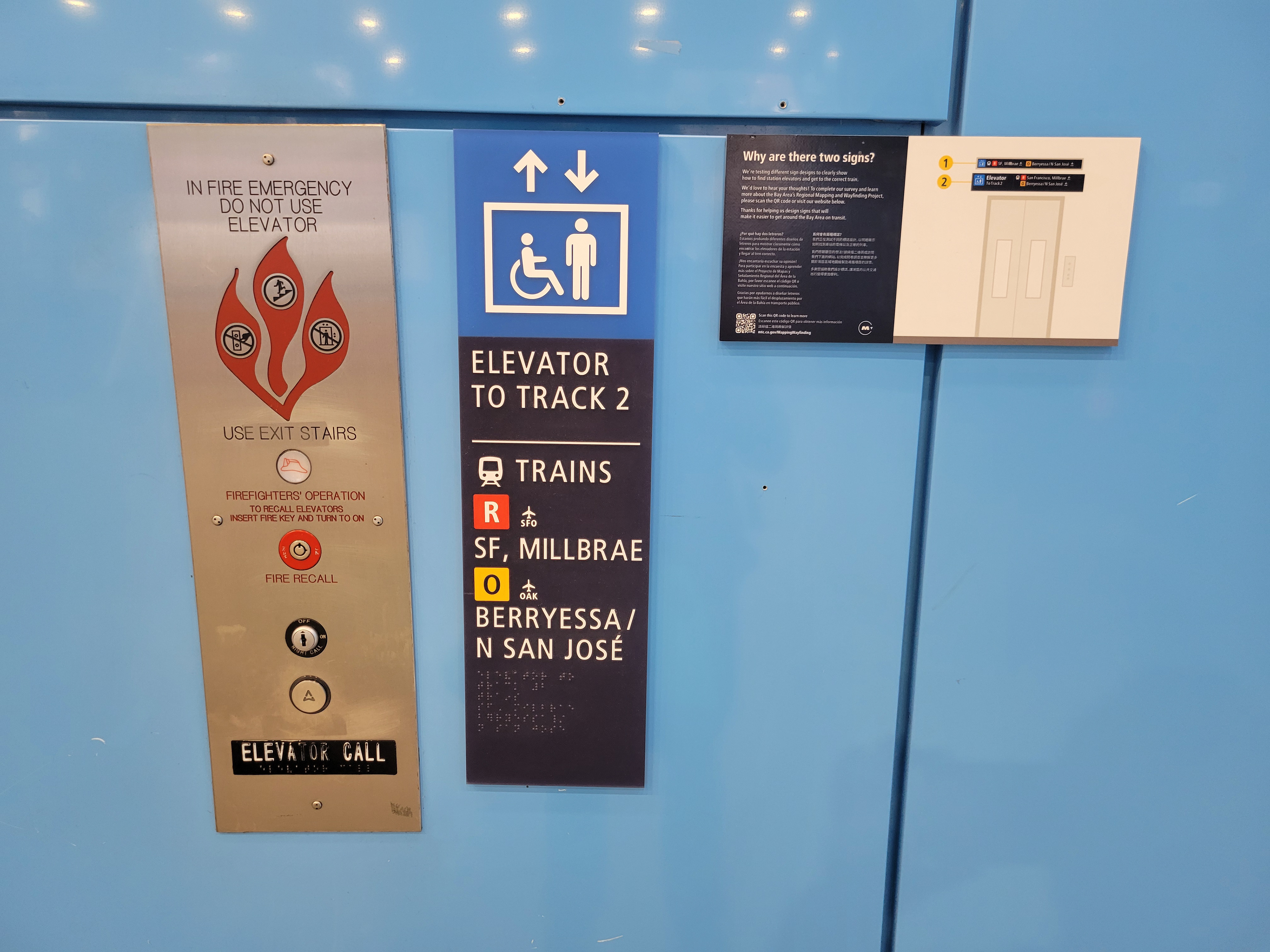
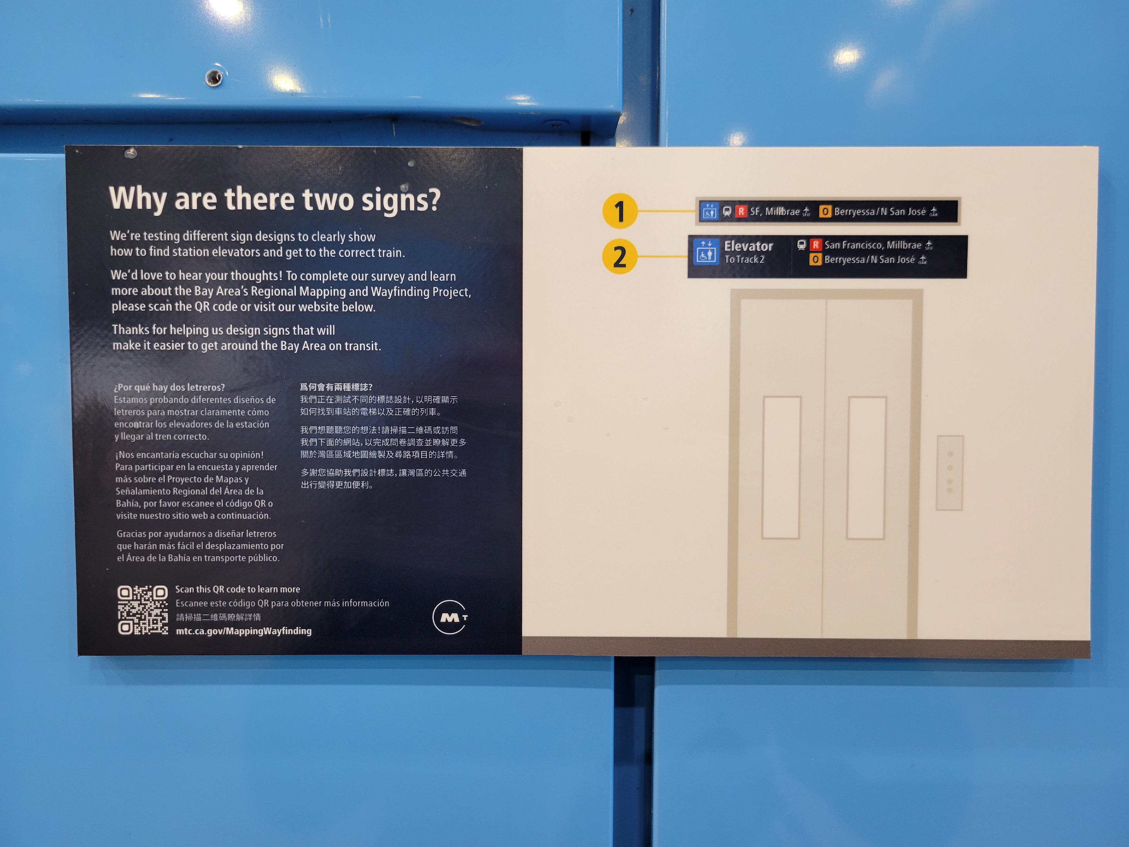
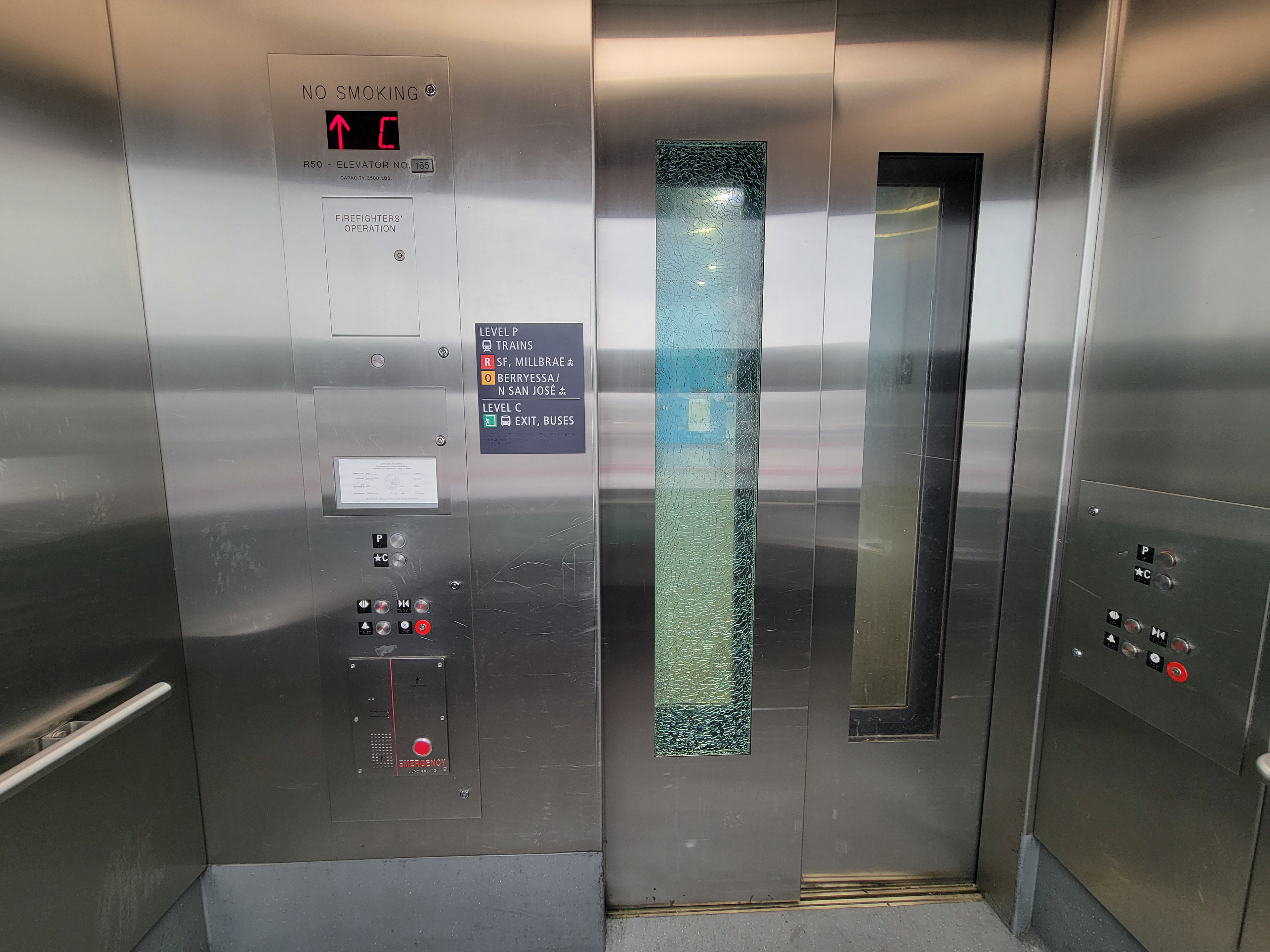
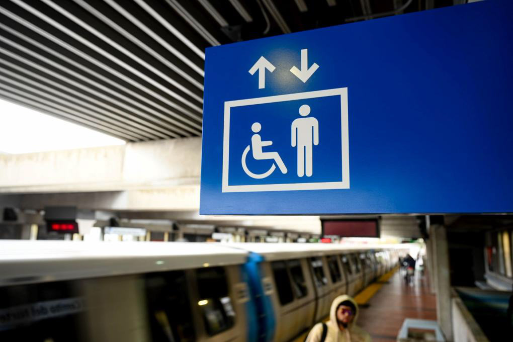
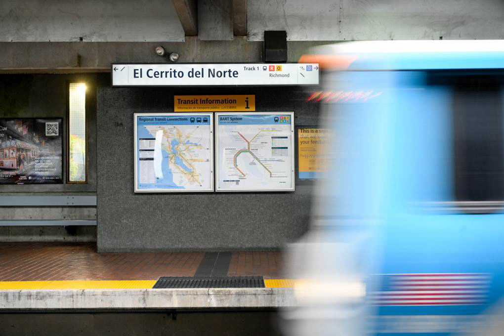
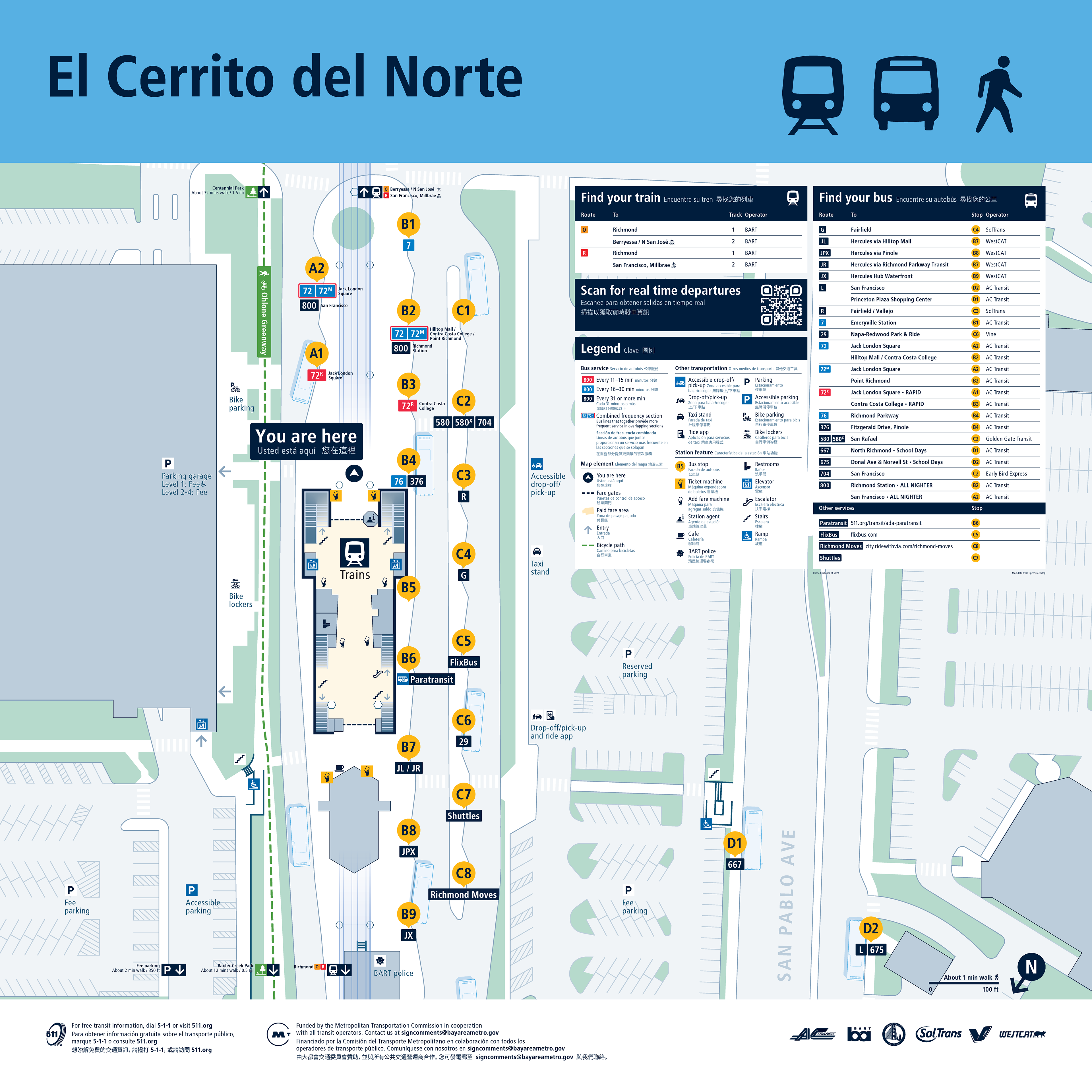
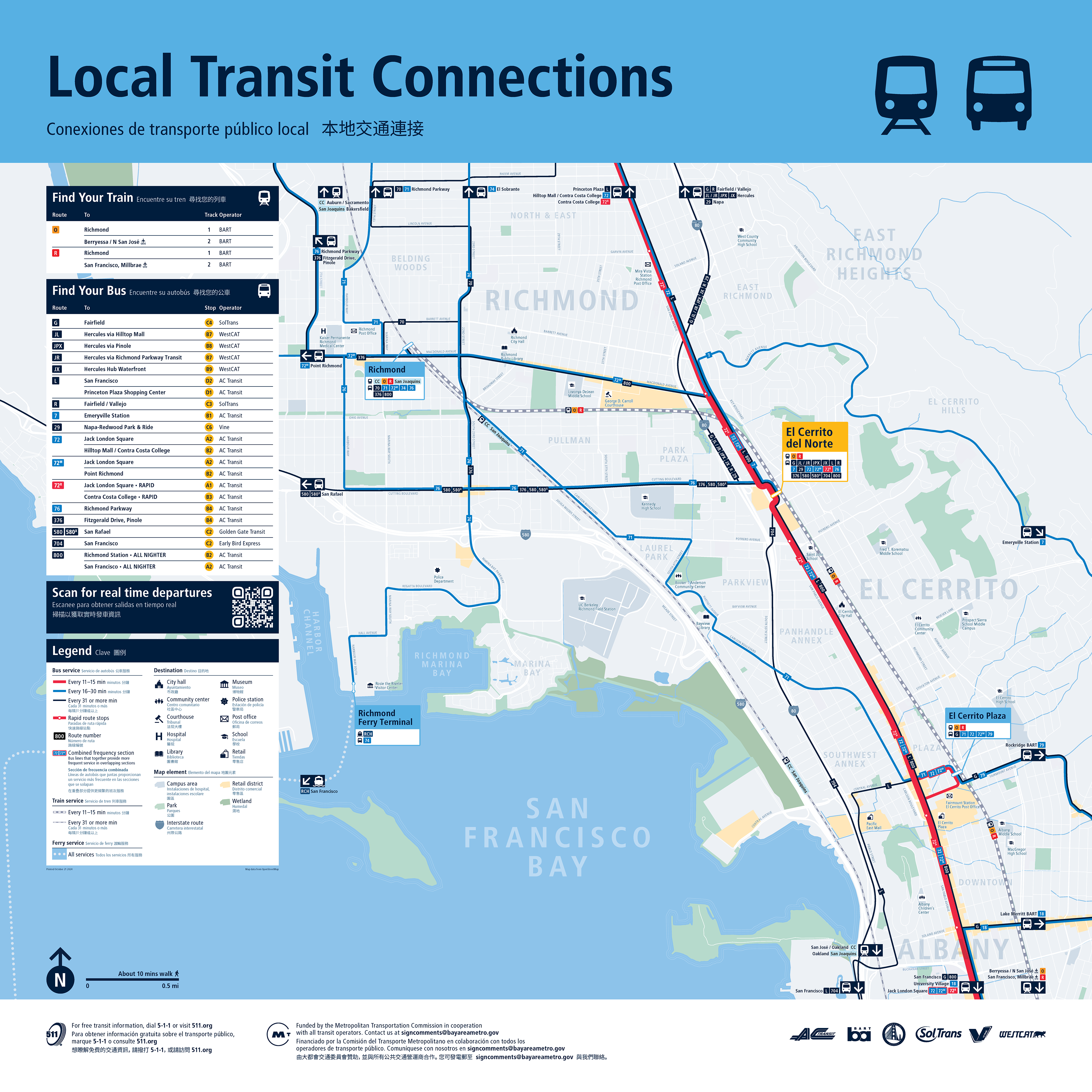
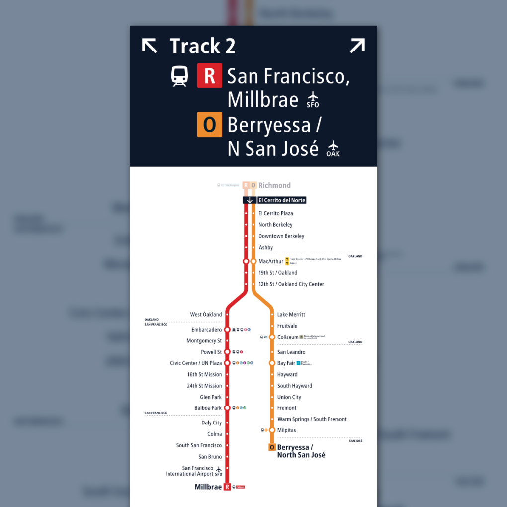
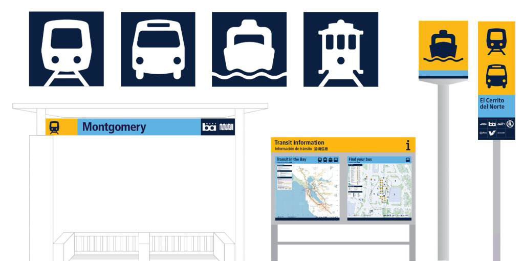
2024: El Cerrito del Norte Prototype


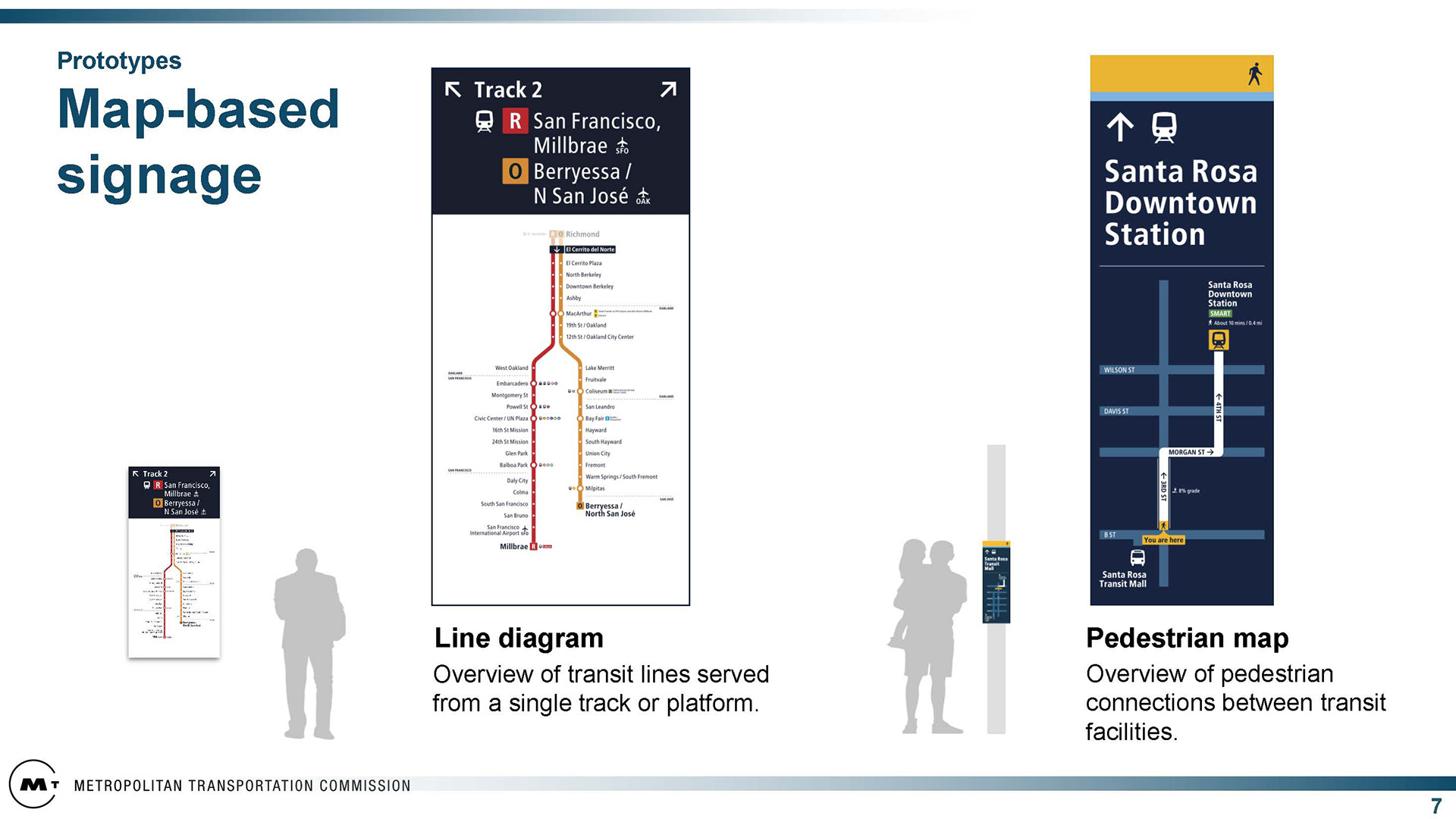
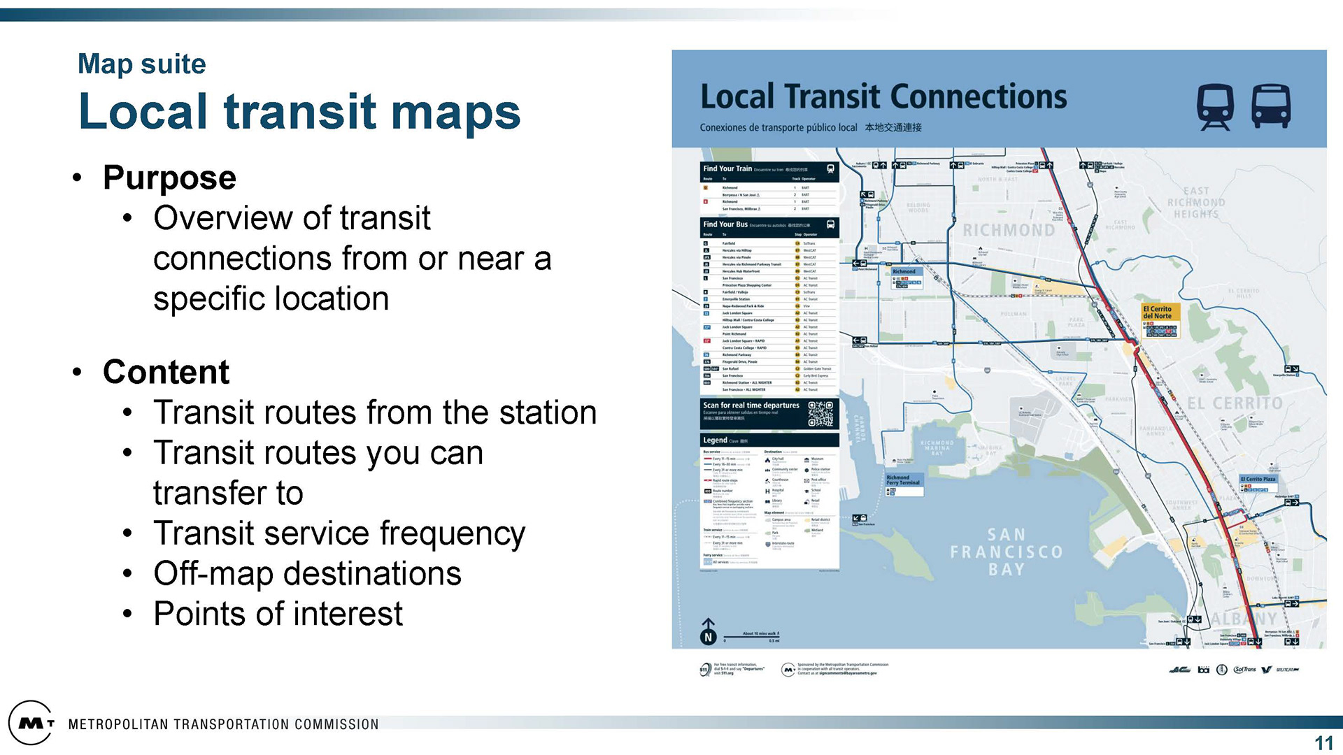
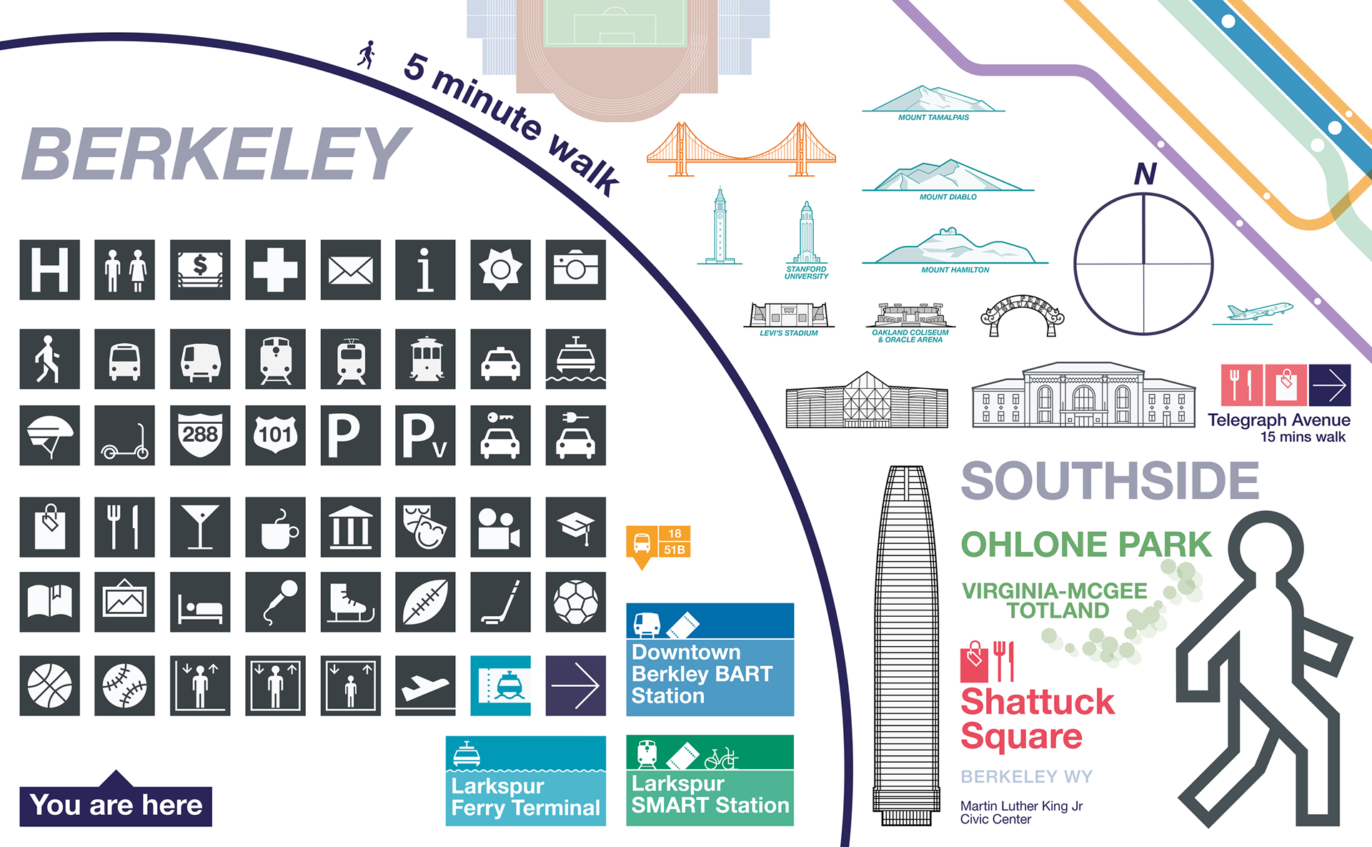
2022-2024: Maps and Diagrams prototypes and Stakeholder Workshops


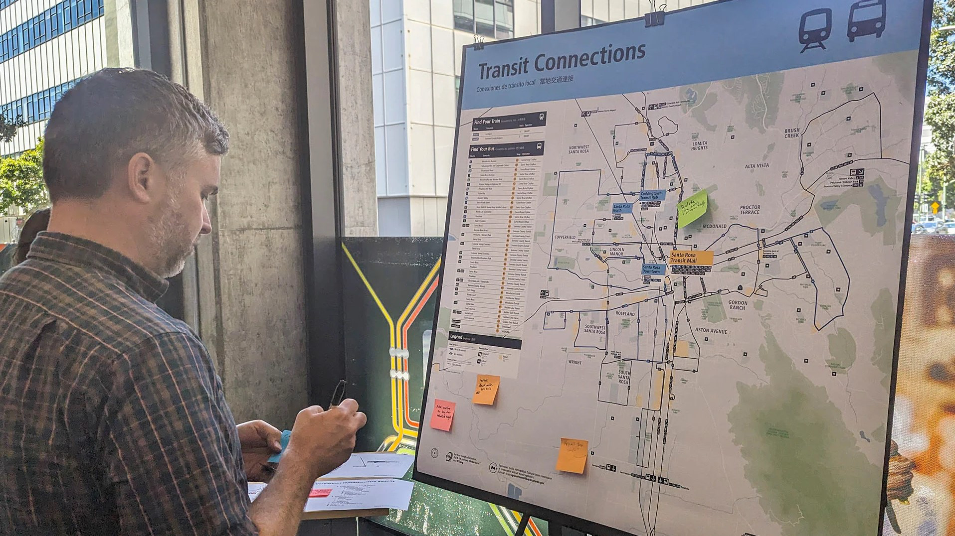
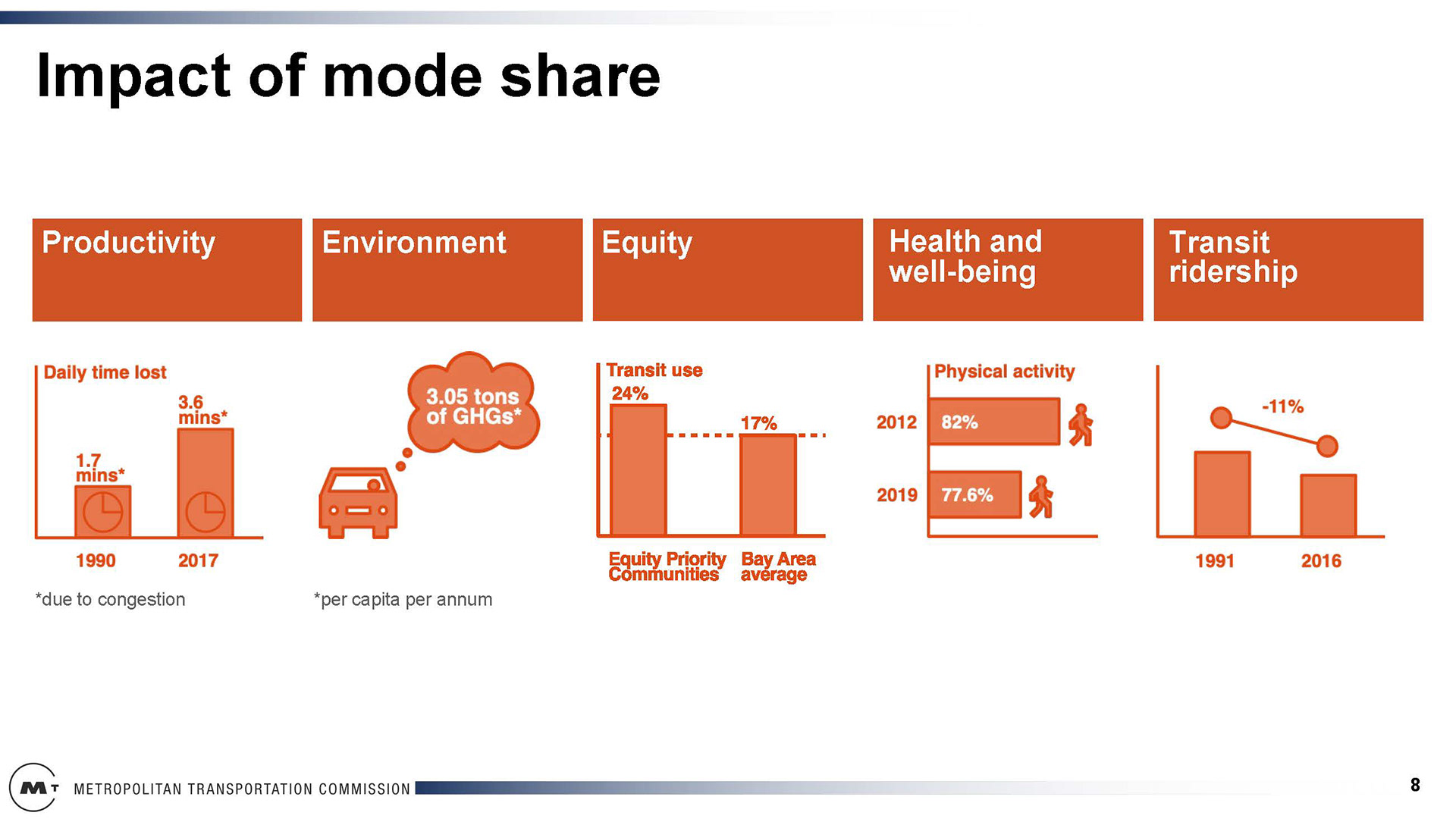
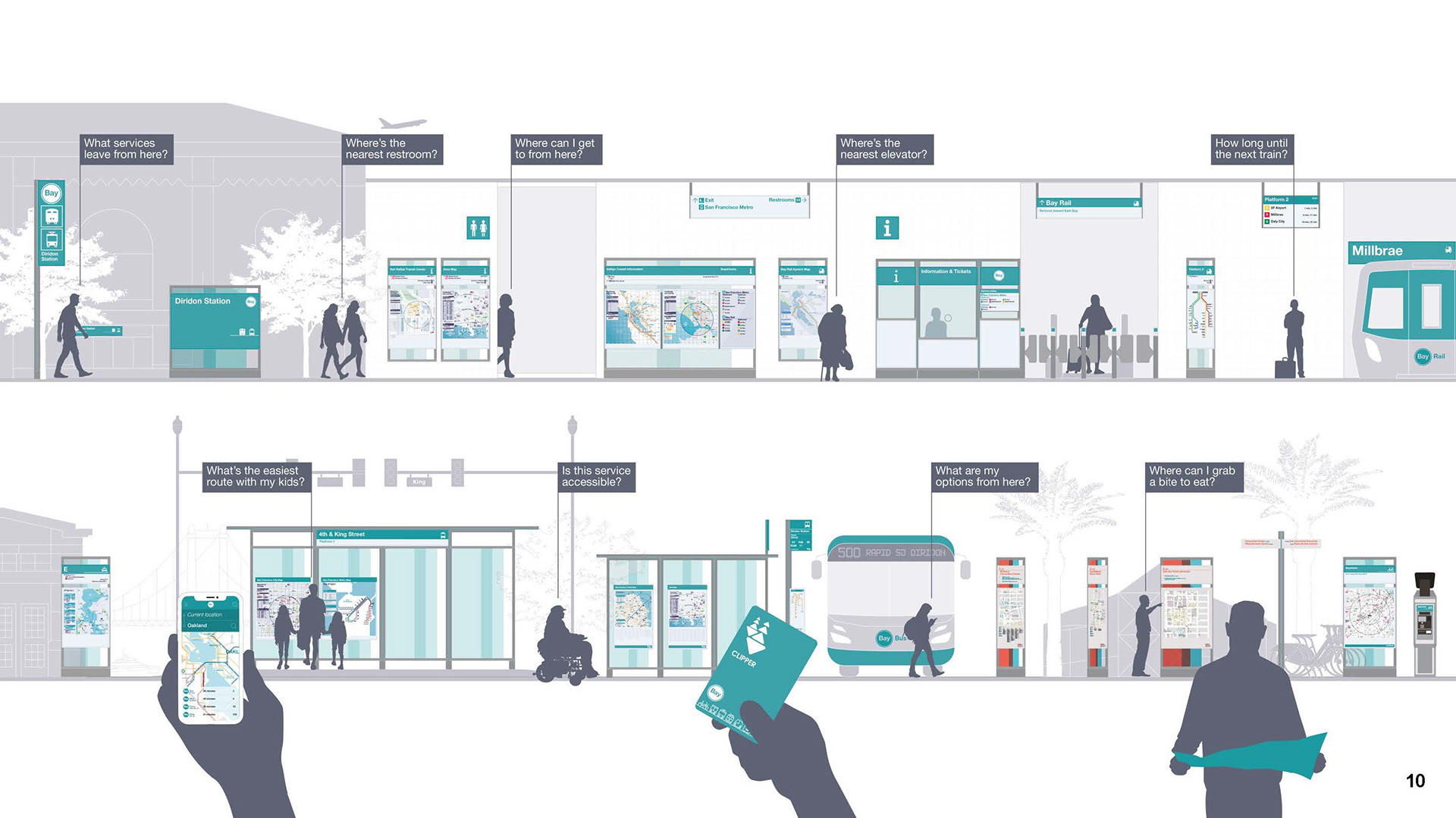
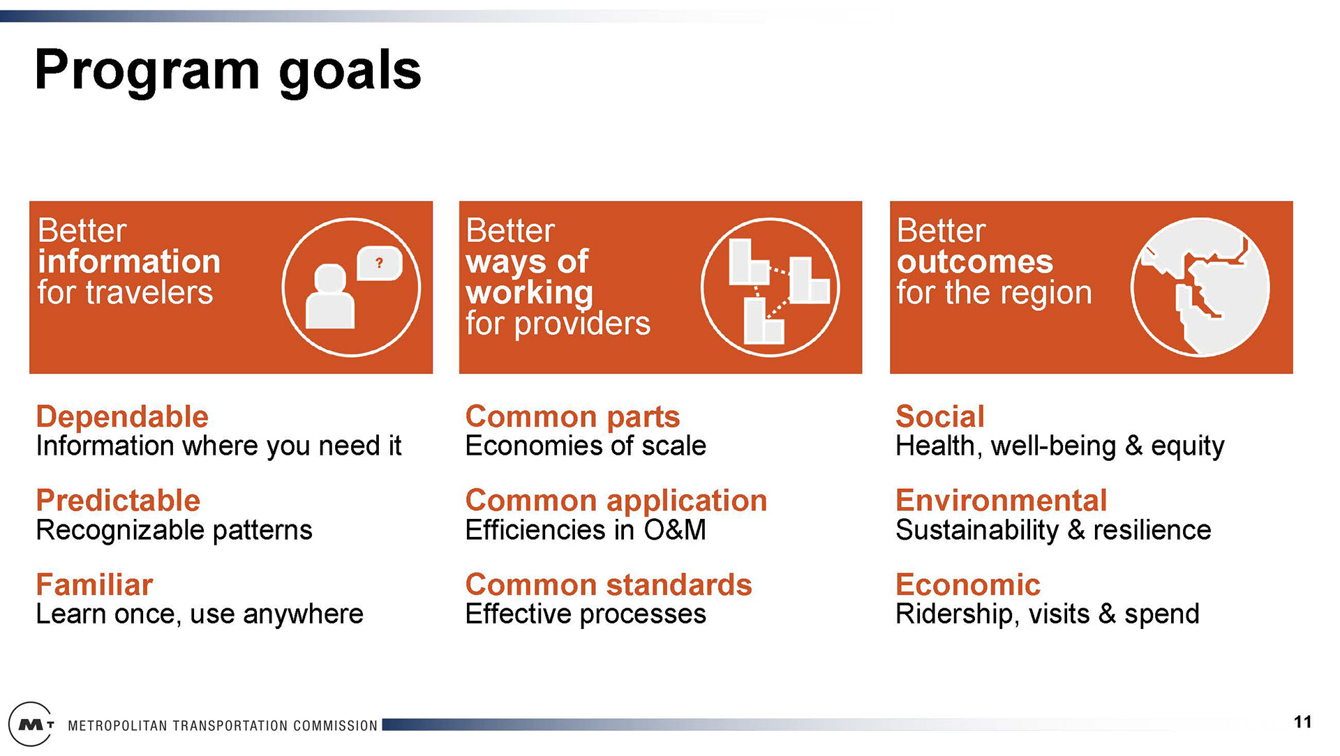
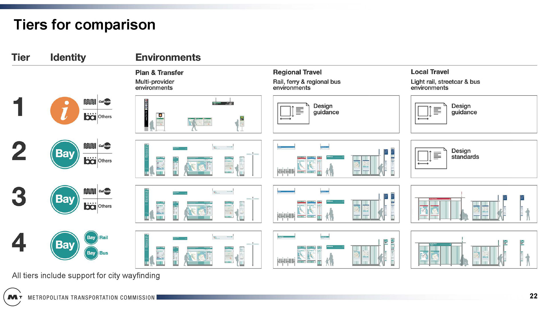
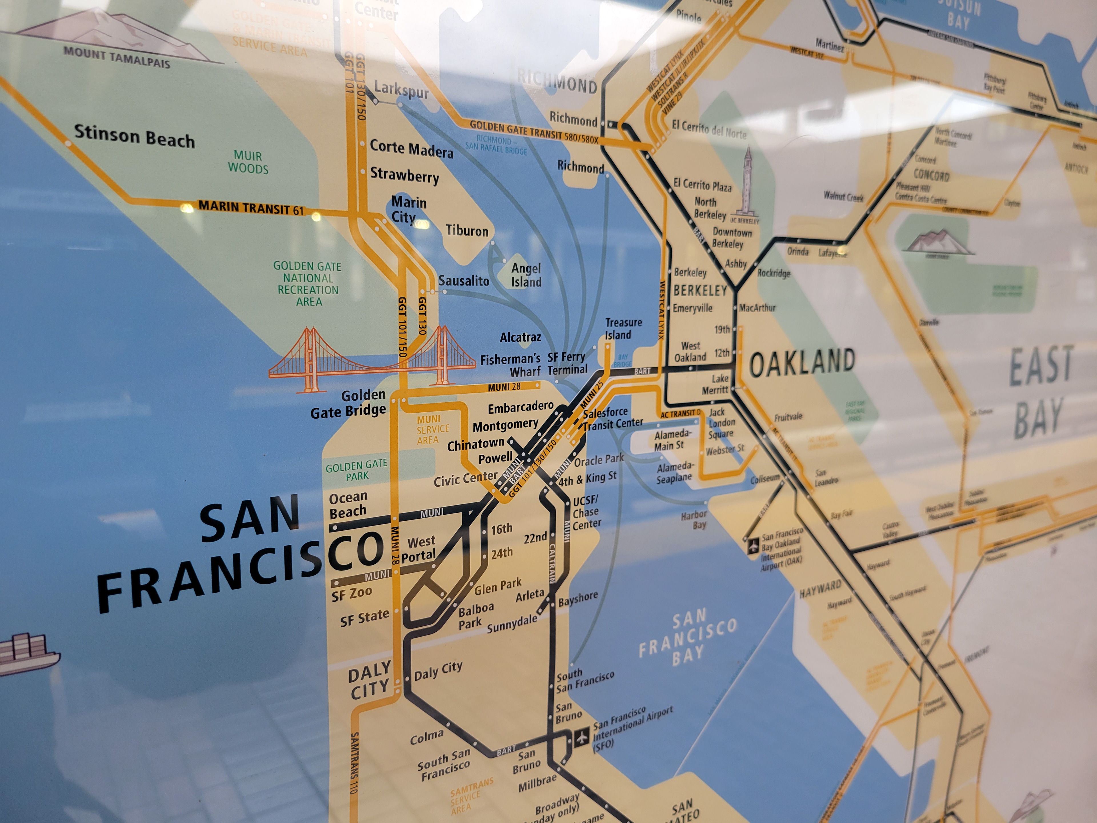
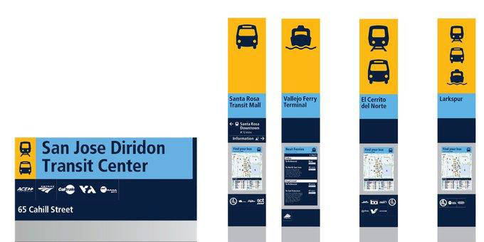
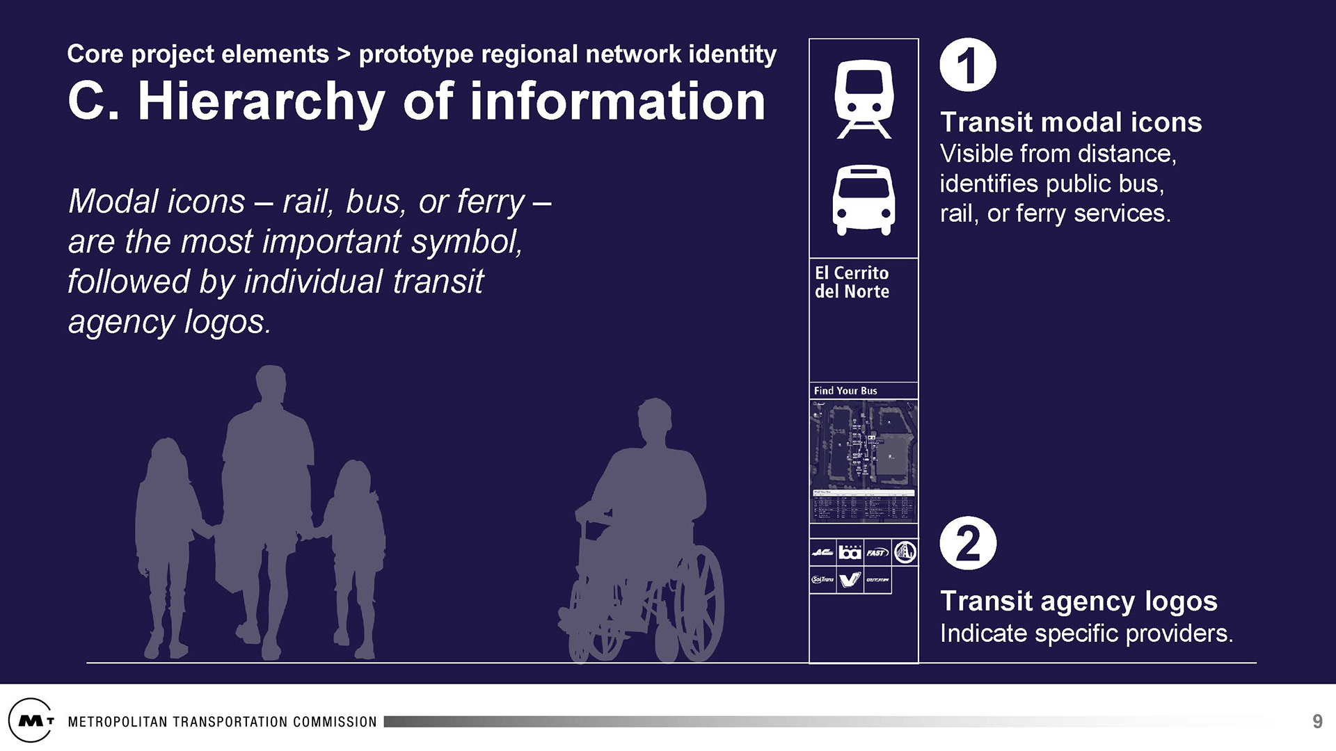
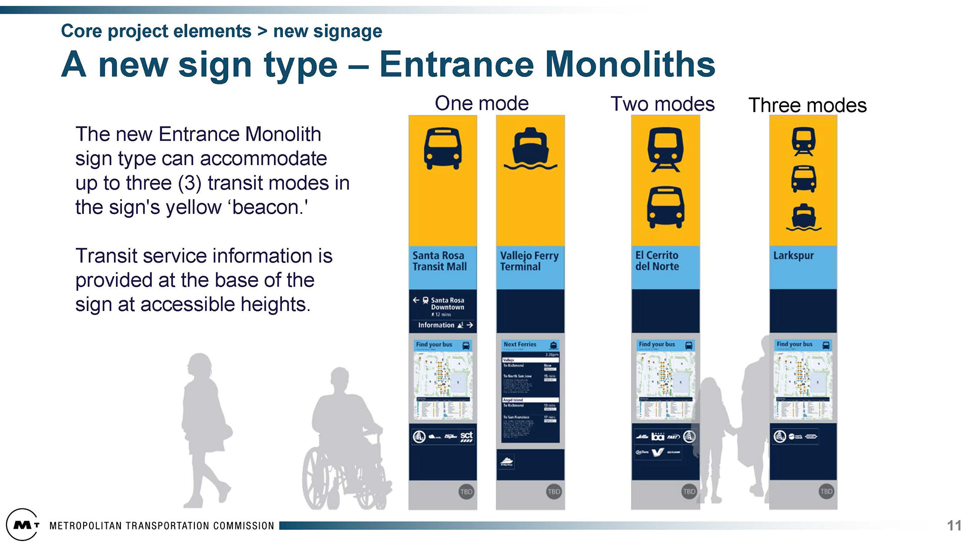
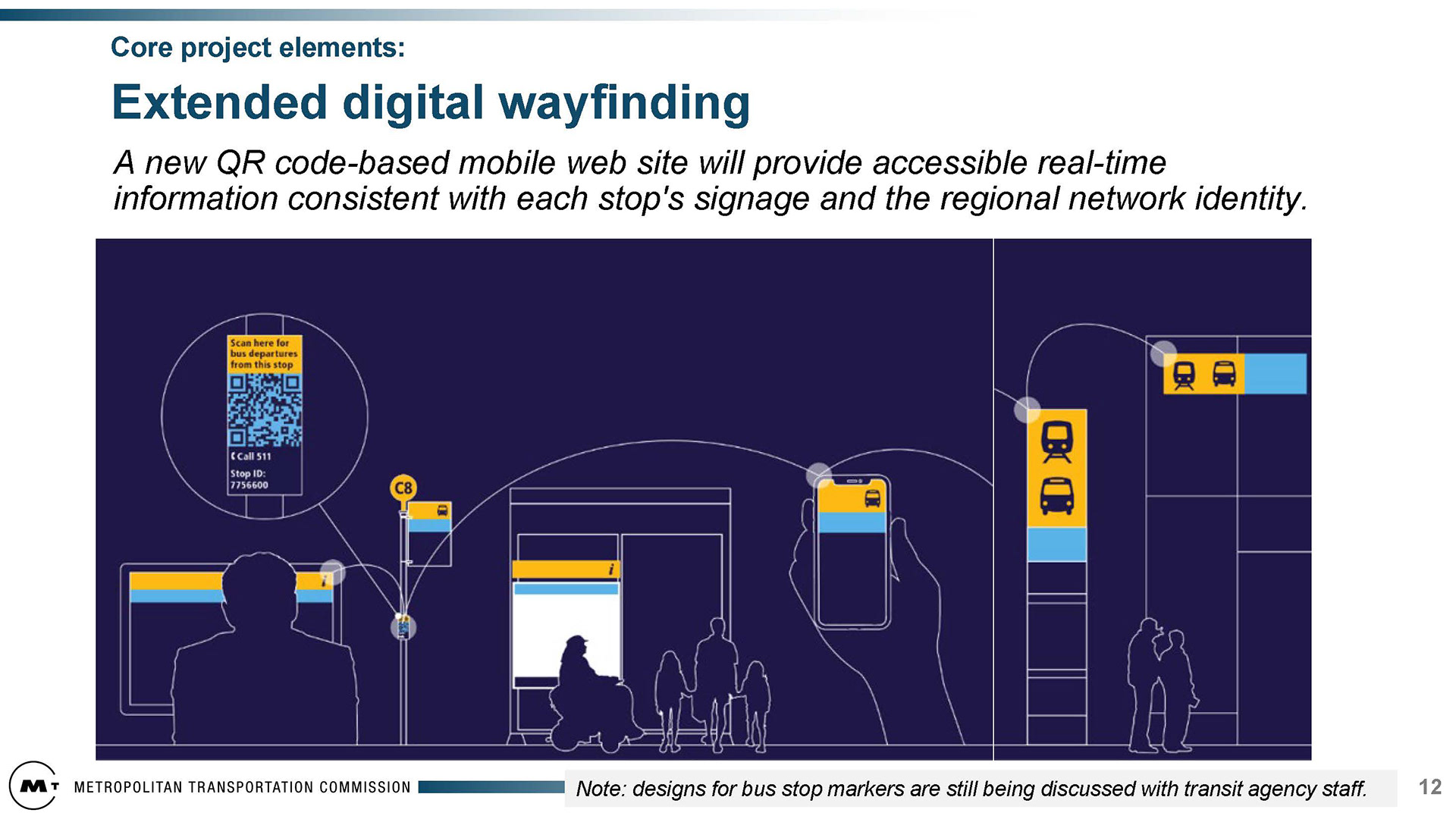
2022-2024: Presentation slides of wayfinding system, map suite, diagram, and prototype development


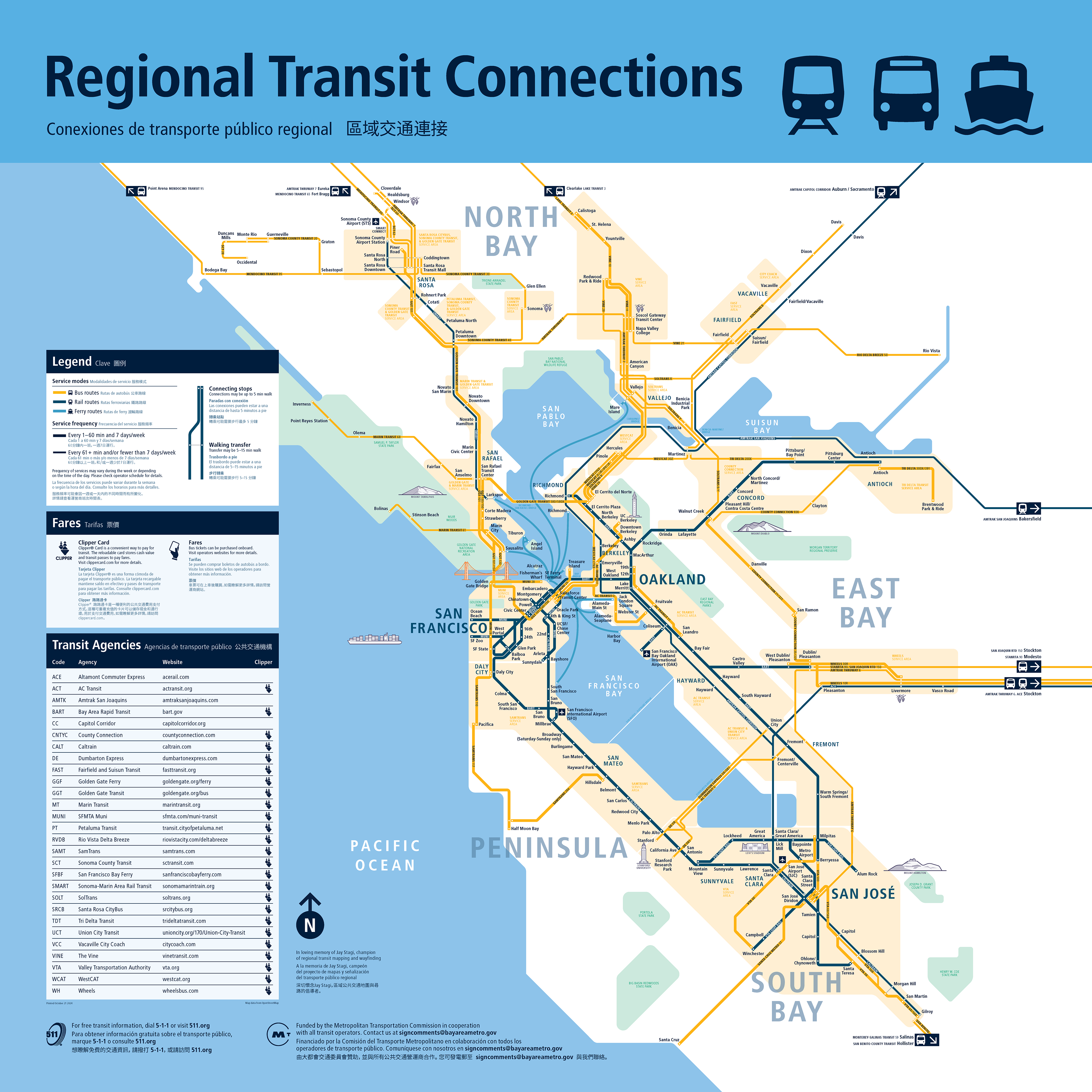
2022-2024: Brand Identity and Wayfinding System Development


Phase 2
System Principles Document, Example Maps, Pilot Development, Rough Order of Magnitude for installing across the Region,
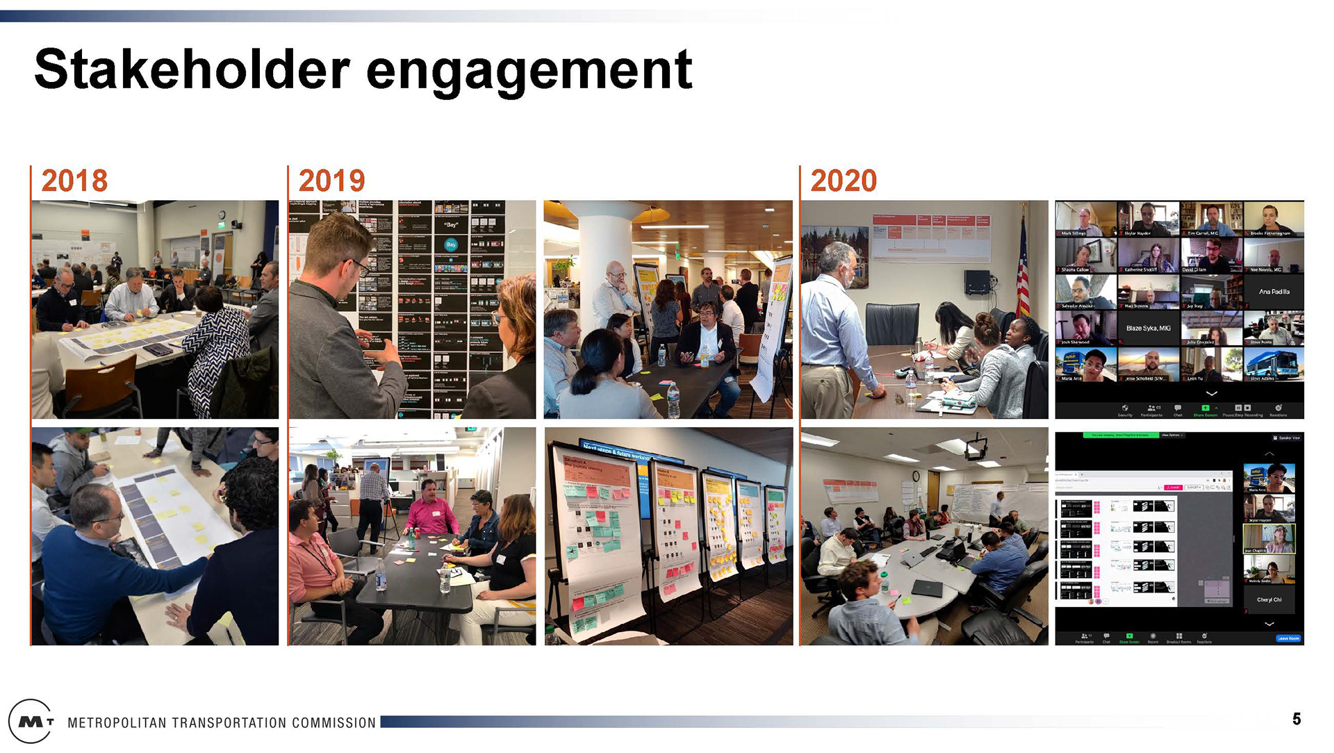
User Research, Stakeholder Engagement
System Principles Document, Example Maps, Pilot Development, Rough Order of Magnitude for installing across the Region,
User Research, Stakeholder Engagement
2021: System Principles Document
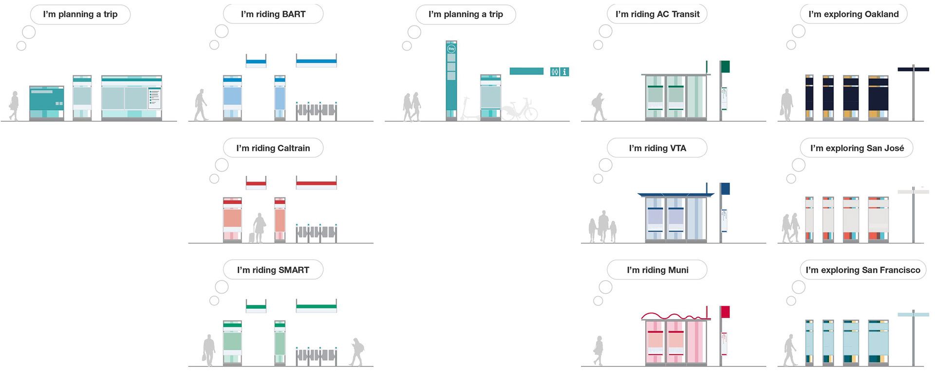
2019-2021: Map Suite, example maps, and preliminary mapping style
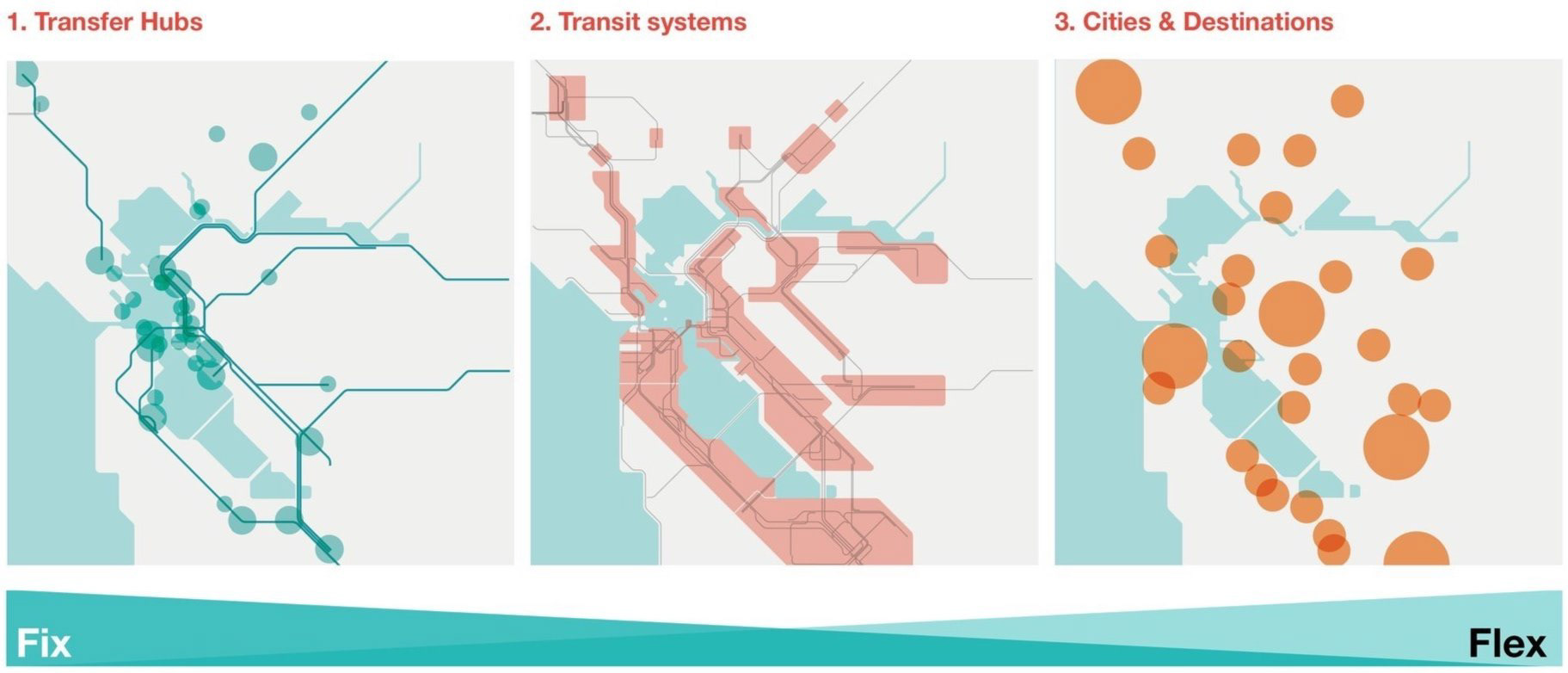
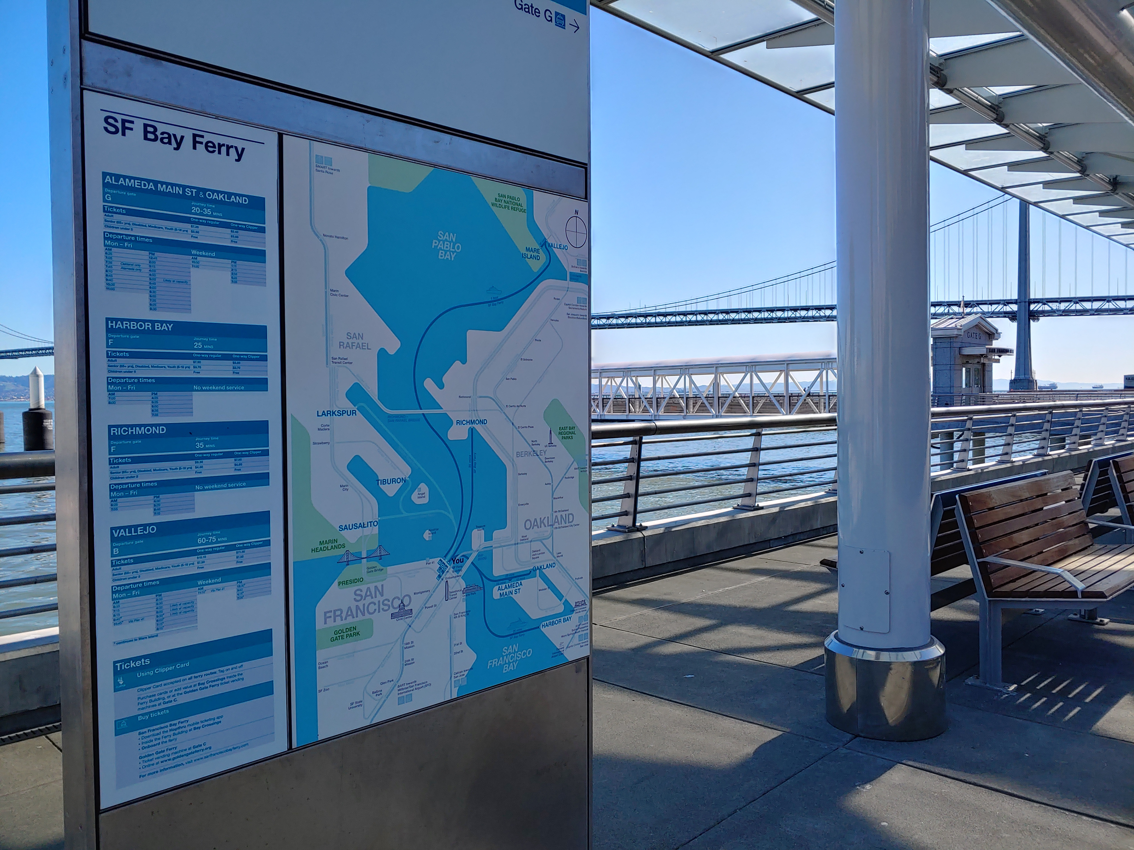
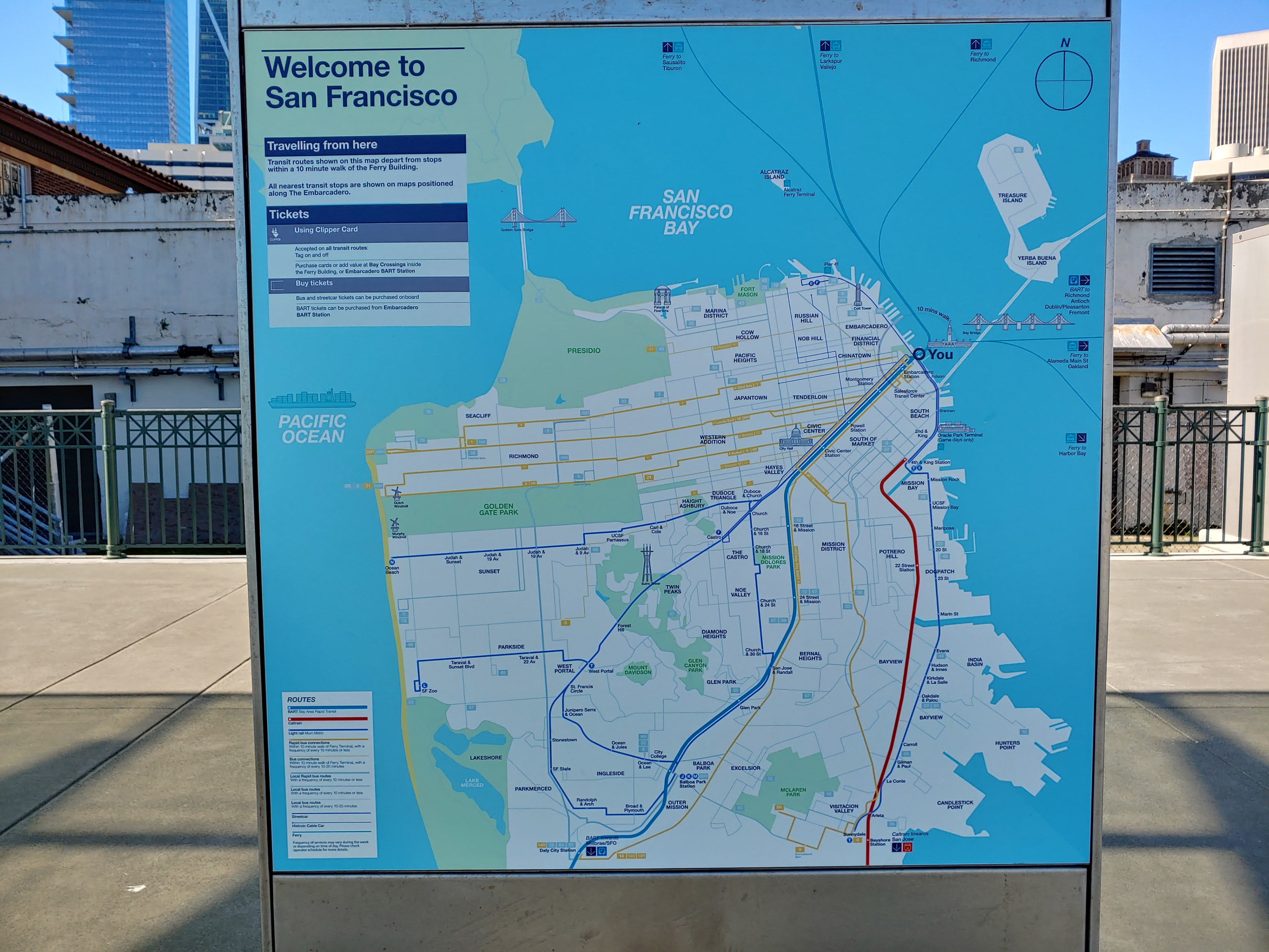
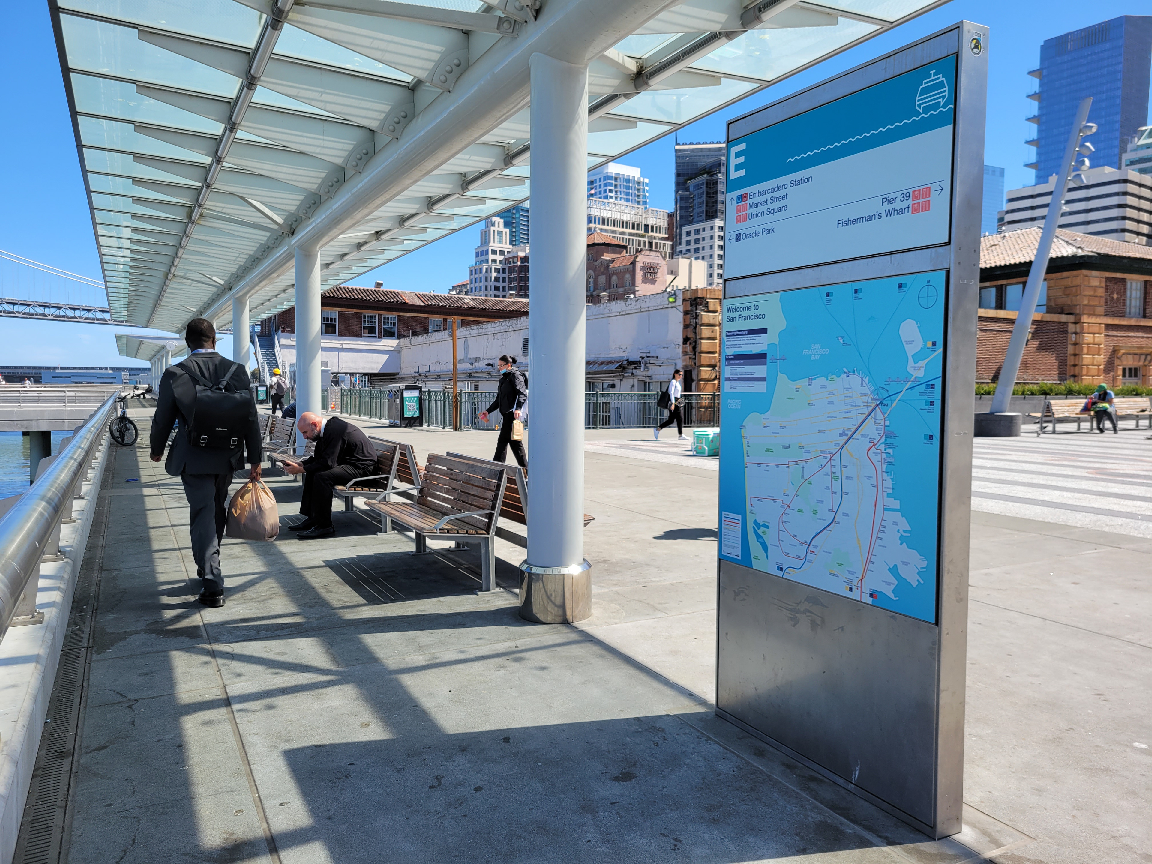
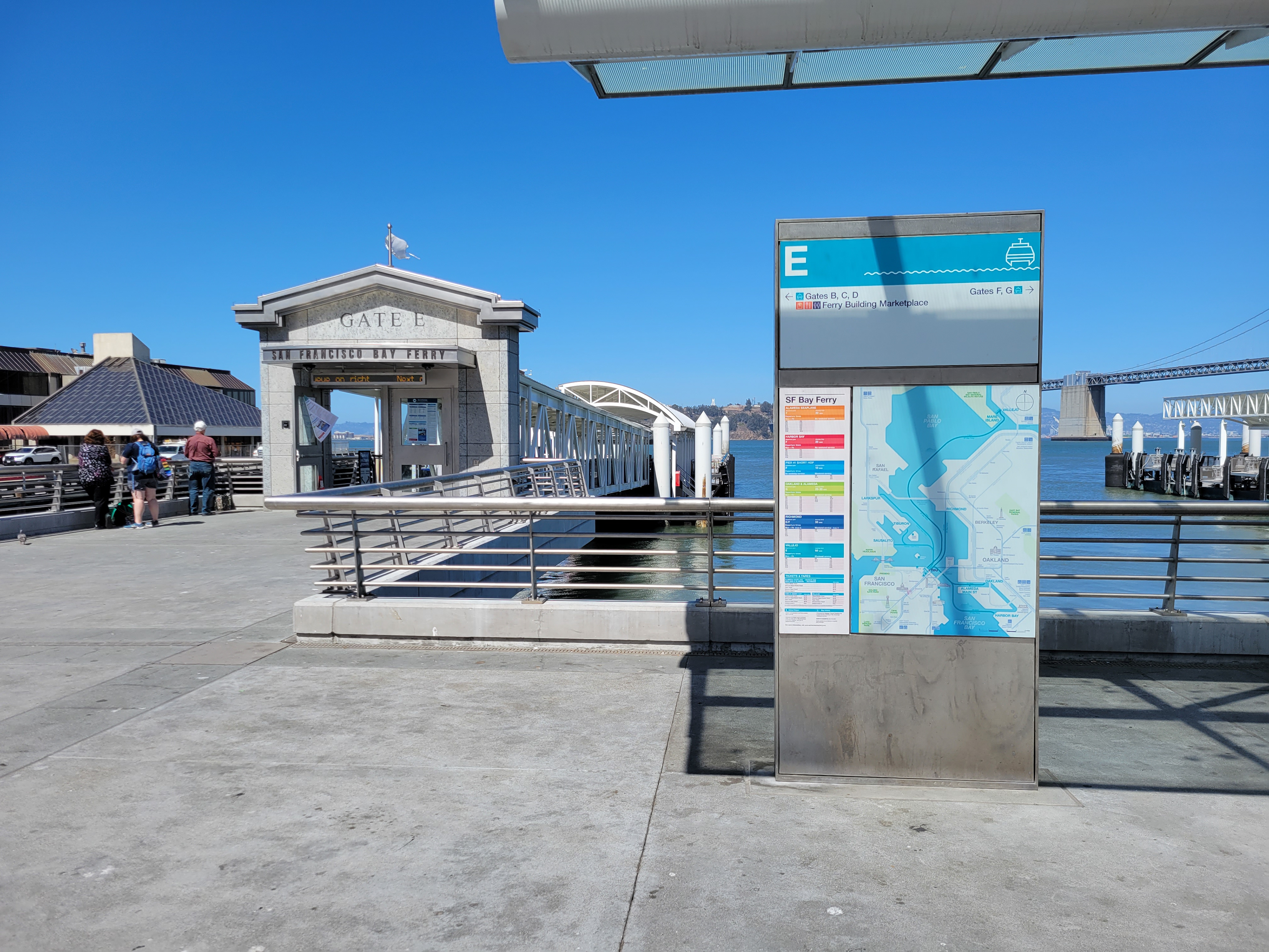
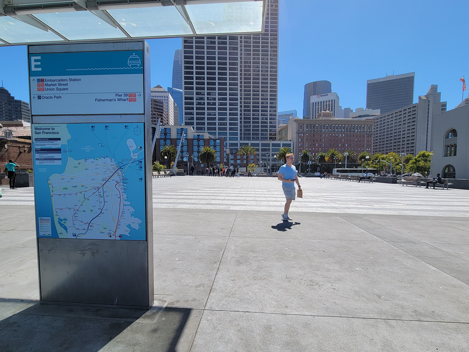
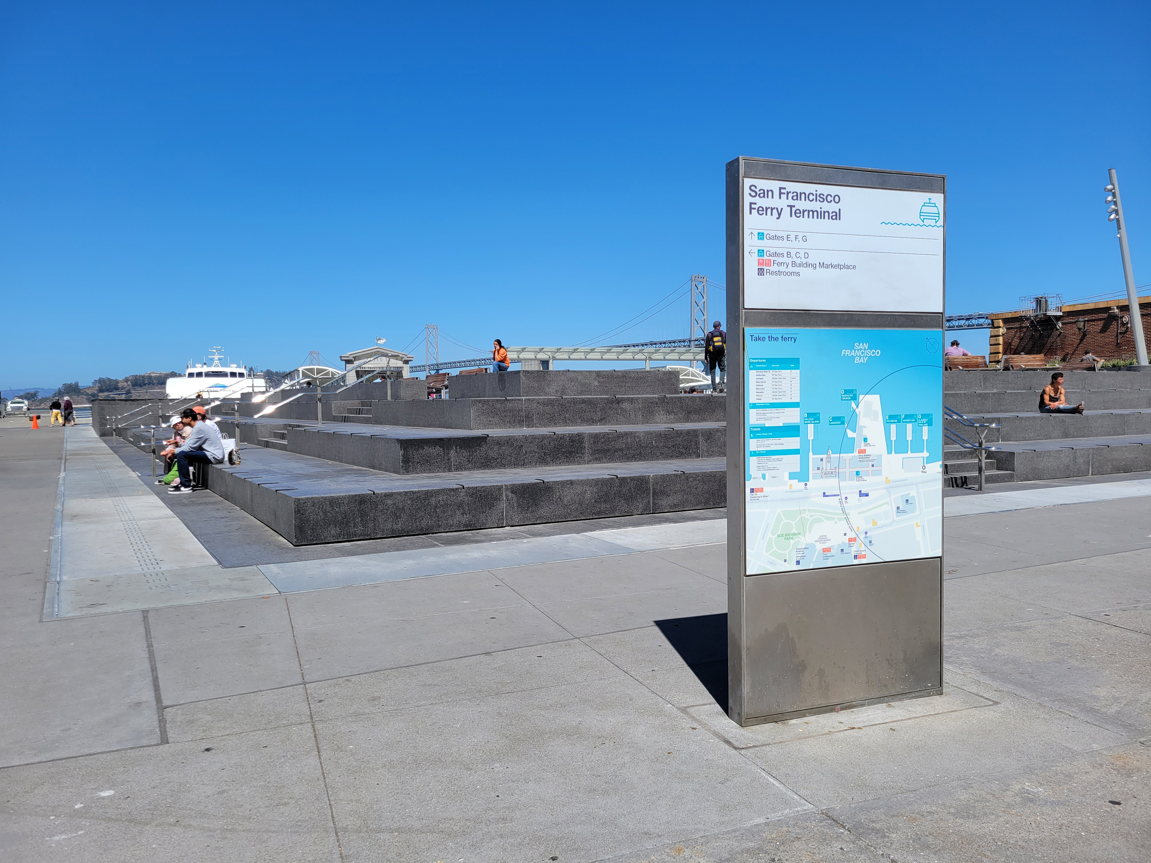
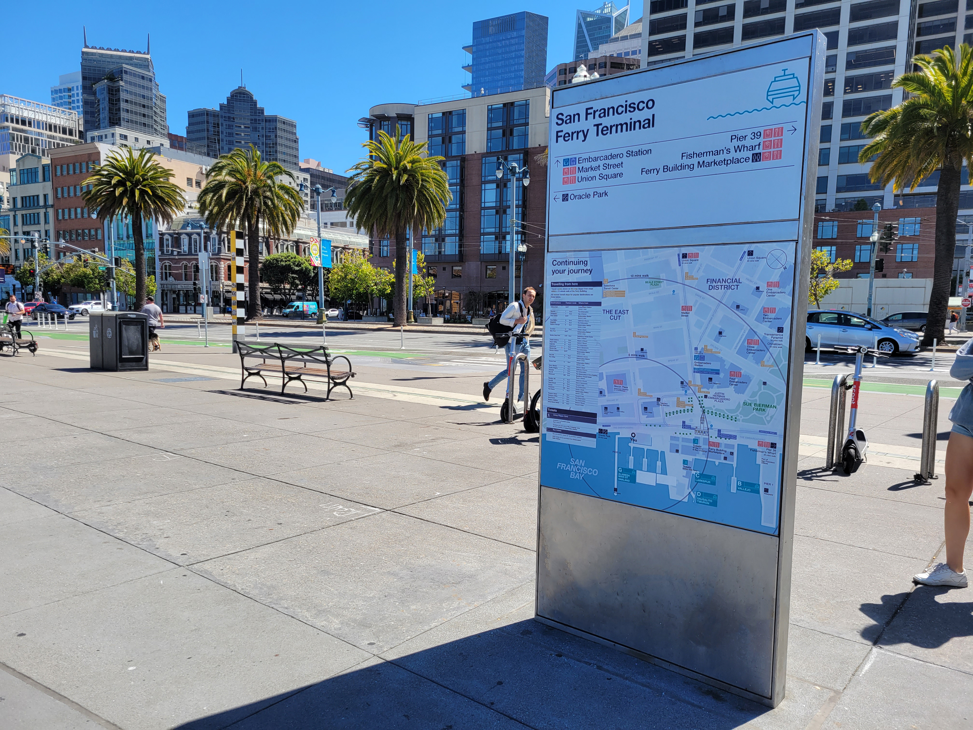
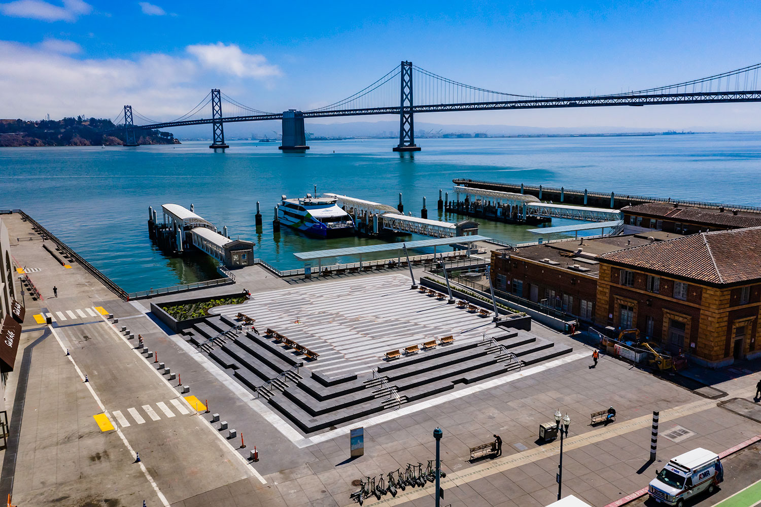
2019-2021: Fix & Flex prototypes for Downtown San José and San Francisco Ferry Building plaza and San Francisco Bay Ferry gates


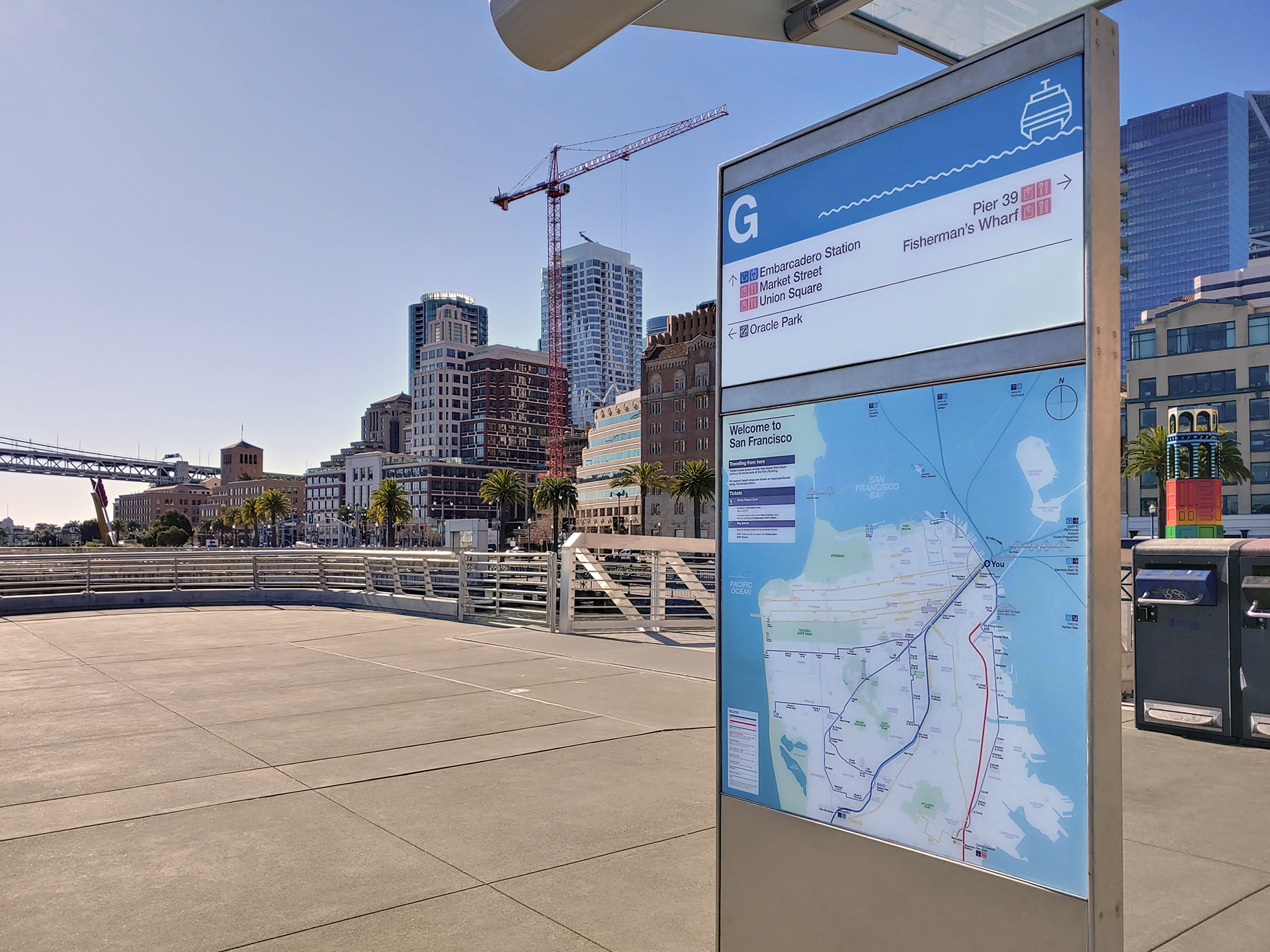
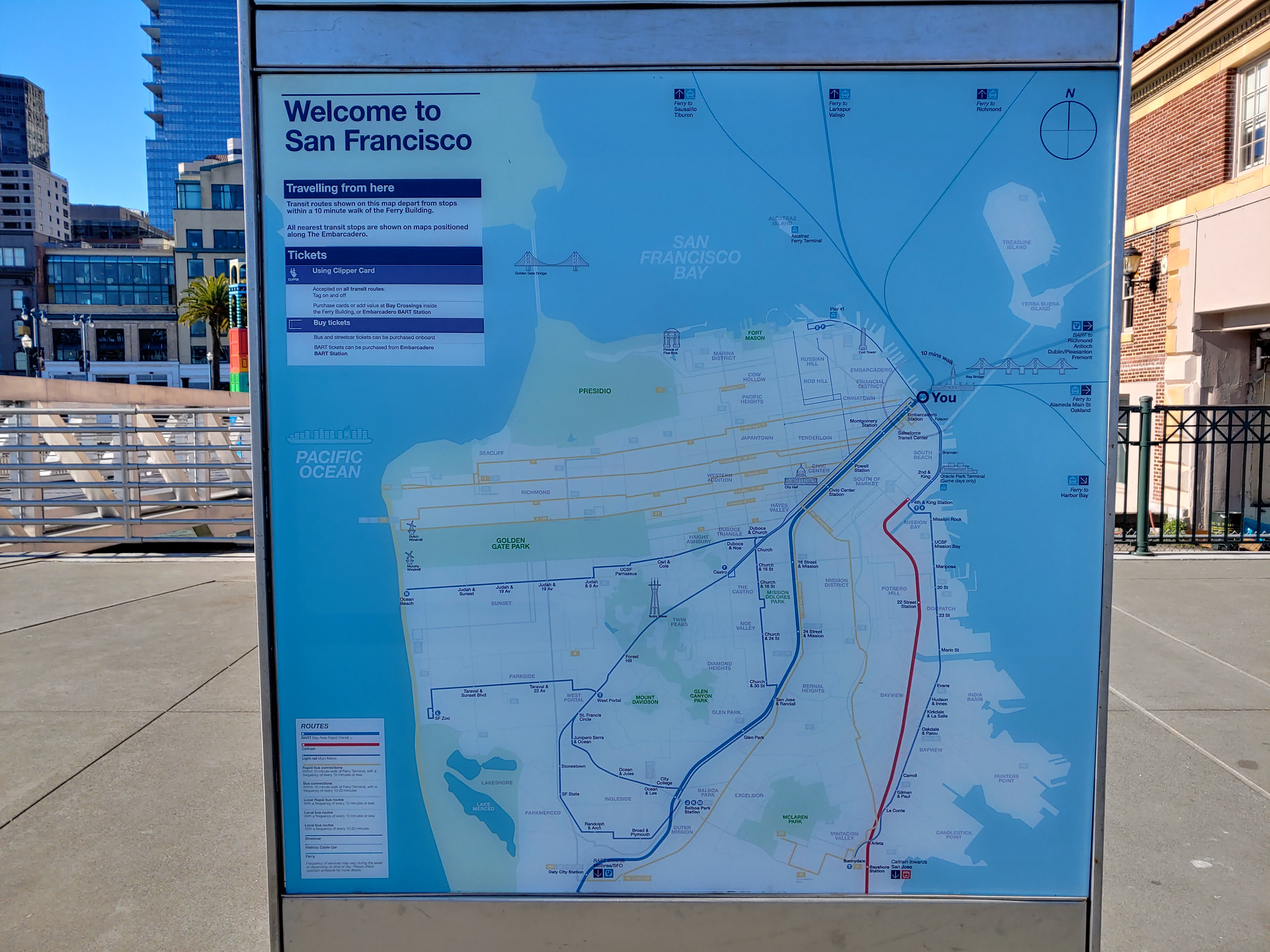
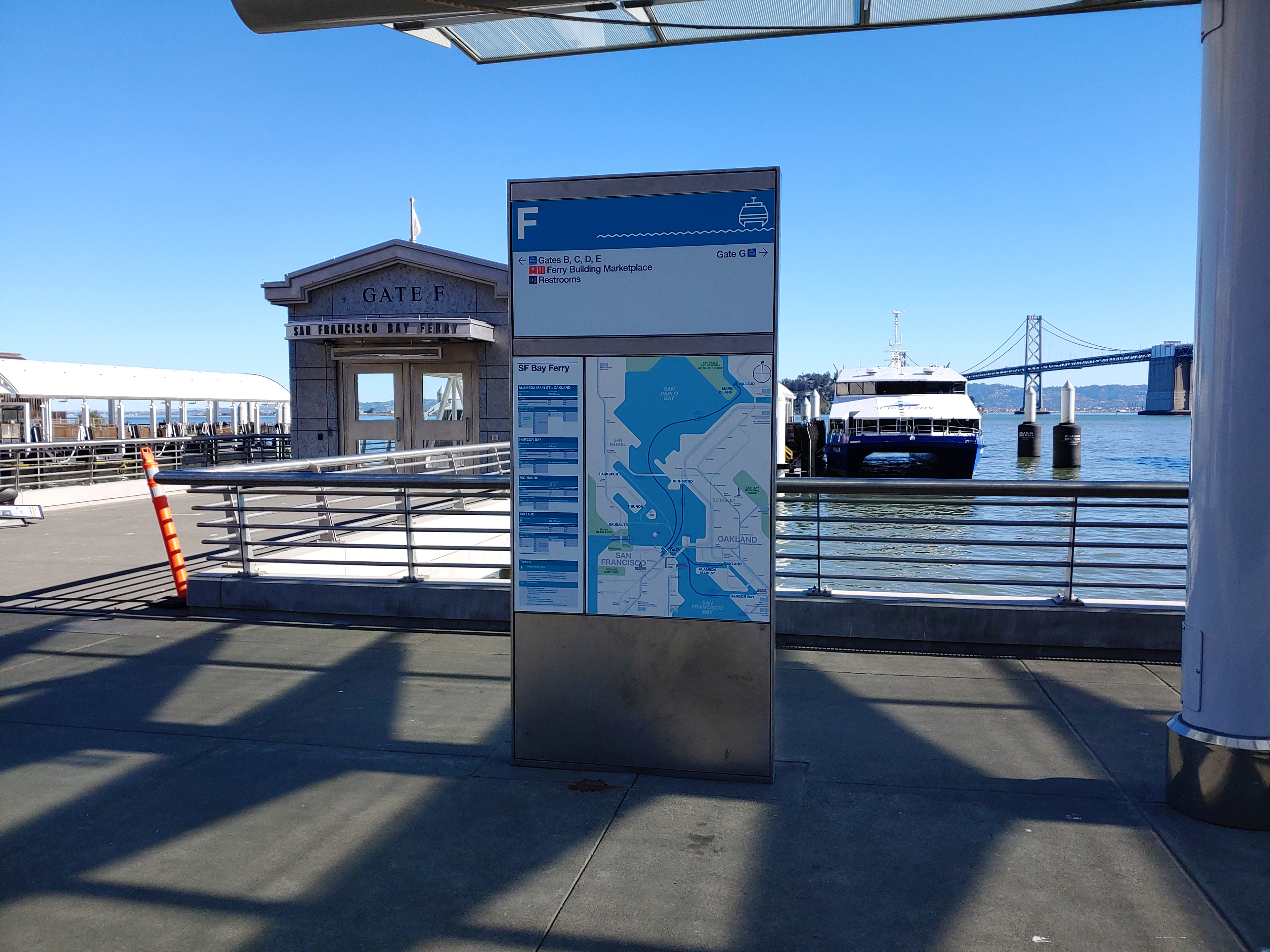

2019-2021: Bay Area Transit & City harmonized wayfinding system development and principles, MTC Regional Mapping & Wayfinding project business case coordination, Stakeholder consensus-building and User engagement actives